TREKKING
TREKKING IN MONTENEGRO
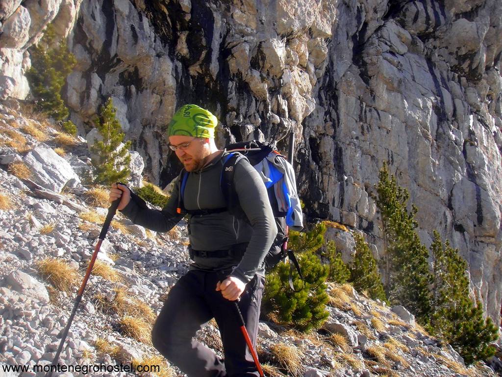
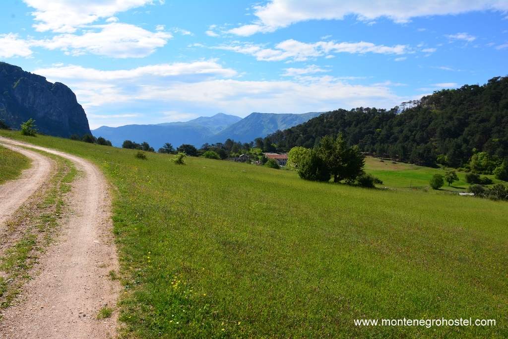
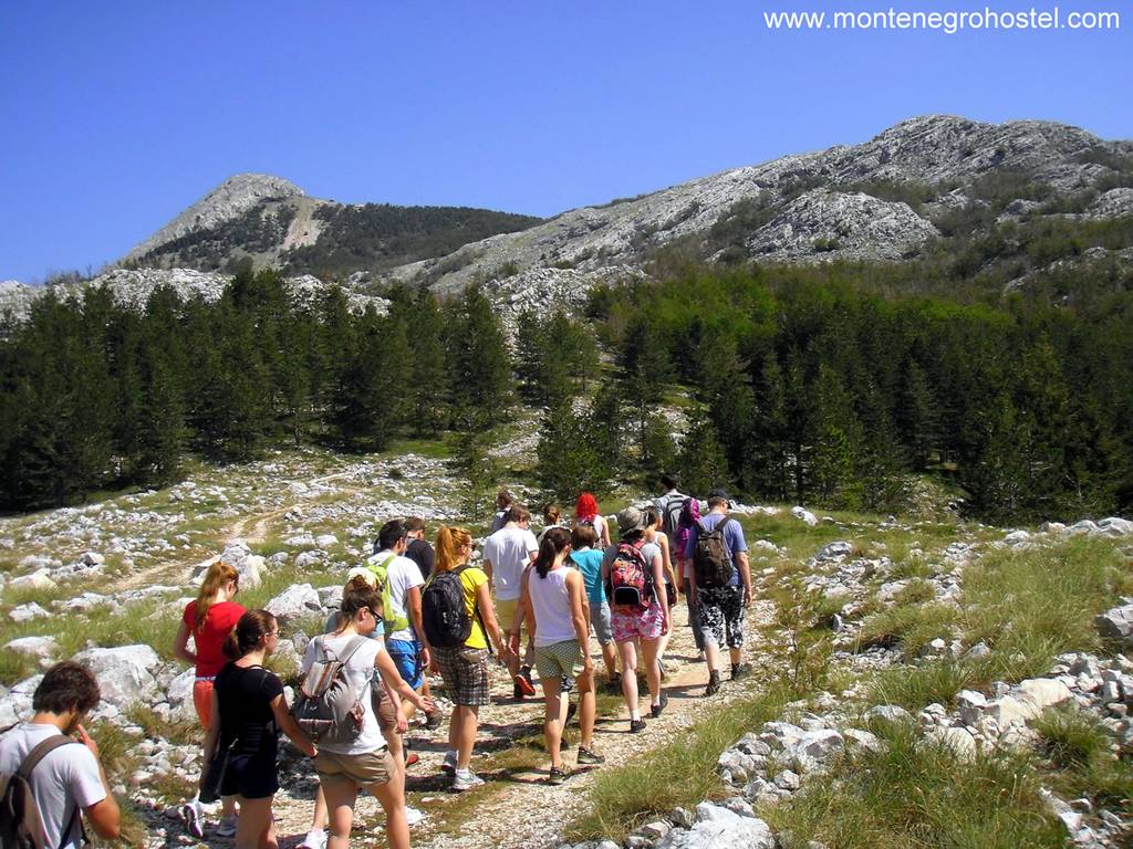
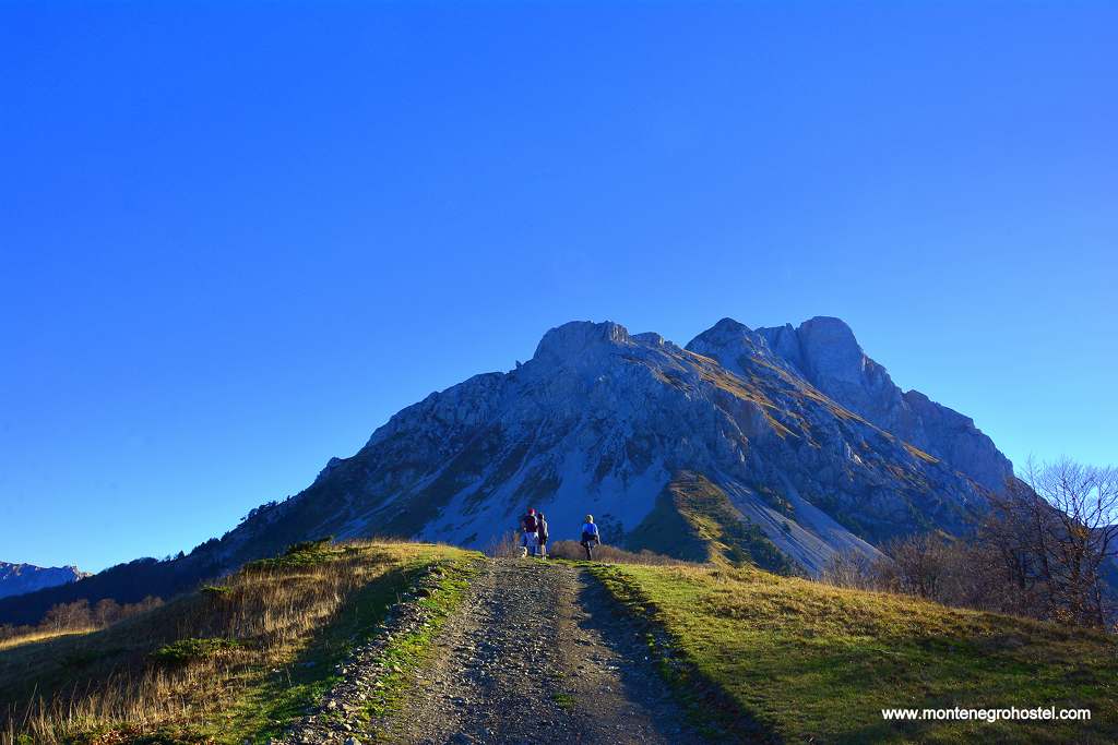
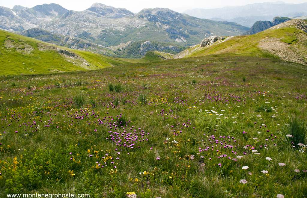
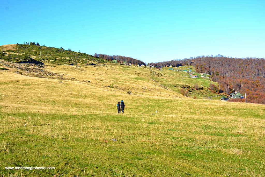
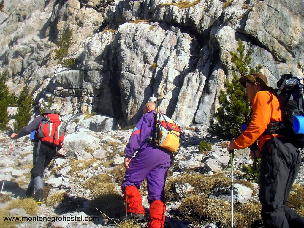
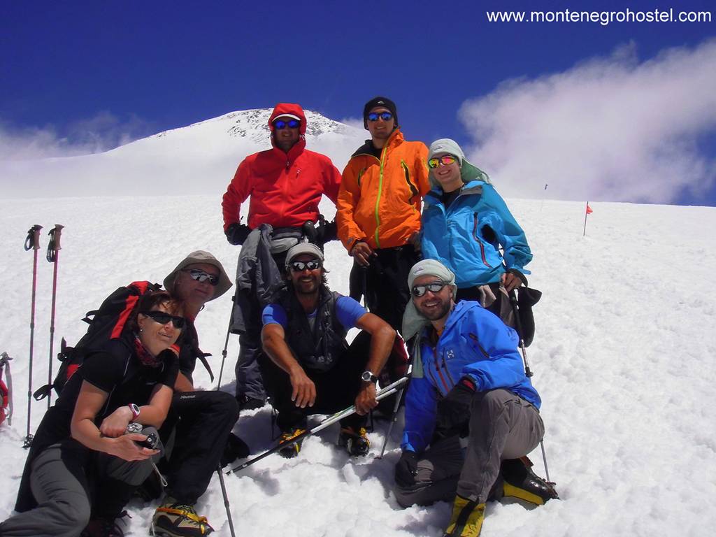
The most renowned and most visited trekking destinations in Montenegro are Durmitor, Orjen, Prokletije, Komovi, Kuči Mountains, Bjelasica, Maglanik, and Morača Mountains. Good traffic connections, the existence of mountain administrative and tourist centers at their bases, and relative recognition of their routes place these mountains in the first line of Montenegro's mountaineering offer. Although you can meet most mountaineers here, proportionally, mountains are still far from being overcrowded. The combination of isolation and companionship is still possible on their slopes, according to individual desire and mood.
TREKKING ON mt. DURMITOR
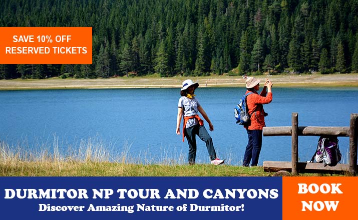
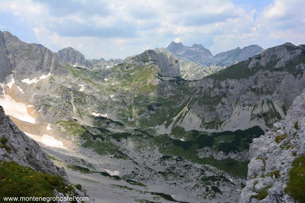
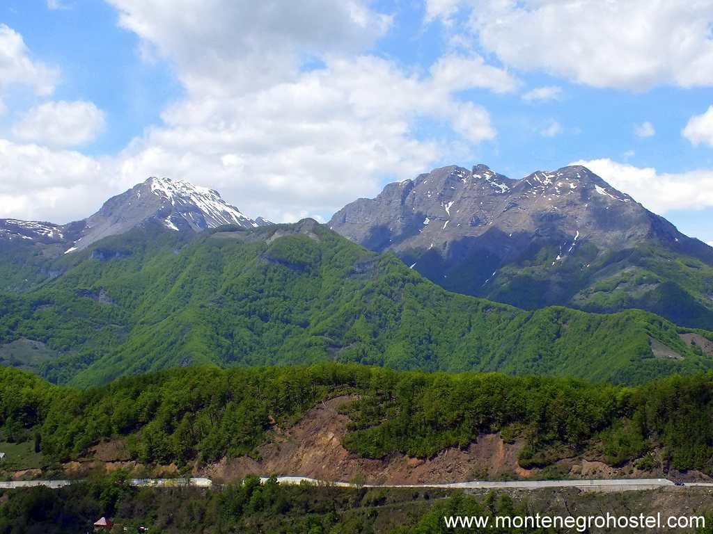
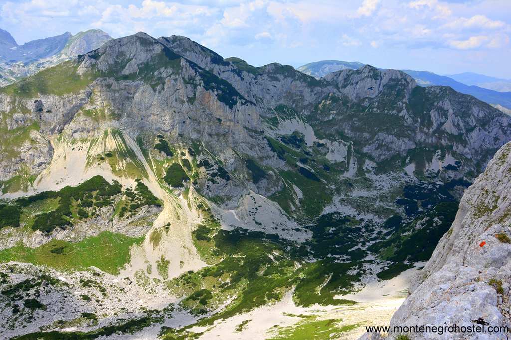
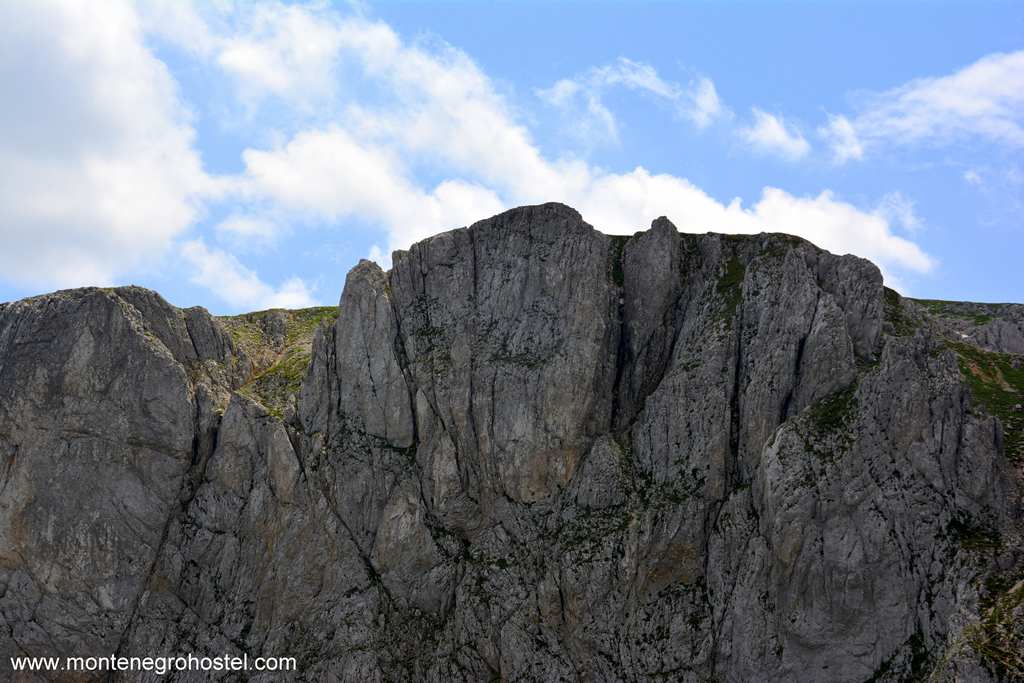
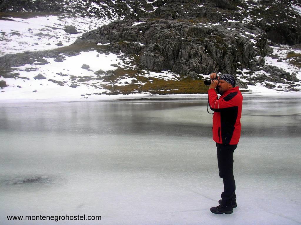
To say that Durmitor attracts as many mountaineers as all the other Montenegrin mountains combined is no exaggeration. Among the first discovered mountain destinations, with its 48 peaks of 2,000m above sea level, 15 high curvatures, 13 glaciers cirques, and 18 lakes, it has more than enough reasons for continually coming back to it. The highest peak is Bobotov kuk (2,523 m), while other peaks of outstanding attractiveness and beauty are Šljeme (2,455 m), Bandijerna (2,409 m), Prutaš (2,393 m), Minin bogaz (2,387 m), Savin kuk (2313 m), Zupci (2,309 m), Terzin bogaz (2,303 m), Međed (2287 m), Šareni pasovi (2,248 m), Crvena greda (2,175 m), Sedlana greda (2148 m), Veliki Štouc (2,104 m), Lojanik (2,091m) and Bokeljske grede (2,091 m). The largest lake is Crno jezero (Black Lake), at 1,414 m above sea level and 49 meters in depth, along with Zminje, Jablan, Malo Škrčko, Veliko Škrčko, Zabojsko, and Vražje Lake.
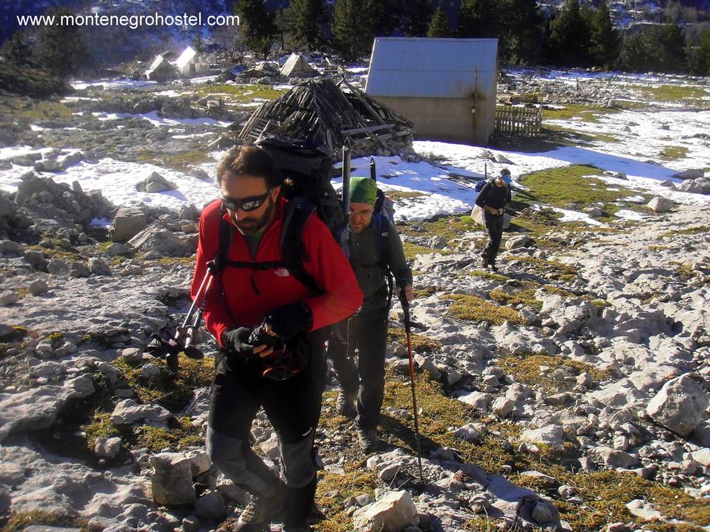
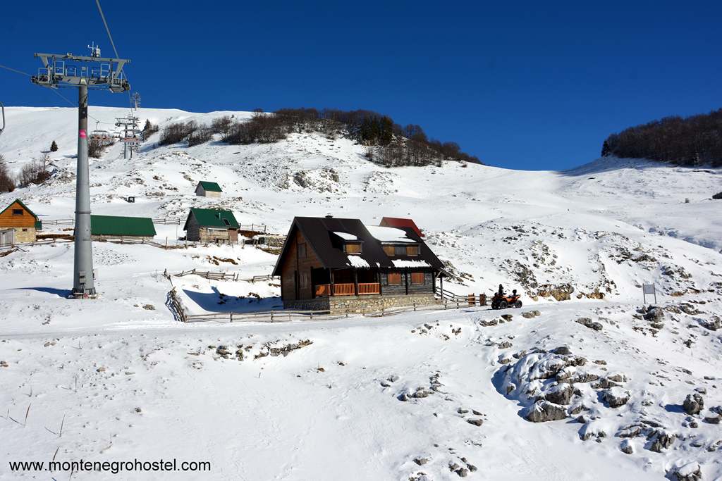
At the very foot of Durmitor Mountain is the administrative and tourist center Žabljak, from where all the roads spring up to the mountains (except for Boljska greda). Hotels, rest, camps, apartments, and rooms in private accommodations in Žabljak offer something for everyone’s taste and budget. There is a seasonal home in Škrka, on the mountain, while the alpine bivouac in Velika Kalica and the mountain shelters in Lokvice are open year-round.
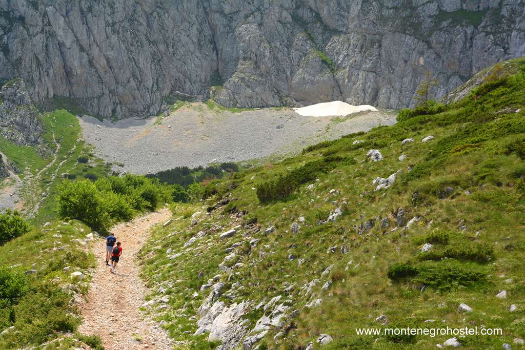
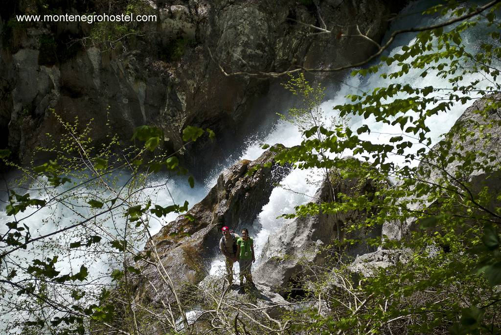
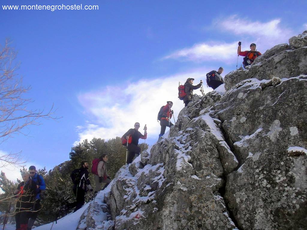
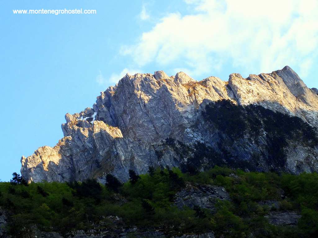
There are 27 marked and 12 unmarked mountain paths in Durmitor, and the most popular ones are winter and summer climbs on Bobotov kuk, from Škrka and Žabljak across Lokvica or Ledena pećina / Ice Cave, climbs on Međed and Terzin bogaz from Lokvica or Ledena pećina (Ice Cave), climbs on Minin Bogaz from Lokvica, on Savin kuk and Šljeme from Virka, Prutaš, Lojanik and climbs on Sedlena greda from Dobri dol on Crvena greda from Montenegro across Sušice Lake and its Canyon Sušice until Škrka. A large number of different tours with different scales of difficulty creates an ambiance for numerous trekkers with unequal physical predisposition, experience, and equipment, in summer as in winter, which still makes this mountain the most important mountaineering region of Montenegro.
TREKKING ON MT. ORJEN
The Orjen massif spreads over the borders of the three countries, Montenegro, Bosnia and Herzegovina, and Croatia, dominating the entrance to the Bay of Kotor. This mountain has been a starting point for mountaineers for a very long time, both from Boka Bay, as well as from the Dubrovnik area, which once built a mountain home on its slopes. Orjen’s relief is a composition of characteristic shapes of Dinarides bare karst with Bosnian pinewood and many hollows, kerfs, caverns, holes, sharp cliffs, and cuts. The highest peak is Zubački kabao (1894 m), and peaks that also stand out are Pauza (1,769 m) on Reovac greda, Subra (1,679 m), Odijevo (1,571 m), Radoštak (1,445 m), and Veliko Ćedilo (1,466 m). The mountain can be reached by road from Herceg Novi, Morinj, Risan, and Trebinje.
There are many very well-marked mountain tracks on Orjen. Easy hiking lines follow the paths of Austro-Hungarian military roads, like the hiking path through Krivošije-Ledenice-Crkvice, or lead to some of Orjen's peaks. From the latter, climbs on Subra, Zubači kabao, and Reovačku greda stand out. An unstable microclimate with a large amount of rainfall is specific to this mountain. Starting from here is a Montenegrin seaside transversal, which leads to the coastal mountain cliffs on the line Orjen-Lovćen-Paštrovska gora-Rumija.
TREKKING ON MORAČKE PLANINE (MORAČA MOUNTAINS)
Moračke Planine (Moraca Mountains) is a name for the mountain region located in central Montenegro, with massifs Kapa moračke, Lukovice, Lola, Torna, Umovi, and Talija, located around the source and upper stream of the river Morača. Although situated in a small space, these mountains are differentiated from characteristic relief shapes, like deep river gulches, valleys, and kerfs, as much as plateaus. Morača itself springs up and hides in its shadows, in the only joint denominator, something that connects and disconnects at the same time.
Indentation of the massif causes a great variety of road access. You can visit Torna and Umovi from the direction of Kolašin to Gornje Lipovo, alternatively from Podgorica or Kolašin through Crkvine. Lola and the north slopes of Kape Moračke are accessed by the Podgorica –Kolašin-Mioska-Dragovića Polje road, while the western slopes of Lola can be accessed from Šavnik-Strug and Nikšić-Krnovo-Ivan-Bego Katun.
Žurima and the south slopes of Kapa Moračka are approachable from the road Nikšić-Župa-Luka Bojovića-Kapetanovo Lake and Podgorica-Kolašin-Osreci-Ropušnica. The region offers numerous and very attractive trekking tours, mostly with climbs on peaks above 2,000 m. Standing out in their attractiveness are climbs on Torna (2,277 m) going from Gornje Lipovo, Umovi (1,945 m), from Crkvine peaks, Kape moračke, Zagradec (2,217 m), Lastva (2,226 m) and Stožac (2,141 m) from Kapetanovo Lake, Mali Žurim and Veliki Žurim (1,962 m and 2,036 m) from katun Ropušnica. Unfortunately, besides climbs on Torna or Bablji zub, which are partially marked, no path is marked with suitable mountain signs. Two glacial lakes on the south slopes of Kape Moračke, Kapetanovo, and Manito give an additional allure to this massif.
TREKKING ON MT. MAGANIK
This, at first sight, an inhospitable and impassable labyrinth of stone formations, is a real jewel for lovers of sharp and vertical mountain lines. The highest point is Međeđi vrh (2,138 m), with several popular trekking tours leading to it. For now, there are no marked paths on this mountain, and navigation is difficult. But, Maganik, exactly because of that, enjoys the reputation of a real, untouched wilderness, where there is room only for the most persistent and capable. The exception is passing through Canyon Mrtvice (between Velje Duboko and Meuriječje).

It is one of the most famous Montenegrin trekking tours. Since it is not that technically demanding, you can pay due attention and be fully concentrated on the almost unreal beauty of the canyon. The track follows a well-marked path, cut through during the first post-WWII years, as a passage between then-segregated villages of the Rovici area. The mountain can be approached from several directions, by roads Podgorica-Mrtvo Duboko or Podgorica-Međurječje- Velje Duboko or Nikšić–Kutsko Hill-Štitovo-Rekočica and Nikšić-Župa-Lukavica.
TREKKING ON MT. BJELASICA
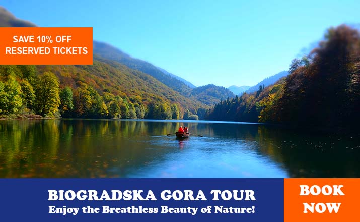
With different geological origins from the other Montenegrin mountains, Bjelasica stands out with its slight and round peaks, grasslands, large and abundant forests on its slopes, and glacier lakes whose beauty leaves a lasting impression. Biogradsko Lake, one of the last rainforest reservations in Europe, today a National Park, Biogradska Gora, is unforgettable. There are also Pešić, Malo Šiško, Veliko Šiško, and Ursulovačko Lakes.
The highest peak is Crna Greda (2,117 m), and marked or unmarked paths lead to it from several directions: Kolašin-Berane-Mojkovac, Bijelo Polje. Among the most popular tours are climbing on Zekova glava (2,117 m) from Biogradsko Lake, Troglav (2,072 m) from Jezerina, and Razvršje (2,033 m) from Katun Lanište. From all over, roads lead to this mountain, so you can come with a terrain vehicle close to almost every peak. Bjelasica is equally suitable for winter and summer trekking, mountain biking, paragliding, snowshoeing, and alpine touring.
TREKKING ON Mt. KOMOVI
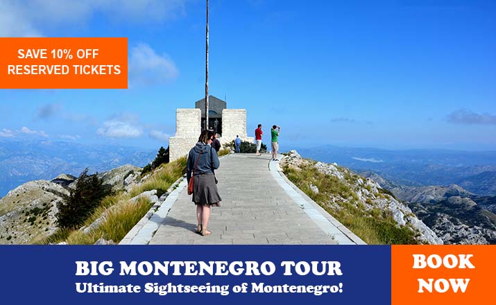
Komovi is the third mountain formation in Montenegro by height. It is situated between Kuči Mountain and Bjelasica. It is known for its exceptionally beautiful peaks, less accessible in winter and more accessible in summer. Komovi consists of two main groups. The first group is Vasojevićki Kom (2,460 m) with Bavan Cliff (2,252 m), and Ljevoručki Kom (2,469 m). The second group is Kom Kučki, with three peaks is similar height: Južni Kučki Kom (2,487m), Rogamski vrh (2,303 m), and Suvovrh (2,211 m). These two cliff systems are concentrated with curvature, known as Međukomlje (2,171 m). Access is possible by the roads Podgorica-Veruša-Opasnica-Sumor-Carine, and Kolašin-Andrijevica-Trešnjevik-Štavna, and Kolašin-Mateševo-Ljuban.
There are various tours on Komovi, and the most famous ones have marked climbing lines on Vasojevićki, Kučki, and Ljevoručki Kom, as well as the partly marked round and the one around the whole massif, which starts from Katun Štavna, at the foot of Vasojevićki Kom. All tours in this massif should be taken very seriously, because of the exposure to the terrain and because of the real danger of losing parts on peaks and cliffs. Here is noticeable here is the noticeable difference in the demography. While katuns (shepherd's houses) on the north side are relatively well inhabited, empty cabins on the south side of Kuči are the only witness that people lived here once. At the foot of the mountain peak Sumor (south slopes of Komovi), one of the most beautiful mountain churches in Montenegro was built. Simple and fitting in the mountain ambiance, it looks just like the first step from the earth to the sky.
TREKKING IN THE MOUNTAIN REGION KUČI
To the northeast of Podgorica, next to the Albanian border, is the mountain region of Kuči. It is defined by enormous intended relief, with numerous valleys, rocky cliffs, over 15 peaks at over 2,000 meters above sea level, and several glacial lakes, among which the biggest and most famous ones are in Rikavačko and Bukumirsko. Parts of the massif Komovi (Crna planina, Maglič, and Sovrh), as well as the entire massif Žijeva. In general, this area is treated as part of the Prokletije range. The mountain landscape varies, from areas of bare karst with Bosnian pine in the south to the beech wood in the north.
Access roads left from Podgorica or Kolašin, and there are several of them: Podgorica-Lijeva Rijeka-Veruša-Širokar, and Podgorica-Lijeva Rijeka-Brskut-Bukumirsko Lake-Širokar and Podgorica-Ubli-Kržanja-Kastrat-Bukumirsko Lake-Širokar, and Podgorica-Ubli-Rikavačko Lake-Širokar. From Kolašin, you can arrive by the Kolašin-Veruša road. Roads from Veruša, Brskut, Kastrat, and Korito are asphalted; the following macadam is of unequal quality.
The most popular tours in this area, depending on the time of the year, physical preparedness, and group organization, refer to the surroundings of the peaks in the region of Bukumir Lake-Pasjak (2,051 m), Surdup (2,184 m), and Štitan (2,165 m), the area of Rikavičko Lake with the dominant peak Vila (2,093 m), and mountain cliff Maglič, with peaks Lumer (2,141 m). All these peaks are accessible in summer as in winter, although winter climbs on Vila and Pasjak demand advanced knowledge of alpine climbing techniques in winter conditions, more equipment, and long experience.
Several directions on the mountain are completely or partly marked climbs on Žijevo (2,131 m), from the west side, Velja Šila (2,022 m) from Kastrati, Treskavac (2,024 m) from the northeast, going from Momonjevo, Šitan, Surdup, and Pasjak from Bukumirsko Lake, and Maglič from Širokar. The rest of the paths, like climbing on Vila and Štrungeze (2,053 m) from Rikavačko Lake, Vilijar (2,121 m), Treskavac, Surdup, and Šila from Trepetljikov dol, or Smojan (2,024 m) going from Koštica, are not yet marked with a mountain, although they are quite visited.
For those whose goal is not exclusively reaching peaks, it is possible to spend more days on a trekking tour, whose longest version starts at Korita, leads across Koštica, Rikavac, Širokara, Maglič, Kozelj, Konjski rob, and Sumor to Carine at the foot of Kučki kom, partly concurring with an old transversal CT1, that leads from Veruša across Komovi, Bjelasica, and Sinjajevina towards Žabljak. The sector is marked, and it follows a line of macadam road from Korita towards Rikavac and further to Širokara, which is from Konjski grob (Horse Grave) to Carine. Two to three days are needed for its crossing, depending on the physical preparedness and the weight of the rucksacks.
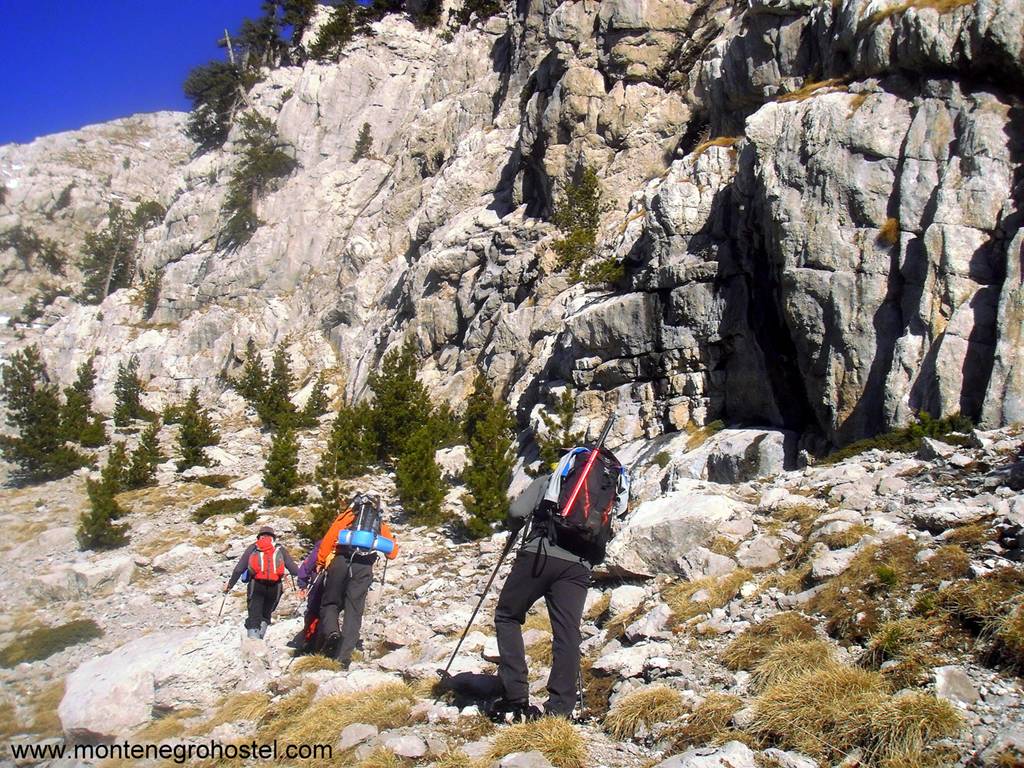
TREKKING ON MT.PROKLETIJE
A very small part of the massif Prokletije belongs to Montenegro, but the heights and beauty overwhelm all the other local mountains. The relatively narrow area in the northeast part of Montenegro, along the Albanian border and on the territory of the towns of Gusinje and Plav, hides many secret paths harder to reach, but more and more visitors.
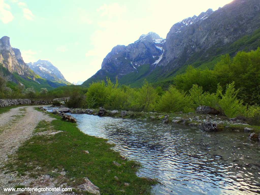
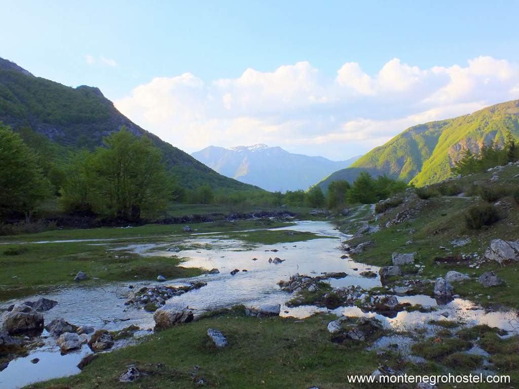
The Montenegro Prokletije consists of a few minor massifs, separated by deep mountain valleys. Those are the massif Trojana (2,189 m) in the west, then Karaula group (1,975 m), Popadija (2,057 m) and Volušnica (1,879 m), crest Karanfil-Vezirova Brada with peaks Sjeverni vrh (North Peak) (2,460 m), Srednji vrh (Middle Peak 2,490 m) and Južni vrh (South Peak 2,441 m), Očnjak (2,185 m), Hadžijino brdo (2,028 m), Obla brdo (2,028 m), Karanfili Ljuljaševića (2,240 m), and Podgoj (2,119 m). Also Bjelič, with the highest peaks in Montenegro: Maja Kolata (2,528 m), Zla Kolata (2,534 m), and Maja Rosita (2,525 m). Valley Grabaja segregates Volušnica from the cliff Karanfili-Vezirova brada, while Rapojana segregates this cliff from the massif Bjelič. Mountain peaks are reflected in several lakes, among which the largest one is Plavsko Lake and at the highest point is Hridsko Lake, while streamlet Grlja supplements the hydrologic segment, with its source in the valley Ropojana, known as Savino oko (Sava’s Eye) and the river’s canyon of exquisite attractiveness, from which flows out under the name Ljuča.
The first slopes of the mountain can be reached by roads Gusinje- Grbaja, Gusinje-Vusanje-Zastan, and Plav-Babino polje-Hridsko Lake. The most popular trekking tours of this region lead to some of the aforementioned peaks. From the valley, Grbaja marked paths lead to Volušnica, Karaula, Talijanka, and Popadija, through Krošnja on Hadžijino brdo (Hadžija’s hill), North (sjeverni) and Middle (srednji) peak Karanfil (carnation), and through Ljubokutić to the Očnjak and Karanfil Ljuljaševića. Worthy of attention is the even shorter tour to Donje Kotlo, beneath the west side of Sjeverni vrh (North Peak), which ends in an unreal ambiance, surrounded by a hundred-meter-high vertical cliffs. From Ropojana, the tour leads across Zastan to Maja Rosit, which is across Žarunica and the katun Grlate at Maja Kolat.
From Hridsko or Ridsko Lake, the climb lines lead to the peaks Bogićevice Hridsko krš (2,358 m), Krš Bogićevice (2,374 m), Pasji vrh (2,405 m), Starac (2,552 m), and Maja Rops (2,501 m). For those whose main goal is not reaching the peaks, hiking through Grbaja, Ropojana, or the terrain around Hridsko Lake (especially suitable for those not in such good shape or less equipped) will bring nothing short of a fairytale atmosphere in the surreal beauty of the area. In winter conditions, most of these tracks represent serious alpine climbs, but there are easier and less dangerous tours like Volušnica, Popadija, or Kranfil Ljuljaševića.
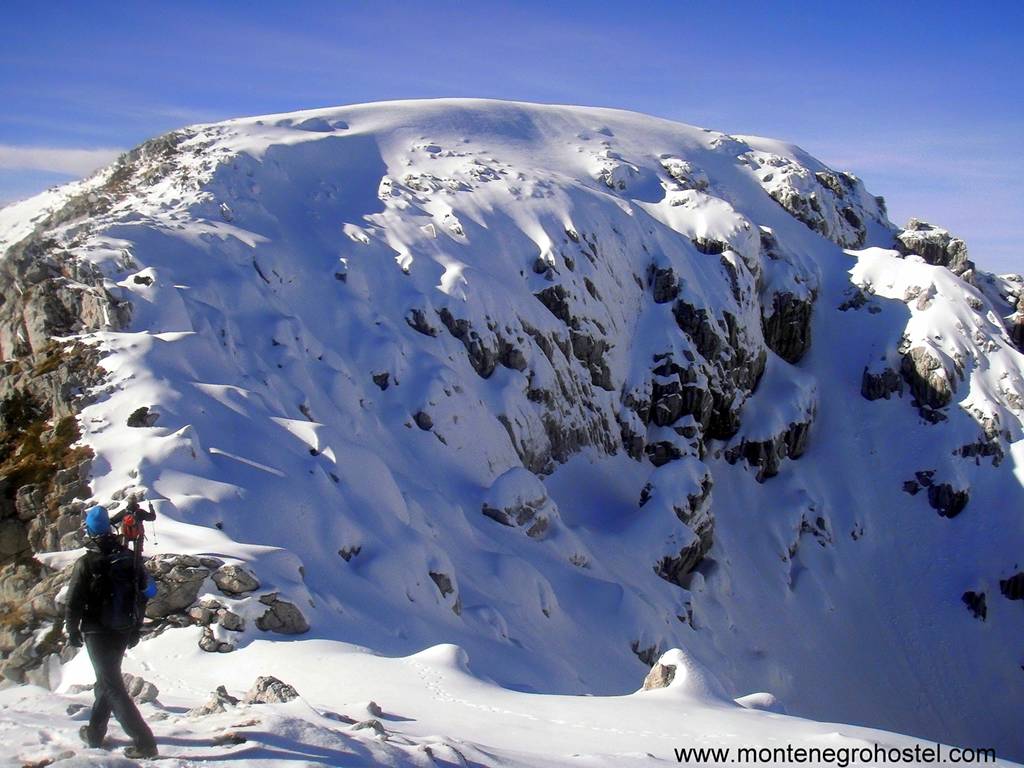
TREKKING SEASON
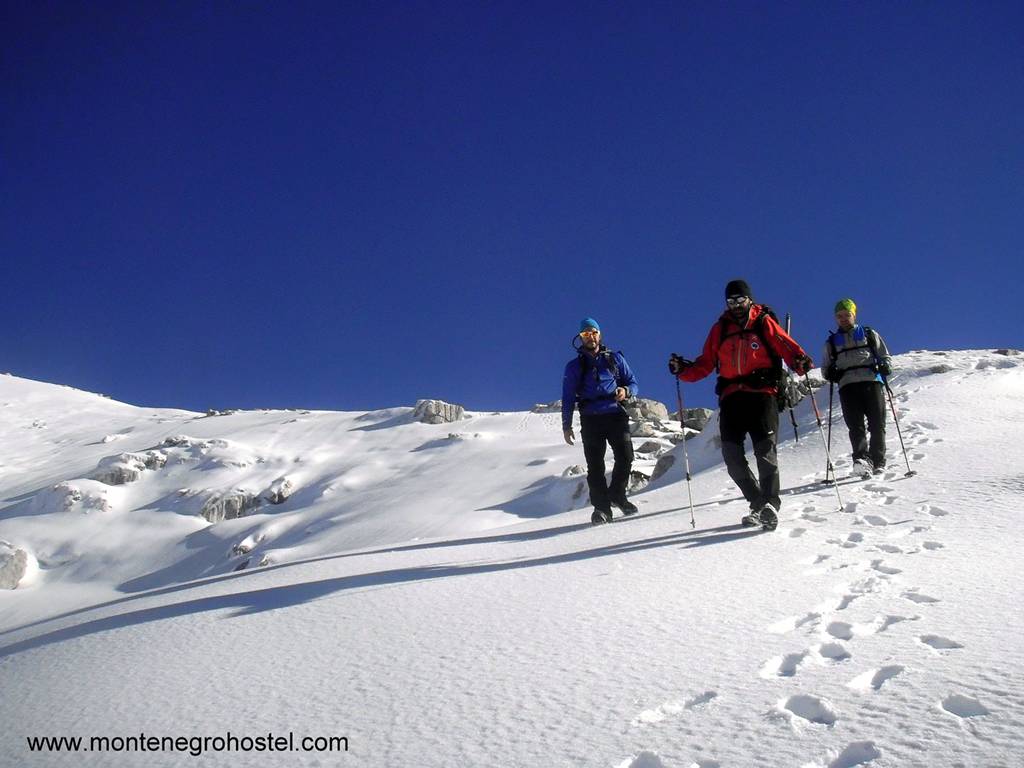
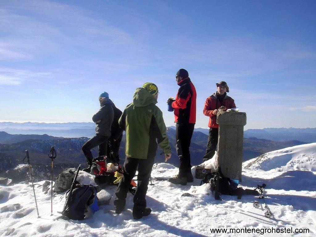
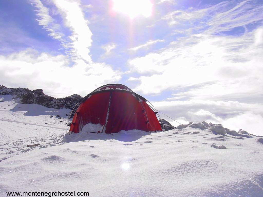
All four seasons create good conditions for diverse trekking activities. Winter months, especially in higher mountain areas, provide an excellent milieu for long tours on snow and climbs on peaks, of the same color as clouds. Although it is not a general rule, the end of winter and the beginning of spring are the best periods for winter trekking, because of the largest amount of snowdrifts and their firm stability. Unfortunately, the closeness of the sea brings rapid penetration of warm and wet air, frequent rainy periods, and thereby, aggravated conditions for all sports activities in the open. This is especially important for mountaineers because it increases the danger of avalanches, so sometimes it is impossible to plan winter mountain action long-term. The recent trend of warmer winters does not favor any of those activities, but the trekkers are perhaps the least touched category. Regardless of winter conditions, some lines will be fine, some climbs possible, and some paths passable. The choice is so big that you will always, with the least acceptable weather prognosis, be able to enjoy the surroundings of local mountains, with the snow sputtering and crunching under your soles.
Spring, summer, and autumn, each in its way, make the story easier or harder. Temperatures are generally above average, which is not bad in spring and autumn, but in summer, it sure is a problem. On the mountains, spring is maybe an ideal period, with the best conditions for the most diversified experiences, with the most persistent snowdrifts, flourishing greenness of young leaves, and warm sun that is still not too hot, while the day is long enough for planning some longer tours. Autumn is the time of the most beautiful colors and light, but with shorter days and frequent rains. The summer months, when most people visit the mountains in Montenegro, bring severe heat, which is more bearable in high altitudes. During that time, trekking along Komovi, Prokletije, and Durmitor is not only a matter of hobby but also a shelter from the heated city’s concentration, such that you need a jacket or sweater in the evening. As much as the days are warm, night always brings coolness for a refreshing sleep.
Montenegro Hostel Team
ALPINISM
ALPINISM IN MONTENEGRO
Starting from the usual understanding of alpinism as the adventure of climbing high rocks, Montenegro could easily be described as a God-given land for this kind of mountaineering. Almost all its mountains have at least 100m high boulders, and even that height is exceeded by its canyons' verticals, while the diversity of climbed and potential routes covers almost all known alpine categories.
The most well-known and attractive alpine destinations in Montenegro are Prokletije and Durmitor, where there are as many paths in dry boulders, and lines in the snow, ice, or mix. Žijevo and Orijen, thanks to the good quality and attractiveness of their boulders, are becoming more and more visited summer climbs, while Komovi keeps the reputation of a classic winter climb. Canyons of Tara, Piva, Komarnica, Morača, Mrtvica, Cijevna, and Lim, as a treasury of countless high rocks, are still almost untouched, with only a few climbed routes.
ALPINISM ON DURMITOR
Many peaks, with exposed rocks and relatively easy and clear access to several locations, contribute to the connection of a significant number of alpine activities in the Durmitor terrain in Montenegro. In the central massif, boulder heights range from 100 to 500 m (Crvena greda), and the highest ones are in the Boljske grede area, where they reach even 700 m. Boulders are limestone rocks of various qualities, but as there are so many of them, it isn’t a problem to find one with suitable firmness, weight, and aesthetic.
The mountain is equally suitable for climbing on dry boulders and climbing on snow and ice. By now, hundreds of routes have been climbed, but since the data is scattered through guides, archives, and collections of different organizations, clubs, and individuals, information about routes is quite inaccessible. The most famous boulders, like the north Šljeme boulder, Osojne grede, Pleća, Bandijerna, Međed, or Terzin bogaz, are frequently visited, with now-famous lines, which are already considered “classic”. Winter routes are “Žljeb Šljeme-Pleća” (300 m, III, 60˚), directly above the bivouac in Velika Kalica under Šljemen, as well as a couple of lines in Osojne grede of Šljeme boulder, above the ski track Savin kuk. They are interesting because of the quick access, relatively short and attractive climbing, and the possibility of catching a couple more ski drivers and the path.
There are significantly more rock climbing routes, and the most interesting ones are within a short distance from the central massif, where most climbers are located on the large north Šljemen boulder. These routes have been rarely reused over the last years due to the loose rocks. The most famous routes are “Direktni” (400 m VI, IV) and “Diretissima” (400 m VI), but for years no one has come there. Boulder with better quality is on Bandijerna, where there are several easy lines for beginners and less prepared climbers, or Trezin bogaz, Zupci, and Prutaš. During the last years, the peak Lojanik, above Dobri dol, has attracted attention, where there are several interesting directions of different difficulty in good limestone.
Yet, the main alpine asset of Durmitor is Boljske grede, a kilometers-wide boulder wall above the left shore of Komarnica. The maximum height of the boulders is 700 m, and only one route has been climbed so far, while several lines were climbed in the lower part of the boulder, whereof, “Another Day in Paradise” (250 m, VII+), certainly, wasn’t only the hardest but the most attractive one. The route is in a part of the boulder whose segment, around 200 m high, is on the border of half access and easy climbs, while the upper barrier (200-300 m) leads to a couple of interesting boulder towers, clearly visible from the valley.
ALPINISM ON MT. PROKLETIJE
The history of climbing in Prokletije is a lot shorter than in Durmitor, but this region is rapidly becoming the most popular and most important alpine destination in Montenegro. Primarily because of the highest cliffs in the country, whose height reaches even 1,200m, but also because of the unique beauty of the mountain landscape that irresistibly reminds one of the sharp peaks and rocks of the Central Alps. Short and easy routes are the rarest ones here. Among the category of classic lines, “Greben radnički” on the peak Očnjak (Dogtooth), or “Sjeverni greben” (North Cliff) (V, III-IV, 500 m) on Sjevrni vrh (North Peak), or the peak Karanfil, should be mentioned.
The most significant routes in Prokletije are the longest and the hardest ones in Montenegro in general. Primarily, these are the routes “Prvo koplje” (VI+A2, 700 m), “Greben Prestola” (800 m, V+, IV), “AKA” (VI, A2, 700 m ), and “Dobri drugovi” (VI, 700 m) in Karanfil, which have witnessed many attempts, frequent failures, and legendary anecdotes. The south rock of Karanfil, which descends to the periodical Ropojansko Lake, is the highest in Montenegro, at around 1,200 m. There are several routes on it, and not a single one of them has yet been repeated. Among the mentioned routes, “Prvo koplje”, up the rock Koplje (Spear) on Sjeverni Vrh (North Peak) stood out as a real attraction for many Slovenian and Polish expeditions during the sixties. The first climb was made in 1972, while its first repeat, despite numerous attempts, had to wait until 2005. In its complexity, this line reminds me of big wall routes, consisting of both free and technical parts of serious and constant difficulty, with hanging reinsurance and frequent problems in navigation.
Winter routes on Prokletije have a great aesthetic value, but also a relatively high degree of avalanche danger. Because of the closeness of the sea, this region is characterized by sudden melting and rainy periods, which seriously affect the stability of snow caps. The most popular winter routes, which more or less follow the lines of summer via normal climbs on Očnjak (Dogtooth) and Sjeverni vrh (North Peak), are a true example of how technically undemanding climbing can turn into a real nightmare if you come at a time when the mountain is not in the mood for guests. Furthermore, not only are the parts of rocks jeopardized by avalanches, but also the access through the mountain hollows Ljubokuć and Krošnja.
Prokletije’s territory in Montenegro should not be neglected from the alpine aspect. Until now, only the peaks and rocks of Grbaja Valley and Ropojana have been exploited. Since these areas are not even close to being exhausted, boulders on Bjelič, Kolate, Maja Rops, and other peaks and areas of the Montenegro Prokletije certainly deserve interest and attention.
ALPINISM ON MT. ŽIJEVO
This mountain is one of the “youngest” alpine destinations in Montenegro, as the first routes were climbed in the late 20th century. They are mostly located on the peaks and in the boulders of the Bukumirsko Lake region, at heights of 100 m to 200 m, and until now, more than 30 lines with different difficulties have been climbed. The sedimentary rocks are generally good, especially in a more uphill and exposed coating, like on the southern rock Velja Torča, or the east rock Kožje Plane. Maybe the most beautiful route on the mountain is “Lullaby for Vesna and Bojana“ (VI, A3, 120 m) on the southern rock of Velje Torča, devoted to Vesna Drakulić and Bojana Tekić, who died during the climb along the west cliff of Pasjak, one of the most noticeable peaks in the mountain.
Žijevo is suitable for winter alpinism too, but climbing up some peaks like Veliki Toljevac, because of a large amount of grass and relatively looseness, makes sense only if snow with its squeeze pressure creates firm and compact climbs. Besides, the dominant north orientation of Žijevo’s boulders enables longer snow retention and sagging into the hollows, thus creating a very rare and rich winter climbing place.
ALPINISM ON MT. ORJEN
Orjen has perhaps the best rock quality in Montenegro, and the most famous alpine location on the mountain is Markov koš or Surbin amphitheater, high up about 350 m. On it, there are about ten routes, with average difficulties from III to VI on the UIAA scale. “Reovac greda” is also interesting, even though somewhat less high, its quality and aesthetic of morphological shape attract great attention. Routes in Markov koš (Mark's Basket) and Reovačka greda (Reovac's Beam) are not even near carriage roads or mountain homes; therefore, it is necessary to plan a couple of hours for access and descent by, hopefully, well-marked mountain paths.
That is why camping at the base is probably the best choice. Explore these locations, where rocks make a strong impression with their grandeur and expositions, a somewhat smaller rock in Miškova greda (Misko's Beam), 15 minutes from home, “Vrtlar” (Gardeners) also deserves a mention. In this rock, there are several routes at 50 m altitude with middle and lower grades of difficulty.
ALPINISM ON MT. KOMOVI
Because of the great looseness of the boulders, Komovi is primarily a winter climbing place. Many technically undemanding lines enable interesting and productive climbs during favorable snow conditions. The most attractive one is “Dijadema” (Diadem), a continuous cliff of Vasojevićki Kom, Bavani, Kučki, and Ljevorečki Kom.
Besides that, the extended west rock of Vasojević Kom (400 m high) is a very interesting ground, with numerous possibilities for snow and mixed lines of different difficulty.
ALPINISM SEASON
Local climate conditions are more suitable for rock climbing than for snow or ice climbing. Despite a large amount of snowfall and the drift thickness, the closeness of the sea causes short periods of a cold and stable climate, needed for the consolidation of the snow surface, so it is necessary to check the weather forecast carefully when planning the climb. Microclimates in individual areas are also very distinguished, so, for example, Prokletije has much warmer and rainier winters than Durmitor, which, because of its distance from the sea and relative overshadowing by other mountain chains, offers much better conditions for climbing on snow-covered boulders. In general, March and the beginning of April are considered the most variable monthly periods that should be avoided. Although planning for the long term may be difficult, the openness of these regions to a sudden burst of warmer as well as colder air masses can at any moment give a period when temperatures are low enough, and snowpack is high and firm enough to catch under crampons or ice axes.
The season for rock climbing lasts throughout the whole year, depending on the sea level altitude and exposure to the sun. Rocks in lower areas with mostly southern exposures are winter shelters for those whose access to higher mountains is withheld by snow, while coldness pushes them away from the shadows on the north and west sides. Equally, with warmer weather, climbing on the big mountains and canyon rocks becomes popular, especially during the summer months, providing favorable conditions. During all seasons, rainy periods are frequent in the mountains, but they are a lot shorter during the summer, and it takes less time for climbing routes to dry. On the other hand, autumn and spring temperatures are completely acceptable for climbing rocks during dry intervals, especially if they have lower starting points or bigger parts exposed to the sun. In general, July and August are the main seasons in high mountains, April, May, June, September, and the beginning of October are the main seasons in the rocks of north and west exposition on minor altitudes above sea level, and the rest of the year is reserved for boulders exposed to the sun from the other side of the mountains. Of course, when there is no rain.
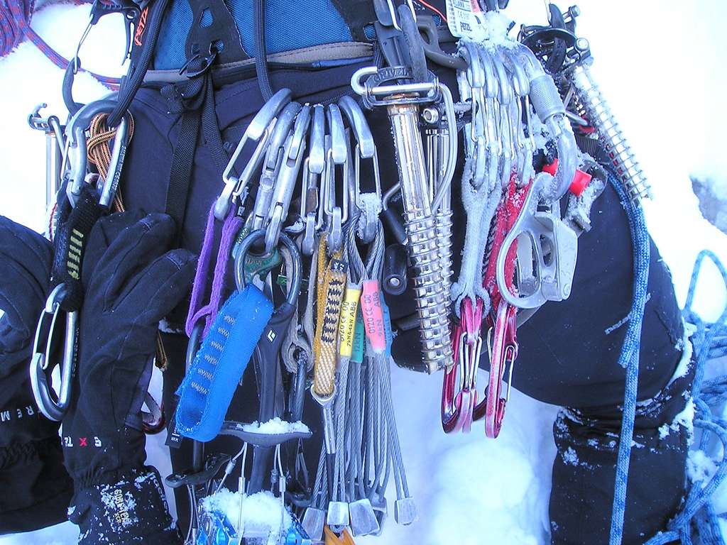
NOTE: Montenegro boulders have a limestone configuration, characterized by a higher or lower level of loose rocks, depending on location. In some areas, the quality of boulders is generally good, in some is not, but the fact is that most, especially longer routes, have at least one loose section. It is interesting that the routes, on boulders that are not of such good quality, are still popular, mostly because of their lower grade of climbing difficulty or short areas. In both cases, following the path of least resistance can be counter-productive, especially for less experienced or less ready rope teams when the possibilities, as an objective and persistent danger, remain in unstable and loose terrains across which the route passes.
Montenegro Hostel Team
FREE CLIMBING
FREE CLIMBING IN MONTENEGRO
There aren’t many arranged and equipped polygons for free climbing in Montenegro. Although the potential is immeasurable, this sport is undeveloped and has not yet been recognized as an attractive part of the tourism offer, so the investments are small too. Yet, with the enthusiasm of individuals and smaller organizations, several boulders are equipped with routes that, by their aesthetic, difficulties, and dimensions, completely correspond to modern world trends.
FREE CLIMBING IN BOKA
In Kotor, Ljuta, Dobrota, and Herceg Novi, several routes with diverse difficulty levels are equipped, ranging from 10-40 m in height. The climb in Kotor is located above the bus station, with the firm and demanding boulder, around 40 m high and 150 m wide. Routes on the very end of the left part of the coating, with southeast exposition, don’t reach the peak of the rock, roadsters are set up at about 20 m of height, and they are difficult within the range of VI+ to VIII- of the UIAA scale. Existing routes are equipped with glued axles, run-outs are short, and no matter how much we enjoy the climbing, our eyes are constantly wandering to the still-unexplored and unequipped lines. This climbing place has a large potential that maybe waiting just for you to leave a route as your legacy. In Ljuta and Dobrota, there are routes designed for beginners and climbers who look for enjoyment in lower degrees of difficulty. On both climbing spots, five to six directions are arranged with identical characteristics, on the firm and solid boulders, and with short access. Above Herceg Novi, minor exercise grounds are equipped on the boulders Čakotin and Šilobod, as training polygons for speleologists and climbers.
FREE CLIMBING IN PODGORICA
The famous free-climbing polygon in Montenegro is located in the area of the main city in a little village of Smokovac, on the way out of Morača Canyon. The cliff is about 30 m high and 200- 250 m wide, which accentuates height and characteristic relief created by calcium-carbonate sedimentation. Its general orientation is towards the west, so even during the summer months, it provides good conditions for morning climbing (until noon), although the best climbs are during the spring and autumn. Access is short and arranged. The terrain below is the route that is flat, suitable, and secure. The difficulty ranges from V+ to X-, and the routes above the VII degree dominate. Although the equipping of these routes has started recently, the quality of the rock and attractive routes has already promoted this climbing spot as a leading Montenegrin climbing spot in this category. There is one more equipped rock in Podgorica, in the very heart of the city, on Ljubović Hill. The routes that range from IV to VII+ difficulty provide an easily accessible rest for those who don’t have too much spare time but yet wish to somehow break the usual rhythm of functioning in the city’s uproar and rush.
FREE CLIMBING IN NIKŠIĆ
Near the monastery Ostrog, in the Povija village, there is a climbing area with routes of diverse heights, from short boulder problems to classical multi-pitch lines. The equipped part is the 1-20 m high boulder, characterized by a tower shape, where climbing is possible from all sides. Difficulties are in the V-VII range and their south orientation, without wind interruptions, makes climbing pleasant even during the sunny winter days. On Jasenovo polje, a few kilometers north of Niksić, towards Šavnik, is a rock, also equipped with several routes. Up to 20 m in height, route difficulties are in the VII-IX range. The only artificial cliffs in Montenegro are, for now, in Nikšić. The first is on the outside wall of the unfinished Dom Revolucije (Revolution Center), accessible to all, and the other is in the indoor Sports Center. Climbing on its possible by arrangements with the members of the Mountain Skiing Association “ Javorak”.
FREE CLIMBING IN KOLAŠIN
On the way to Kolašin towards the ski center “Jezerine”, in the Biočinovići village, there is an equipped free climbing polygon on a 40 m high crag. It is divided into two sectors, where the first one is directly next to the road, while the other one is ten minutes away along the path through the woods. The terrain is situated in the pine wood shade and offers excellent conditions for an escape from the summer heat. Routes are equipped systematically to cover ad much wide a range of difficulties as it is possible and to adjust space for climbers of different levels of knowledge, skill, and physical predisposition, especially for beginners and less ambitious amateurs. Equipping the routes of greater difficulties is left to the future climber’s interests. Arranging of this polygon was founded in May 2008, with the assistance of the Austrian-Montenegro Partnership “Bjelasica and Komovi” and members of the Outdoor Club from Podgorica.
FREE CLIMBING IN ROŽAJE
A few kilometers away from Rožaje towards Novi Pazar, in the canyon of the Ibar River, is, for now, the only equipped climbing place in this region. The rock is located along the river, behind the first tunnel on the main road that leads from the town to the north. Access to the rock is rather difficult, and the safest way to come down to its bottom is by a rope. The routes are in the VI-VII range, of medium difficulty.
FREE CLIMBING IN GUSINJE
The development of free climbing on Prokletije received an unexpected surge in May 2008. On four locations in the Gusinje surroundings, several free climbing polygons were equipped with 65 routes in the III-X UIAA range. Polygons are located on "Alipašini izvori" (Alipasha's Springs 30 routes), Troja (10 routes), Đerani (13 routes), and in the Grbaja valley near the mountain home (13). As in the Kolašin climbing sport, these polygons are primarily intended for beginners and recreational climbers, but it shouldn’t be forgotten that about half of the routes include line difficulties over VII, so that even the best climbers won’t be bored.
FREE CLIMBING SEASON
The free climbing season in Montenegro lasts in general during the whole year, but optimal conditions in individual locations vary depending on exposure, altitude, and current temperatures. Spring and autumn are always the most secure options, while during summer and winter, everything depends on the temperature. In lower areas closer to the sea, average winter temperatures are about 10˚C, which is completely acceptable for climbing. It is even better if the rock is exposed to the sun for some period of the day. On the other hand, these rocks are totally “unclimbable” during summer, since no one enjoys the temperature of +40˚and more, therefore it is necessary to search for the rocks on higher mountains, of the ones that are in total shade. All this means that a global season doesn’t exist for this discipline; instead, there are more micro-seasons and individual best conditions. Therefore, at any time of the year, suitable conditions can be found. All arranged climbing rocks in Montenegro are in the direct vicinity of good and frequent traffic corridors. Whichever you choose, the access will not take more than a hour's walk from the car, just as much as it takes to drive from the nearest city to the last parking zone.
NOTE: It is not known whether any kind of tax on free climbing is charged anywhere in Montenegro. State regulation does not include such mechanisms, and as long as you stick to the public property, your freedom to climb to your heart’s content won’t be jeopardized by anyone. If the routes are on marked private property, then it is necessary to get approval from the owner, which may include a certain monetary compensation. The routes on the territory of national parks also do not fall under the regime of special charges, but to climb in such places, you should pay an entrance fee to the park or a general residence tax. As for all-mountain activities, one of the main assets of Montenegro in the field of free climbing is that it is almost completely undiscovered. Despite familiar and frequently visited climbing destinations in Europe and the USA, where routes are a few meters away from each other, here is common not to have a single route on entire mountains, although there are thousands of possible routes. If you want to add to the list of climbed routes, some of which are completely yours, you will find ideal terrain in Montenegro. You will more often be left without inspiration for route names than without routes for new climbers. If you want to complete your stay in Montenegro by enjoying free climbing, you will have to bring the full equipment. Although few teams or individuals are doing free climbing and have acceptable equipment and are sometimes willing to borrow it, there is not a single shop where you could buy some pieces of technical climbing equipment-climbing shoes, rope, chalk, or quick-draws, etc. Therefore, check that you have not forgotten anything.
Montenegro Hostel Team
BOULDERING
BOULDERING IN MONTENEGRO
Surrounded by the stone blocks of rocks, a few meters tall, with interesting combinations of several moves, you have losing excuses for not going climbing. You will always be able to find some spare time for this; it doesn’t demand distant travel, nor does it require a trained partner or special equipment. Wherever you go, whether you wish for something easy, to warm up your hands, or you don’t have anything against spending a few days solving the same problem, some little boulder will always be there for you.
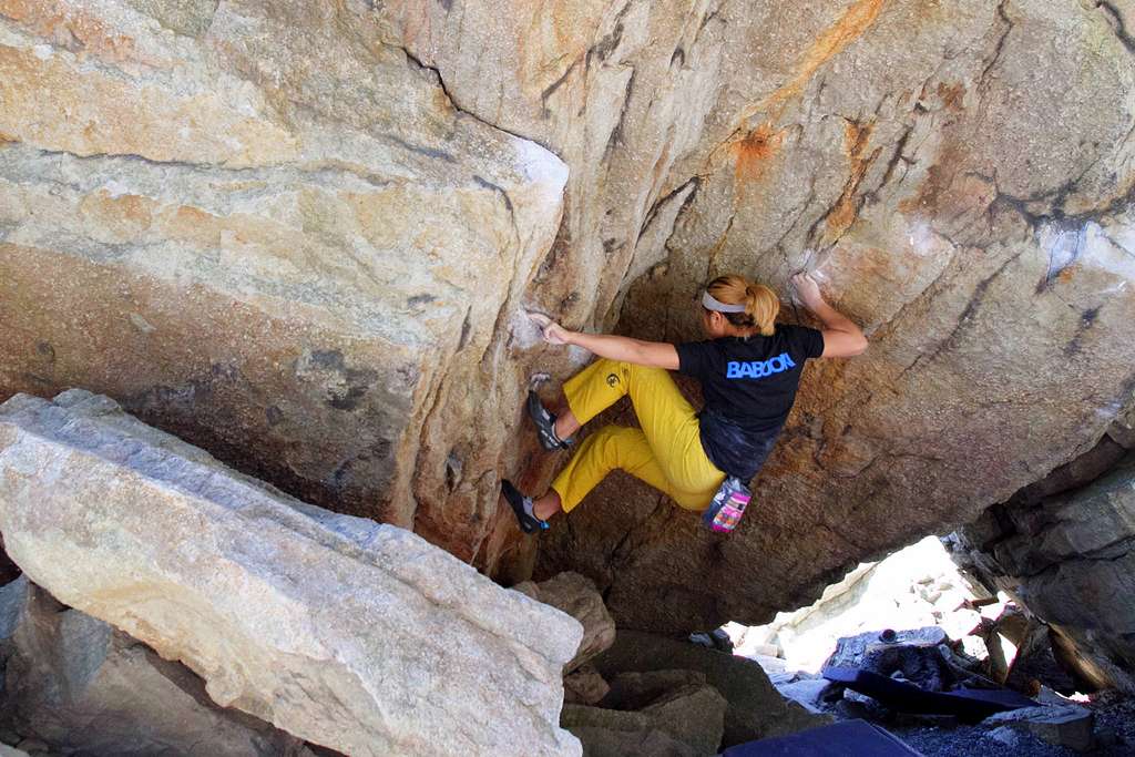
Climbed boulders are mostly located in the centers of climbing activities, like Prokletije, Žijevo, or Durmitor. Especially known are boulders in the Grbaja Valley on Prokletije Mountain, which have been for years the climbers’ only solace when the rain forces them to postpone some of the great climbing routes. They are situated along the valley, a few hundred meters away from the mountain home of Mountain Association “ Radnički”, and are up to three meters high, while previously climbed routes’ difficulty ranges from V4 to V7. Unfortunately, none of these routes has been named. The same is with the boulder in the Komarnica Valley, beneath the Bokeljske grede (Boka's Beams), but also of all local mountains and mountain valleys. The exceptions are boulders near Alipašini izvori (Alipasha's Springs) at Gusinje, where German climbers, during the equipping of the free climbing polygon in May 2008, have marked a few boulder problems of lower difficulties.
BOULDERING SEASON
If the answer to the question “where” is “almost everywhere”, then also to the question “when” you can answer “almost always”. If the winter and snow are covering the mountain boulders during winter, then ones at the coast or in Podgorica's surroundings are available. If you can’t even sleep because of the summer heat, let alone climb, then the mountain areas represent the peak of the bouldering season. In Montenegro, you can always find, in a couple of hours' drive at most, some boulders where it doesn’t snow or rain, and the temperature is just like it should be.
NOTE: In the Grbaja Valley, or so-called “other meadow”, there are several interesting boulders and above them arching crags of Maja Hekurit, Koplje (Spear), and Prestola (Throne).
Montenegro Hostel Team
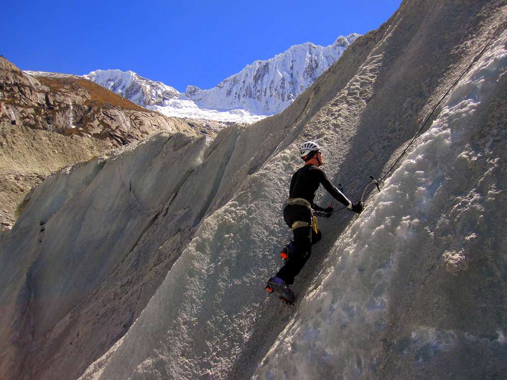
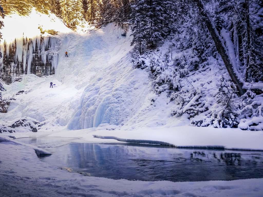
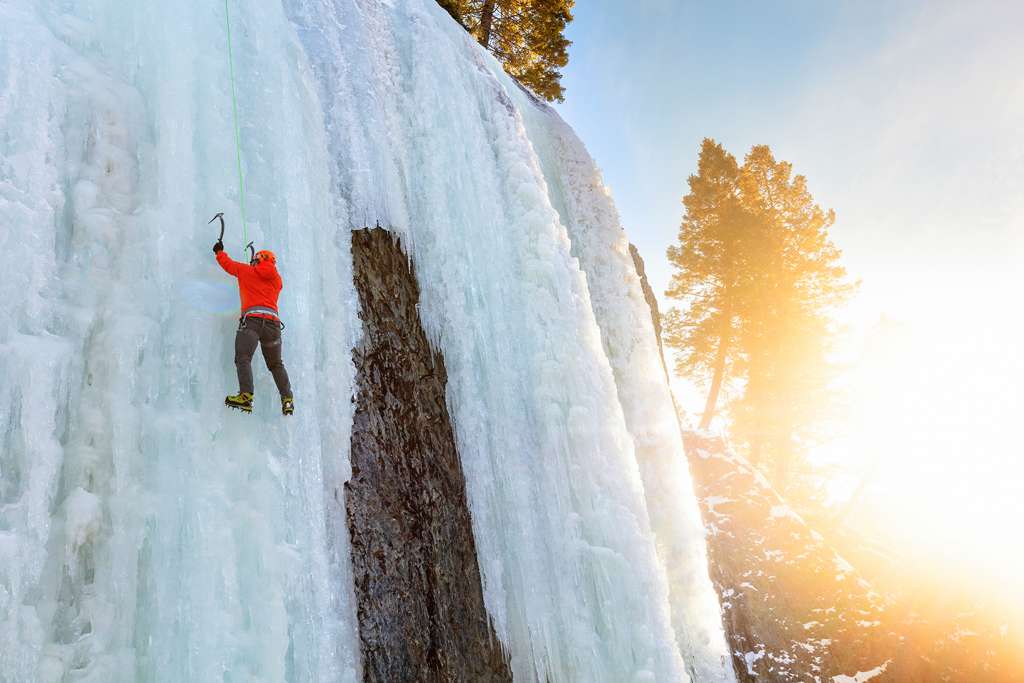
ICE CLIMBING
ICE CLIMBING IN MONTENEGRO
Frozen waterfalls are present in all regions of Montenegro, from the coast to the northern mountains, but their formation time and duration, as well as the ice quality, are far more suitable in higher and colder areas. In the canyons of Morača, Mrtvica, and Tara, as well as in the valley of the mountains like Komarnica, most frozen waterfalls are formed or are not so easily approachable.
Except for a few routes that have already been climbed, the possibilities for climbing for the first time and leaving a personal trail in ice crystals are huge. Whether it is still an unclimbed route on the existing or a completely new waterfall, every location where they are formed is still a treasury of undiscovered adventures.
ICE CLIMBING NEAR THE CITY OF BAR
Even though unusual, even a coastal town has the attraction of frozen waterfalls in its tourist offer. On the south side of the Rumija mountain, on the road which leads across Sutorman towards Virpazar, 15 minutes from Bar, there are two little waterfalls around 30 meters high and of WI 2-3 difficulty. Their exposition and geographical-climate position are not suitable for long duration and creation of a sufficiently thick ice-shell, but still represent an extraordinary experience-swinging tools into ice, with the Adriatic Sea as the background.
ICE CLIMBING IN PODGORICA
The capital city of Montenegro is more known for summer heat than ice. Podgorica’s surroundings abound with potential for this discipline, especially the canyons of Rivers Morača and Mrtvica. Waterfalls in Morača Canyon are easily accessible (except for a few lines under Dragovića polje, on the right bank of the river), and are in the vicinity of the asphalt road, with a few of them in the close vicinity of the main road. The area with waterfalls is marked by jumps and variations in difficulties and the ice quality, which is the consequence of water freezing on weaker courses that don’t have a constant water inflow. Waterfalls like Svetigora, under the Morača Monastery, partly because of strong flow, and partly because of their exposition, rarely form lines suitable for climbs. Three waterfalls on the line Međurijećje-Morača Monastery (WI 3-5), are frequently formed during the season, as well as those under the turning on Mioska (WI 2-4), and there are numerous ice or mixed lines between Dragovića polje (Dragovica Field) and the source of Morača River (WI 3-5, M6 and more difficult). The Mrtvica Canyon, known by the hiking road, carved in a boulder on the left river shore by Yugoslav National Army soldiers, flows down the sharp canyon walls to enable only short periods of sunbathing, even on the sunny sides, these lines have relatively good quality and sufficiently thick ice shell, with a pretty difficult, long-lasting access and withdrawal. By now, not a single one of these routes has been climbed in the canyon, which is a hundred meters high. In the direct vicinity of the city, on the way to the Kuči, there is a cascade of Vodenica waterfall, on a brook, which relatively often freezes and gives good conditions for easy and interesting cascades that are around 15 m high. Waterfall difficulties are in the range WI 2-3.
ICE CLIMBING IN ŠAVNIK (THE VALLEY OF KOMARNICA)
Considering the discipline, the Šavnik surroundings are the most visited and attractive region in Montenegro, especially the areas of the villages of Boan and Komarnica. Waterfalls in the Boan village are easy (WI 2) and are tens of meters high, but the situation is changing as you approach Šavnik. A few kilometers away from the village above monastery Podmalinsko, the ice line “Francisco”, WI 3, 50 m high, is being formed, while, on the other side of the river, a whole little ice park, consisting mostly of icicles and stalactites, is being formed by a stream overflowing by the right bank and leaking down the rocks. No routers are climbed here. Everything is untouched nowadays as it was centuries ago.
In the Komarnica valley, there are three interesting waterfalls, with Skakavac as probably the most climbed one in Montenegro. It is situated on the Grabovica streamlet, in a little amphitheater before the river mouth, at the Nevidio Canyon’s entrance. The exposition and the relief in the background enable this relatively strong river flow to form an attractive ice structure, where especially attractive is a characteristic alcove in the upper half of the route. Through larded stalactites, like the fringes of some fairytale baldachin, opens a view to the dark kerfs of Nevidio (Unseen) and the mystery of its cliffs. The second waterfall is situated on Mokra Ploča (Wet Slab) at the end of Komarnica village. Its difficulty is WI 4+/5; height is about 60 meters, and freezers are very rarely in climbable form, with thin and fragile ice. The third, WI 5, 20 m, is a few kilometers further up the valley, hidden in the forest below the Boljske Grede (Boka's Beams).
ICE CLIMBING IN TARA CANYON
The biggest in Europe and one of the largest in the world, Tara Canyon is also home to numerous frozen waterfalls, but none of them have been climbed up to the very end. Since the approach to the crags and routes in the highest parts of the canyon is very difficult and long, we will limit ourselves only to the entrance part, from Dobrilovina to the bridge Đurđevića Tara. In a big amphitheater, on the left side, only a few kilometers away from Dobrilovina, towards the bridge, there is one of the most interesting and attractive waterfalls in Montenegro. Those who have enjoyed pictures (or climbing) on Fanga or Pilsner Pillar in the USA, will find something here for themselves–a grand stalactite which ultimately touches the ground, forming a pillar that is 30-40 m high, with ice that reaches at least the same height over the cliff.
For the ones that feel at home in the climbs rated in difficulties around WI 5, this line is more than a good reason for an early rise. Depending on the season, waterfalls that flow down to the very road can be found in the whole of this area. Their heights, difficulties, and quality vary from wide and light curtains (WI 3), 20 m high, to the long and periodically mixed combinations in the bevels and lurking places that characterize the boulder above the road. Down the cliff over Tara’s right bank, in front of the bridge, streamlet brooklet's waters fall and form a waterfall of great attractiveness in its structure, and also by the scenery around it. It is about 70 m high, with difficulties that don’t go under WI 5. Because of the south exposition, sun warmth will represent a worthy prize for the effort of the first climbers, whenever they show up.
ICE CLIMBING SEASON
Although waterfalls in Montenegro freeze over almost every year, due to the relatively low sea-level altitude, mostly southern exposition, and above all, the closeness of the sea as a reservoir of warm air, which melts them, the ice climbing season is very short. Low temperatures, on which they are formed, mostly begin at the end of November and last until March, but the period from mid-December to mid-February is considered the best, although as usually takes two to three weeks of low temperatures for most of them to be regarded as climbable. Yes, these periods of cold times are hastily and rapidly changed or interrupted by significant defrosting, which melts and overthrows formed ice structures. So, it is always necessary to watch the weather forecasts and plan the climb accordingly. Sometimes the season offers only a few suitable days for climbing, and due to that, organizing longer climbing activities is impossible. Global warming, whose consequences are increasingly felt, also contributes to the season’s reduction.
NOTE: All mentioned waterfalls are located on public property; therefore, no special licenses are needed for access and climbing outside the national parks. For climbing waterfalls in the Tara Canyon, besides the usual tax of the NP “Durmitor”, no special taxes have been required so far, but the fact that the Park guards don’t have much understanding of this sport should be considered. Although there is no specific rule, they often demand that the rope teams stop climbing and move away. You should be especially cautious on the lines that go directly down to the traffic artery, where the safety of climbers and other traffic participants is jeopardized. Rope teams that are climbing in such places should mark their position by standing to signal, to avoid not only the traffic penalty but also any serious incidents that are completely unrelated to climbing. Camping during winter makes sense only if high-quality equipment for bivouac is used: winter sleeping bags, good pallets, and four-season tents. Yet, the question is: are you able to enjoy the waterfalls after a night spent in several degrees, particularly when the goal is not only pushing the limits of toughness but spending free time in a way that will charge your energy? So it is better to choose indoor accommodation, even if it is a bit far, to save more energy for tomorrow’s climb and lessen the possibility of some unwanted outcome caused by an inadequately organized bivouac.
Montenegro Hostel Team
SKIING
SKIING IN MONTENEGRO
The local terrain is ideal for touring skiing. Whether it is about long and technically demanding cruises or climbs with steep slopes, loaded with adrenaline. Wherever you are in Montenegro, in the wintertime, at one hour's drive at most, there is some hill with an ascent that awaits the fur on your skills.
SKIING ON DURMITOR
Durmitor Massif is the most famous winter destination in Montenegro, with huge potential for all skiing disciplines. Concerning your skiing, there are many interesting lines on this mountain. The only question is just how much time you’ve got. Depending on technical possibilities and fitness, you can choose some of the long tours among the peaks of the middle massif. One of the most popular tours starts beneath the cable car on Savin kuk (Sava's Hip) and leads through the clear side of Šljemen up to the top.
From here, the return is possible by the same path, through the Mlječni do or the circular continuation across Šljemen Cliff and Velika Kalica (Great Kalica). The other version is a lot longer and more demanding; it consists of skiing down the curvature between Šljemen and Milošev tok (Miloš's Flow) and bracket arm beneath the boulders of Malo Šljeme (Small Šljeme) towards the curvature Mala Pljevlja (Small Pljevlja), and from the spring, known as Točak (Wheel), right to the bottom of the ski track. The tour can be done in a day, and in case of slower advancement, the alpine bivouac in Velika Kalica is a secure and comfortable place to stay one night.
SKIING ON BJELASICA
The rounded peaks of Bjelasica provide immense possibilities for different touring, and yet are little used. One of the shorter and technically undemanding lines, which attracts with the beauty of the surrounding landscape and which is almost always possible to do, leads to the ski center Jezerine (1,444 m) across Katun Vranjak on the peak Troglav (2,072 m) with a system of light slopes and with several versions of descent. It is, if desired, possible to extend it with a bracket arm to Zekova glava (2,117 m), along which you should keep away from the top line on the Troglav Cliff because of eventual caves. Three hours are needed for this tour.
SKIING ON MAGLIČ
This is not about Maglič Mount on the border of Serbia, Montenegro, and Bosnia and Herzegovina, but about one of the Kuči Mountains, between Komovi and Žijevo. The tour starts in Veruša village, at about 1,000 m above sea level (depending on where you leave your car), follows the line across Mokra towards Širokara, some 12 km, and comes out on a curve on the Katun Laković (1,820 m). Here it leaves a road, turns north, and keeping along with the line of the wide cliff, some 2-3 km, goes to the highest peak, Maglič Lumer (2,141 m). From there starts the slope which goes either along the southwest side of the Bušat curvature and the beginning of the Mokra valley, or southeast to Maglički Bogazi and the upper part of Mokra. The first version is a bit steeper, while the second is longer and more interesting, with more space and different combinations. From Mokra, the same road leads to Veruša. Between 6 to 8 hours are needed for the entire tour.
SKIING SEASON
As for most skiing activities, the season for alpine touring starts from the last days of November and continues, depending on snow quantity, until May. The end of winter and the beginning of spring are considered the best, either because of longer days or because of the thickness or compactness of snow cover. In any case, this activity requires at least favorable meteorological conditions. Everything else is a question of convenience and skills.
NOTE: World statistics show that the biggest percentage of avalanche-related incidents to skiers occurs on alpine touring. Crossing large distances in off-trail areas brings many dangers and risks, the biggest on the avalanche. Experience, knowledge, and being well-informed about conditions on the terrain must be the most important segment when planning your mountaineering and ski tours, since these incidents usually happen away from those who would come to the rescue.
SKIING ON UNDEVELOPED PATHS
In all Montenegrin ski centers, there are great possibilities for skiing off the arranged paths, relatively near the cable car, as the easiest and fastest way to get up. These terrains often provide more space for various ski adventures than the existing ski paths; therefore, skiers who can ski very well in frozen or deep snow can enjoy the slopes along the length of natural monument lines. The other, incomparably wider category of ski fields outside the arranged paths are mountains with no ski infrastructure at all, but with slopes that look as if they are made for a free ride. They require more effort and organization, the danger is greater, and help is more distant and harder to reach, but the feeling of adventure and pleasure is such that every risk seems worth taking.
Durmitor
The most popular off-trail skiing lines on Durmitor are those on Savin kuk (Sava's Hip), whose peaks are only a few hundred meters away from the last cableway station. Skiing down to the east side, the so-called clear side, is possible from there, as well as skiing along the corridor between the upper cableway or skiing down Mesna Lastva to Velika Kalica. The other two versions have very steep and demanding slopes, with a slant of around 45˚, and they are only for good and confident skiers. There is a clear side of Šljemen, but since there are no ski lifts on these peaks, the ascent is possible either on alpine skis or on foot, with skis on the back. The slant of this mountain is about 30˚, and in good snow conditions, it provides real enjoyment. In Velika Kalica, under Šljeme, is the residue of an ancient glacier, known as Debeli namet (Thick Alluvium), where it is possible to ski even in summer.
Bjelasica
Bjelasica is known for its gentle and long slopes, pastures during the summer, and ideal spaces for skiing or snowboarding during winter. For those who are not ready to carry skis on their shoulders for long to go down the slopes through the snow powder, the most accessible cliffs are on Bjelasica, which leads southwest from the peak Ključ (Key). From here, it is possible (for good skiers) to go down to the ski track line in several different ways. Whichever you choose, take care of the eventual caves of the cliffs. The height difference is around 300m.
Season
The best skiing conditions in Montenegro are from mid-January until mid-March, but the season sometimes begins much sooner or can be extended to the last days of April. Even here, global climate changes disrupt temperatures and rainfall quantity, but the annual high point of snow thickness and its quality is exactly during this period. If your goal is at a higher altitude, the reason expands. Some lines are already formed in November and can last until the end of May. Of course, the most ideal skiing conditions shouldn’t be expected then.
NOTE: Although it doesn’t belong to a particularly demanding slope, the slope down the so-called “clear side” of Savin kuk on Durmitor is classic of local skiing outside the arranged tracks. Pitch is about 30-35˚somewhere even 40-45˚, around two kilometers long at starting altitudes of 2,313 m and bottom altitudes of 1,480m. While you ski, the plateau of Jezerska Visoravan (Lake’s Upland) opens in front of your eyes, showing the mountains of the middle and northeast part of Montenegro, as a wide, elusive space. The access is easy, by cable car to Savin kuk, and then a few hundred meters on foot to Peak’s outlet. In the upper part, the path follows the line of the cliff above Velika Kalica, then slowly separates towards the south and, depending on the snow, drifts to the regular ski track. Because of the south and southeast orientation of the slope, snow is often not good enough for skiing, but when it forms, this line gives an unforgettable enjoyment. There are no specialized services in Montenegro that deal with avalanches; therefore, if you wish to ski outside of the usual paths, you should check the state of the snowdrift and its eventual tendency to avalanches. You should avoid slopes with exposition and orientation that can cause avalanche movements, which are located in the layers of snow caves on the cliffs and lead to concave relief shapes, especially after larger rainfalls or temperature rises. Do at least rough avalanche testing on every slope. Those 15 minutes can save your life.
Montenegro Hostel Team
SPELEOLOGY
SPELEOLOGY IN MONTENEGRO
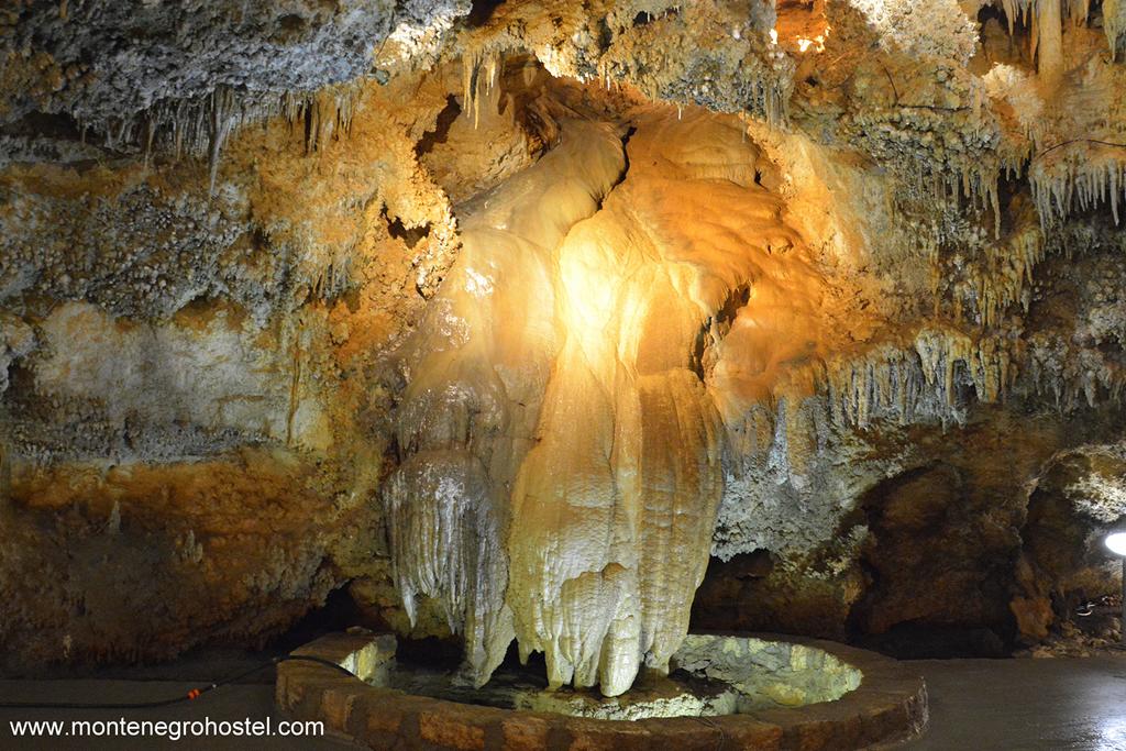
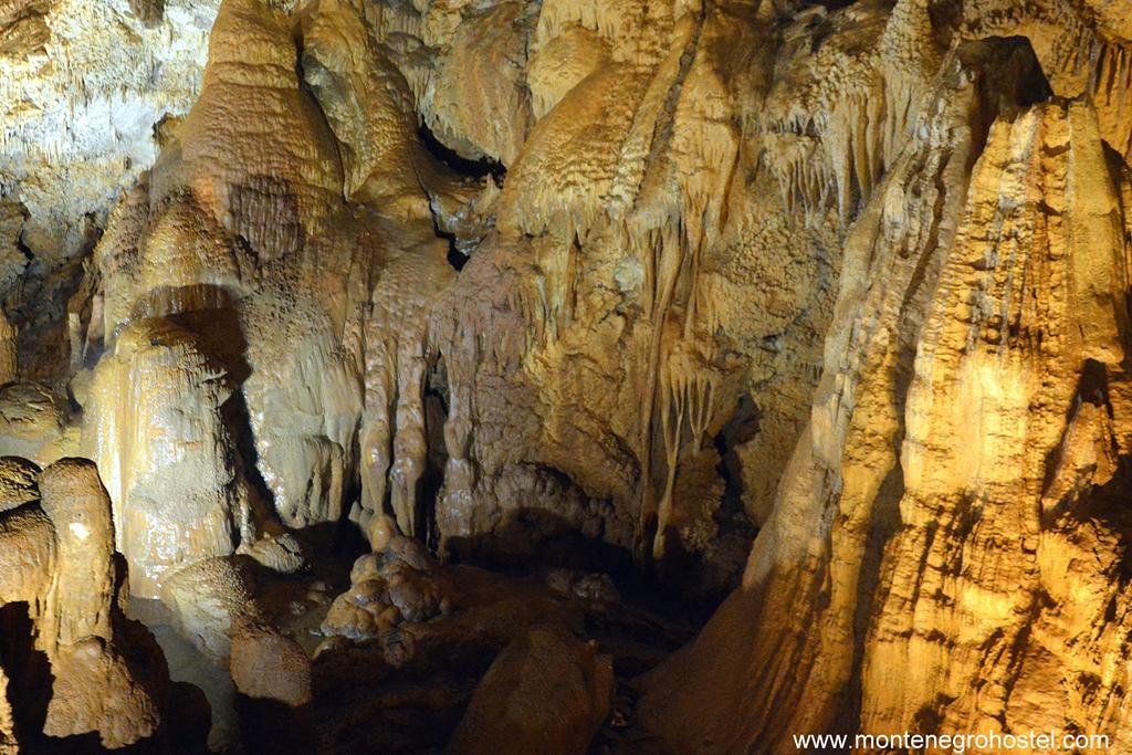
The Mountain massifs of Orijen, Lovćen, Meganik, Kapa Moračka, Durmitor, and Prokletije, as well as part of the Pešter plateau, have karst that is overfilled with long holes leading to deep caves, and there is no area without at least some gaping holes. Considering the complexity of terrain, number, and characteristics of the structure's research possibilities, specific speleological organizations have been organizing activities in the same locations. A database on terrains was made and constantly expanded, as well as a map of halls will be able to conjure the beauties of the Montenegrin geological underworld.
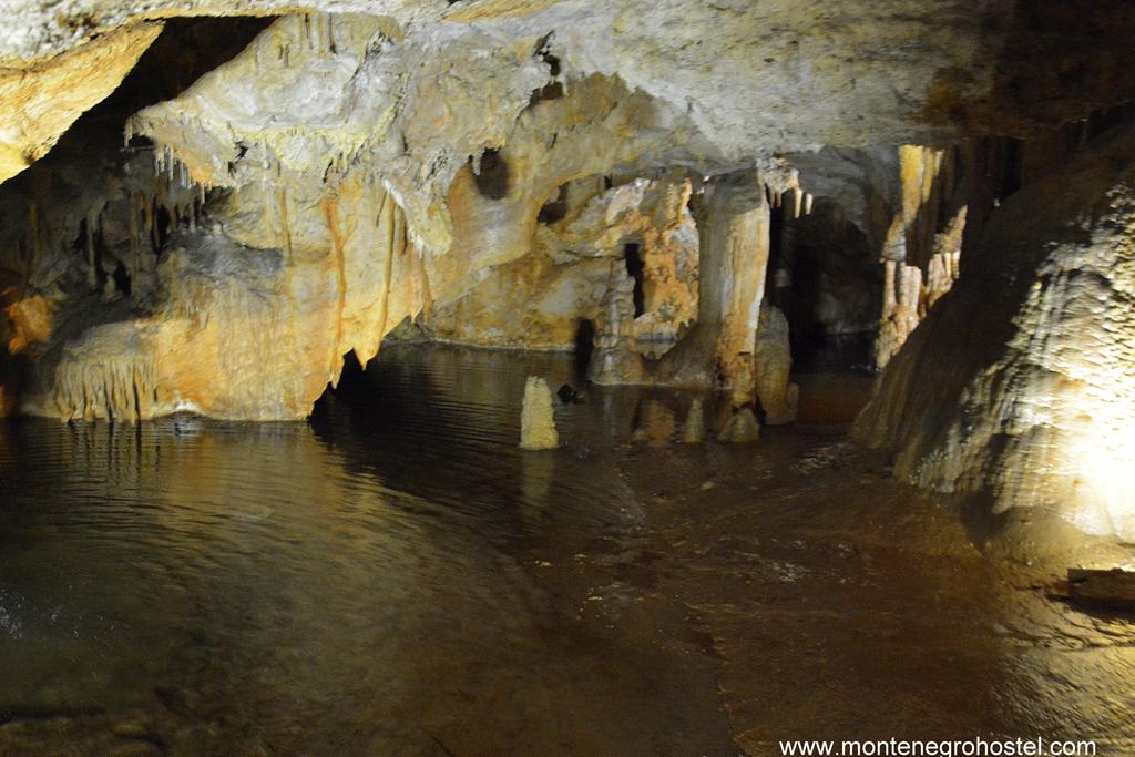
VJETRENA BRDA CAVE
In the area of the National Park Durmitor, there are several speleological elements of imposing size, mostly caves. The thickness of the karst and the high altitude of the entrances enable the creation of deep caves, among which is the cave on Vjetrena brda (Windy hills) that was long considered the deepest in the Balkans, while the cave on Mali Lomni Do carries the epithet of technically most demanding even today. The cave on Vjetrena brda, with 755 m of depth, is the deepest one in Montenegro and one of the deepest in the Balkans. Although there are no great technical difficulties in it, its grand size demands a serious organization well-prepared team, and a large amount of equipment. The cave was discovered by Polish speleologists. In August 1985, during the international speleological expedition “Durmitor 85”, the cave was explored to the very bottom, at 897 m of depth, according to the measurements at that time. The last measure (2005) with more precise instruments has shown that the real depth is 775 meters.
Although it is not the deepest one, the cave on Mali Lomni Do is technically the most demanding. Because of that, it is not often the subject of actions or expeditions, while stories of conquering its details are an inevitable part of local speleological history. Discovered and searched up to a depth of 560 meters in 1984, during the international speleological expedition “Durmitor 85”, when the ultimate depth of 605 m was reached, without the possibility of further progression. The cave system in Obručin, with a depth of 464 m, is the most often visited cave on Durmitor. It is an excellent introduction and preparation for descending into bigger and more difficult objects. For the first time, this technically relatively easy cave system was explored during an international expedition.
ĐALOVIĆA KLISURA (DJALOVIC’s GORGE)
The cave above Vražiji firovi (Devil’s Whirlpools) in Djalovic's Gorge (the canyon of Bistrica River), near Bijelo Polje, is the longest cave system in Montenegro. It is situated about a kilometer upstream from Glava Bistrica, through Đalovića klisura (Djalovic's Gorge), at the same altitude as the lowest of four ponds, so-called Vražiji firovi. Explored length of this canal is around 11,750 m, while the precise measure is 10.550m, and the denivelation is about 120 m. The researched cave part above Vražiji firovi consists of canals, hallways, and caves that are mostly divided into four basic entities: A canal with lakes, Veliki Lavirint (Great Labyrinth), Veliki Kanal (Great Canal), and a braid of canals that connect the upper level with the lower one. The richness of morphological shapes and cave jewelry makes this cave a pearl of the local underground, by its dimensions and aesthetics.
MAGANIK AND MORAČA MOUNTAIN
The central part of Montenegro, in which the mountain massif rises on Maganik, Prekornica, Kape Moračke, and Lola, is also an exquisitely attractive speleological terrain. Among the huge number of cave objects and different depths, Dvogrla jama (Two-necked Pit) in Pribatov dol on Maganik stands out by its dimension, at 395m of depth, and the cave in Crveni dol beneath Stožac and Kapa Moračka (444m). In 1994, both caves were explored for the first time, and in 2001, during the research of the depth limit of 393 m, a cave continuation that increased its depth to 444 meters was found in a hole of Crkevi Dol.
ORJEN, LOVĆEN, AND RUMIJA MOUNTAINS
Southern areas, especially ones covered with chains of seaside mountains, Rumija, Lovćen, and Orjen, don’t have altitudes like the ones in Durmitor, which enabled the formation of caves of great depths, but they don’t lag in their numbers and diversity of speleological objects. Terrains like Kameno more (Stone Sea) within the wider scope of Orijen massif, where caves burst, practically everywhere, or on the wider Lovćen region and mountains leaning onto it, offer almost unlimited possibilities of enjoyment in the underground magic. The zone of the main coastal cliffs is characterized by the formation of holes or combined cave-hole objects that drain the surface waters towards that coast, as is confirmed by several hydrological examinations. An example is a combined cave in Duboki do, in the Njeguši area, which is 2,178 m long and 506 m deep. Its dimensions make it one of the most representative Montenegrin speleological objects in both categories, while the unique complexity of the passage, which includes speleological diving in a great siphon, demands from the speleologist all of his knowledge, equipment, and skills.
SPELEOLOGY SEASON
During the whole year, the air temperature in speleological objects is the same, but not the level and amount of water in the streams and accumulations. That is why the second half of summer and the beginning of autumn are the best choices, since during that time the surface receives the smallest amount of precipitation, which is still drained and collected in caves. Besides that, after numerous hours spent in wet and cold overalls, it is good to meet a warm August morning instead of a February storm.
NOTE: Speleology in Montenegro is free. Exceptions are the areas of national parks, where you should pay general and visitor’s fees, and for every activity in the objects of the National Park Durmitor, you should get approval from the park management. Cave jewelry that we admire so much and whose beauty is the counterbalance to the extraordinary monumentality of underground spaces should remain there for everyone else who will come to admire it. Resist the drive to break it off and don’t take it away. From the silence of underground chambers, souvenirs are carried in memories, not in a bag.
Montenegro Hostel Team
CAVE DIVING
CAVE DIVING IN MONTENEGRO
Speleo diving, the most demanding and dangerous mix of underground and underwater enjoyment, the mostly divided into two categories: diving into surface springs and wells, whose canals continue further through the underground, and diving in siphons, lakes, and streams inside the speleological objects. The first version means easier access and logistics, but deeper, longer, and more complicated diving, while in the other case, diving is often in service of passing some permanently or temporarily sunken object’s segments, starting and ending in the darkness and the cold of the cave.
By now, in Montenegro, cave diving has usually been done in both ways, mostly within international speleological activities and expeditions. Cave divers’ attention has been drawn by Savino oko (Sava's eye) in Prokletije, source Jama (Pit) in canyon Mrtvica, estevela Gurdić in Kotor, as well as underwater sources in Skadar Lake like Karuč, Raduš, ponds in Malo blato (Little Mud), etc. The end of any of them hasn’t reached up to nowadays. For example, in Savino Oko, it was divided up to 64 m of depth, without indications of the near end. This form of cave diving is becoming increasingly popular, while dives in speleological sites have been, until now, done in the caves above Vražji virovi (Devil’s Whirlpools) and Duboki do (Deep Bottomland) on Lovćen Mountain.
CAVE DIVING SEASON
For diving in springs on the surface, considering the outside weather conditions, the most suitable period is summer, while for activities inside the sites, the situation is a bit different. In the caves and caverns, whose dimensions and magnitudes represent a greater danger from flow bursts after copious rainfalls on the surface, it is recommended to dive during winter when low temperatures freeze most drain canals and cut the waters’ breakthrough into the underground. While choosing the speleological diving terrain, you should keep in mind the regulations that are pretty undefined in this area. That especially refers to diving inside the National Park Skadar Lake, where local authorities will prevent your access or allow you to dive, depending on their own will more than on the existing written rules. In principle, it is necessary to get approval from the National Park.
NOTE: Savino oko (Sava's eye) in the Ropojana Valley has long been the inevitable part of every visit to Prokletije. It seems like its emerald color is spilling over the banks and hypnotizing with its unreal appearance. To dive in, it rounds up the story, regardless of the temperature of 4˚C. When making diving plans in the spring of Skadar Lake, it is also good to consider the modified socio-demographic conditions on its shores. If you wish to dive here, it would be wise for you to get all possible licenses and to watch out for local poachers; believe it or not, their favorite fishing tool is dynamite.
Montenegro Hostel Team
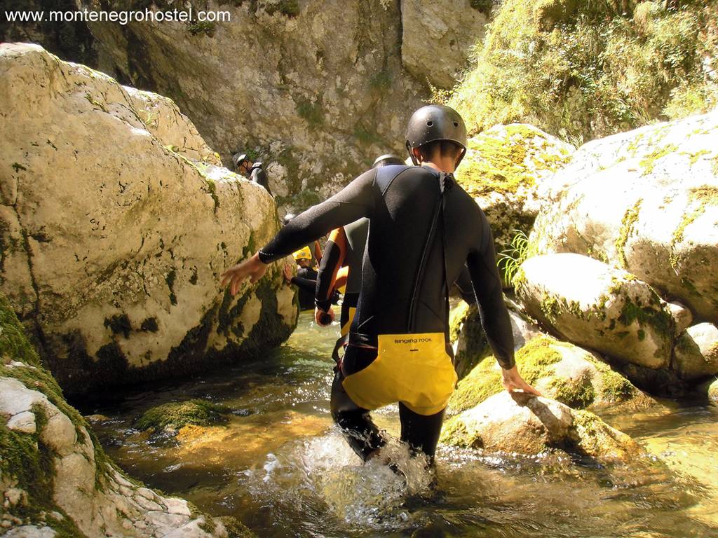
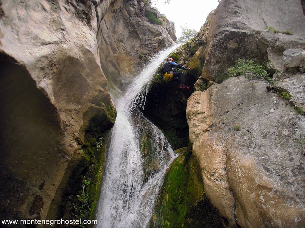
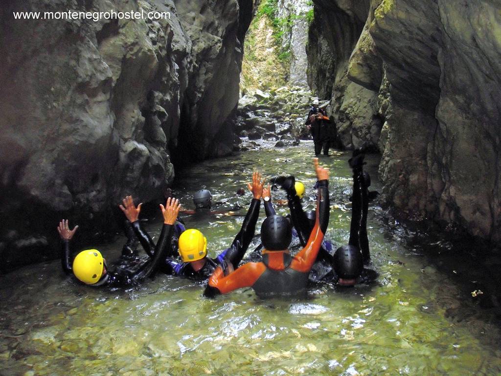
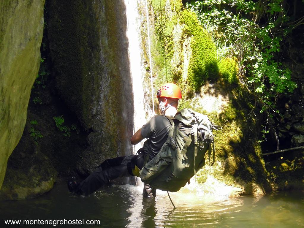
CANYONING
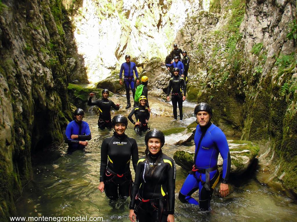
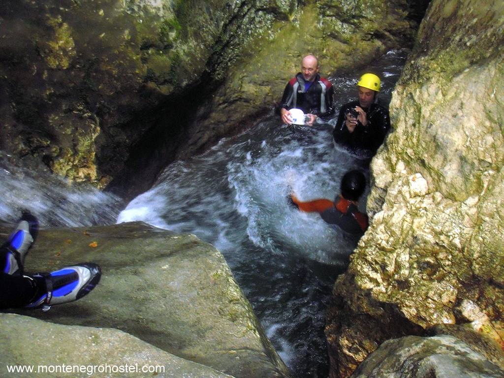
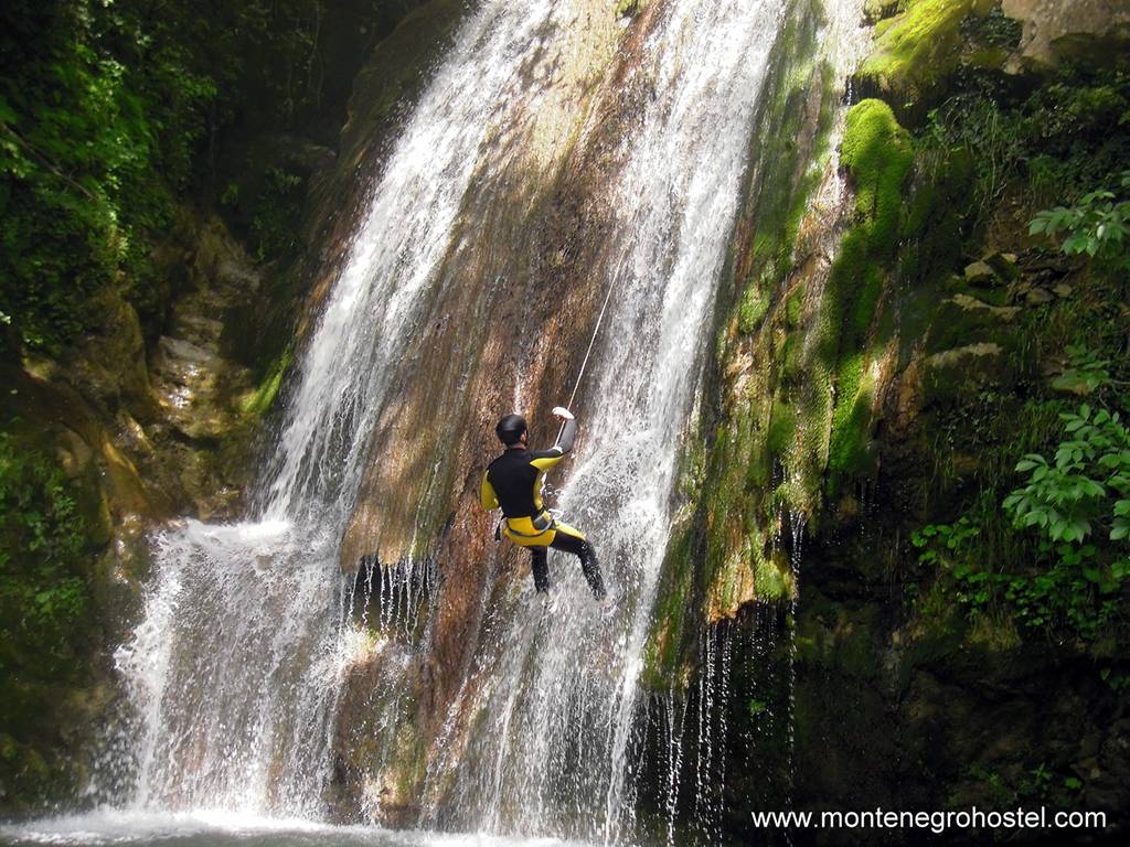
CANYONING IN MONTENEGRO
The feeling of adrenaline that splashes over us from the inside, making us stronger and faster, raising inner tension up to a breaking point, and turning experienced moments into a pack of emotions for the year ahead, is a reason enough for any adventure. Canyoning means enjoying a water flow, which gallops through kerfs, flows down the cliffs, and cataracts into deep pools under a veil of millions of drops.
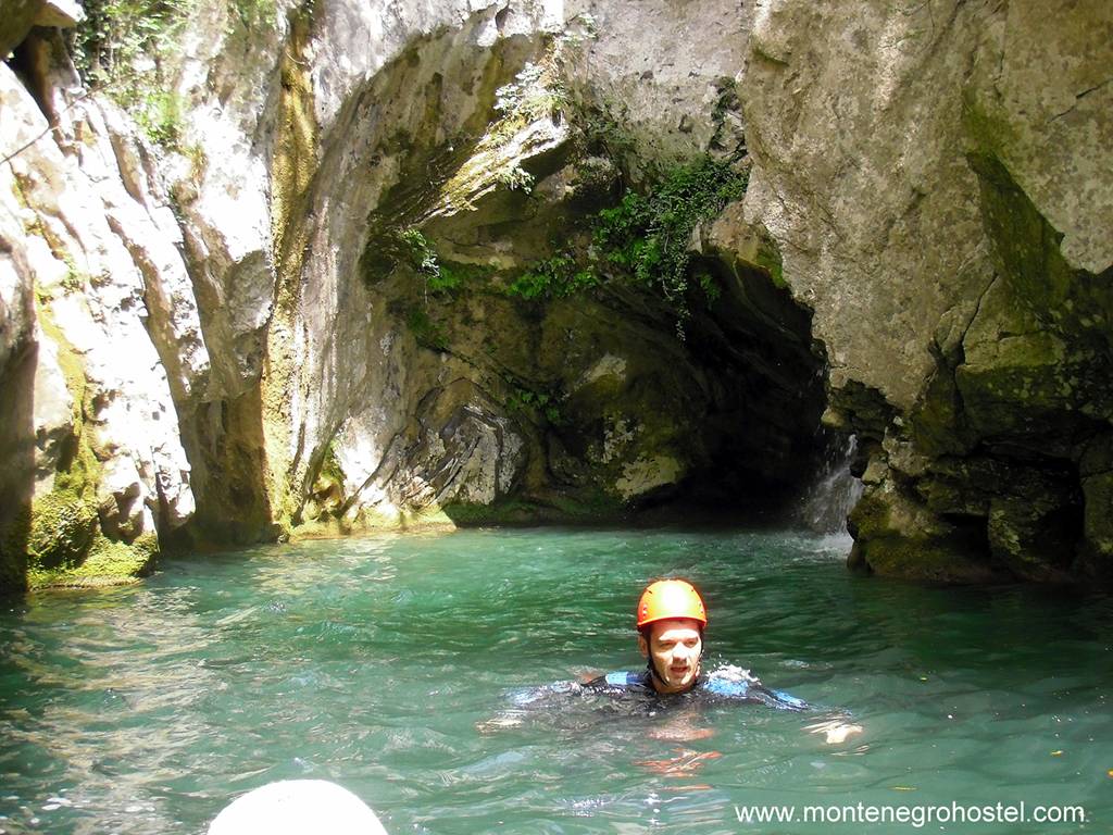
CANYONING IN NEVIDIO
The beginning of the canyon Komarnica, known by the name Nevidio (Unseen), is the most famous and visited canyoning terrain in Montenegro. The entrance is situated in the village of Komarnica, about ten kilometers from Šavnik, 50 meters after the meeting point of the small River Komarnica and Grabovica. It is 3.4 km long, while passing it usually lasts about four or five hours. There are several technical details with jumps in pools or slopes down the rope, but there are also areas where you can walk.
Exiting the canyon, after the last jump and waterfall, consists of a pretty hard climb along a sharp left side, some 200 m towards the road that follows the direction of its extension. Thanks to the members of MSS (Mountain Skiing Society) “Javorak” from Nikšić, who passed through its shadows and whirlpools in 1965, Nevidio has become a synonym for this discipline in Montenegro.
CANYONING IN GRLJA CANYON
Technically, the hardest, coldest, and darkest canyon in Montenegro, it is formed by a little River Grlja, in Vusanje village, under the Prokletije, 5-6 km from Gusinje. The entrance is at the beginning of the Ropojana valley, in a place where water from Grlja falls into a 15 m deep boiler and continues further among narrow, depart cliffs. The canyon is relatively short, less than your feet during the rappels down the waterfalls. Their heights are from 7 to 30 m. At the end of the canyon is a breakwater or a plug made of deposited materials (mostly branches), about five meters long, that should be dived under or jumped over. After it, on the way out of the canyon water stream becomes perfectly calm and easy.
The passage lasts for about two hours. In the canyon itself, it is very important to pay attention to the biggest waterfall, which starts bit by bit and almost unexpectedly transgresses vertically, from where it is almost impossible to jump down safely because of the cliffs that stick out. Anchors are equipped with bolts, and equipment for departure, besides the classic combination of iron and textile, includes neoprene wetsuits of at least five mm thickness. The river itself changes in the canyon, entering as the Grlja River and flowing out as the Ljuča River.
CANYONING IN TREBJEŠNICA CANYON (SJEVERNICA)
The Trebješica River sources above the village of Gornja Trebješica, at about 1,200 m of altitude. With Sjevernica, it interconnects in the canyon itself, as the left confluent of the Morača River, disgorging in it at the bridge Pjenavac (180 m), on the main Adriatic road. The depth of the canyon is about 300 to 400 m and is around three kilometers in length. The canyon itself is easy; the passage lasts about three hours. The best access to the canyon is from the railway station Trebješica (780 m) at the railroad Podgorica-Bijelo Polje, four stations before Kolašin.
From out there, it takes two hours to the canyon entrance that starts at 630 m, beneath the village of Donja Trebješnica. The whole tour demands specific physical preparedness because it takes around eight hours of walking, descending, and swimming, from the Trebješica station to the main road. Besides the equipment, a little plunger suit and technical equipment, a little pontoon is suitable too.
CANYONIG IN BOGUTOVSKI POTOK (BOGUTOVSKI STREAM)
The Bogutovski potok canyon is in the territory of the Rovci, 30 km from Podgorica towards Kolašin. It is about 1.5 km long and has eight verticals, where the biggest one is 25 m high. There are natural anchors for descending on most verticals, while there are hangers with rings on others. The tour ends with the delta of Bogutovski potok (Bogutov's Stream) in Morača, in the most beautiful part of Platije, and it takes about five hours.
You can access the canyon from the village of Vlahovići, which is located on the main road from Podgorica to Kolašin. You should turn left at the sign from Trmanje Village, at the 33rd km, from where there are about 10 km of asphalt road 633 m high village. Coming down from the village to the very riverbed of the stream by macadam takes about 45 minutes.
CANYONING IN ŠKUDRA CANYON
Škurda Canyon, one of the most vertically exposed canyons in Montenegro, is situated directly above Kotor and comes down to the very city walls. The easiest access to its entrance is by a marked path that starts at a place called Krstac, on the road Kotor-Cetinje (at about 900 m of altitude) and leads down the hill, through the pinewood, following the shore of the stream. The canyon entrance is at the old stone breakwater (at about 600 m of altitude) from where the path proceeds along the left side. In several places, it is possible to leave the canyon and come down to Kotor following the path. In the canyon, there are 25 verticals, up to 35 m in height, equipped with a fixed installation for descending in places where there are no natural anchors.
A well-trained team needs 6-7 hours to pass through. During the summer months, the canyon bed is characterized by an intermittent (not continuous) streamflow, and due to that, the route is easier, but stagnant water in pools and stone tubs is more of an ambiance for frogs than mountaineers. So, it is better to choose later spring when the river waters partly make the passage difficult, but in return make it much more beautiful from a sports perspective.
CANYONING SEASON
Canyoning, as a sport in the cold waters of mountain rivers, is certainly a summer recreation. Besides that, ones with less experience sometimes prefer to enjoy the canyon’s architecture and landscape rather than the water flowing along its bed, so in this period of low water level, experiencing this adventure becomes possible for the largest number of admirers.
NOTE: A small circle of people partakes in canyoning in Montenegro. That means that there are many canyons and gulches where no man has passed, whose secrets no one has discovered, and not a word has been spoken yet about their beauty. While you are picking the ropes, diving suit, and helmet in a transport bag, don’t hold back the explorer in you. As rarely anywhere else in Europe, there are plenty of places for him in Montenegro, especially when we talk about precipitous water passage in stone, with a skyline above the head wide as the water flow beneath the feet.
Montenegro Hostel Team
RAFTING
RAFTING IN MONTENEGRO
Mountain rivers like Tara, Lim, and Morača, especially in their canyon areas full of rapids that call and attract, boil in bubbles, and outshine with intensity. On the other side, the calmness of Skadar Lake, Zeta, and the upper stream of Morača seems it calm down and hushes, collected adrenaline calls for peace, and relaxes senses.
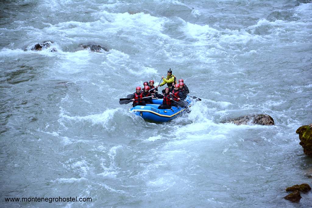
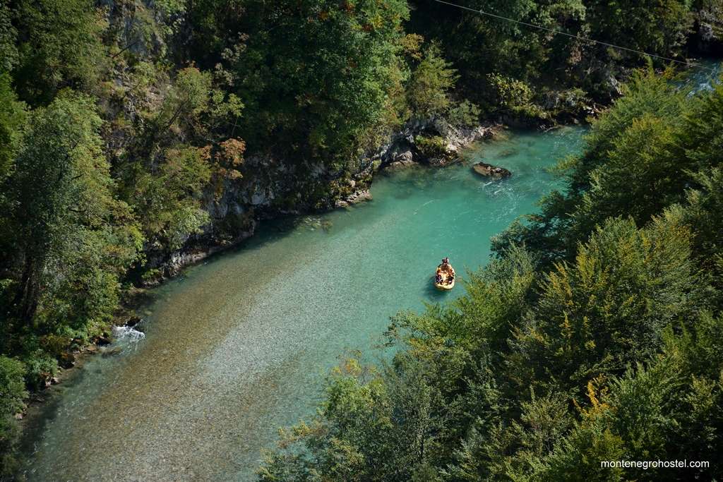
RAFTING ON THE RIVER TARA
Rafting down the Tara River is a trademark of the local tourist offer, not without reason. One of the most beautiful canyons on the planet, about 85 km long, is mostly covered in two or three days, while adventure starts at the location Splavište, a few kilometers downstream from the bridge over Đurđevića Tara. To this place, you can arrive from three directions: Mojkovac, Pljevlja, and Žabljak. The first session relates mostly to rafting down from Splavište to Radovanova Luka, and then from Radovanova Luka to Brštanovica, and the third one is from Brštanovica, with difficulties rated from three to four WW, depending on the water quantity.
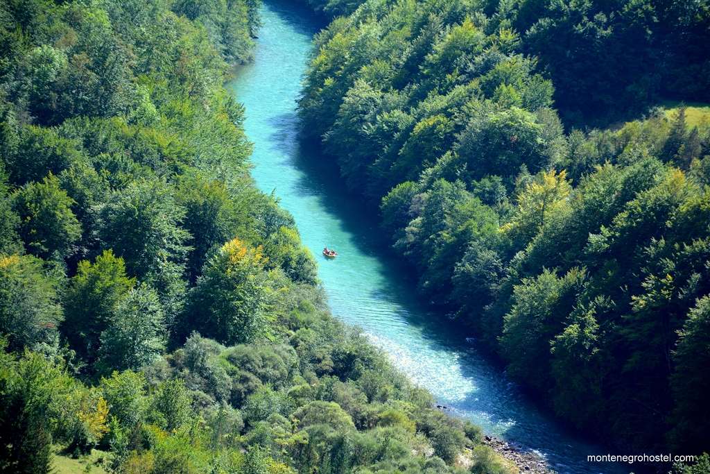
In a place called Lazin Kamen, Tara is the narrowest, only four meters wide, and also deepest (about 16 meters), while the canyon cliffs reach the greatest heights, around 1,300 m, at Bajlović Sige. Since there is a carriage road to Brštanovica, one-day rafting tours are often organized from Brštanovica to Šćepan Polje, which is the essence of adrenaline and enjoyment in the fastest river section. Places for rest and sleep are organized camps and a motel in Radovan Luka.
RAFTING ON RIVER MORAČA
Considering fast waters, rafting on the Morača is possible from Međurječje, that is, from the junction of the Mrtvica into the Morača, depending on the water level. From there to Podgorica, rapids, whirlpools, gulfs, cliffs and caves, beaches, and canyon fragments are interchanging. The easiest access to water and limits of potential sections are in Međugorje, Duga, Bioče, Smokovac, and Podgorica, wherefrom the river, already much calmer, continues through Zetska Ravnica (Zeta’s Lowland) on Skadar Lake.
RAFTING ON RIVER LIM
Lim is suitable for rafting all along its stream through Montenegro, and considering the inhabitation of its shores, it is possible to choose the start, finish, and length of sections, according to almost everyone’s desire. Besides segments of the river’s canyon, beneath Berane and Bijelo Polje towards Brodarevo, the river is not characterized by long-lasting rapids; therefore, it represents a combination of calm and strong mountain streams. Unfortunately, the River Lim is almost completely unexploited by rafters in Montenegro.
RAFTING SEASON
Considering the seasonal difference in the water level, the same river section may seem completely different, depending on the period of the year. Snow melting in spring brings new water masses to streams, raising their level and making them incomparably more powerful. With more knowledge and experience, this is the time to enjoy the adrenaline of the river at its peak.
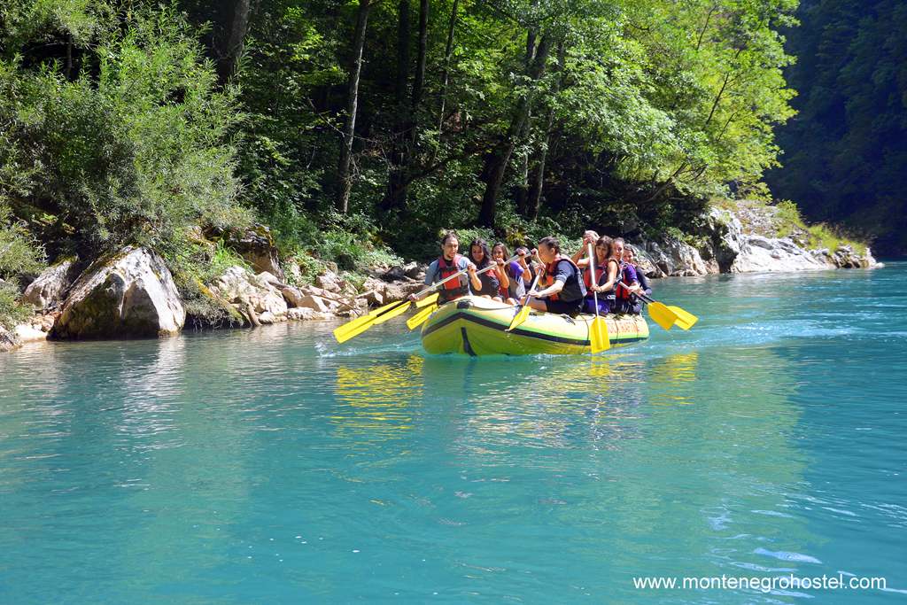
The water level falls during the summer months and at the beginning of autumn, making streams so much lower that they are accessible for most recreational rafters. During the years of strong, big droughts, some streams decrease so much that they seem more like a system of connected swamps than a river whose whirlpools you should be afraid of. This is especially characteristic of Morača, while Tara and Lim reduced, have enough water during the whole year.
Montenegro Hostel Team
FAST WATER KAYAKING
FAST WATER KAYAKING IN MONTENEGRO
Rapids of local rivers, according to the size of the kayak, open space for adventure, even beyond the main and the best-known courses. Naturally, rivers: Tara, Morača and Lim, and Ibar, enjoy the deserved and untouchable priority, but the possibility of kayaking down their confluences, during higher water levels, shouldn’t be disregarded. Among them, Ljuča stands out. Komarnica is the stream’s section from the Nevidio canyon until the delta into Piva River, Mala Rijeka, and Cijevna River, which gives away their waters to Morača, although several little rivers during the first spring months are surely known to foam as well.
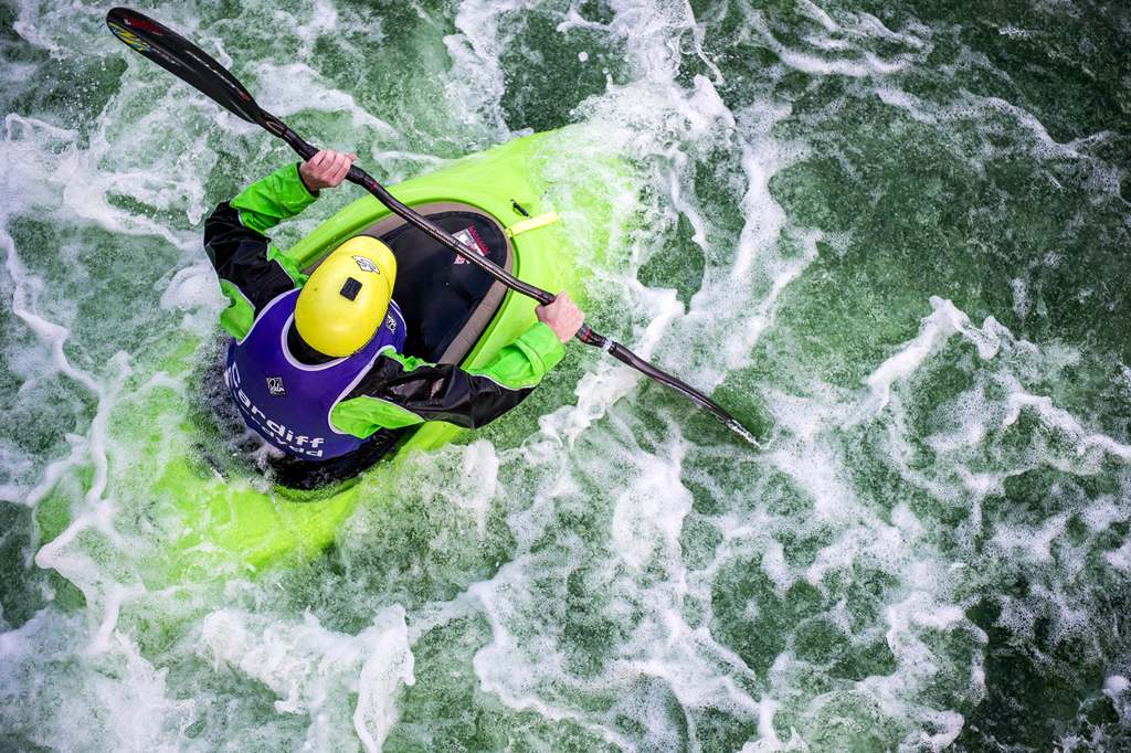
KAYAKING ON RIVER TARA
During its entire course (124 km), Tara represents wild water, navigable from Opasnica to Šćepan Polje. Certainly, the most interesting part is through the canyon itself, about 85 km in length. The hardest sections are, depending on the water level, 3-4 degrees of difficulty, and in the canyon, there are several places for rest and overnight stay. The most common combination, both for rafting and kayaking, is the whole tour from Splavište, at the bridge Đurđevića Tara, to Šćepan Polje, or only the most interesting part, which starts with Brštanovica’s rapids. It should be mentioned that on the section from Brštica to Splavište, at Đurđevića Tara, for a length of 20 km, the descent is forbidden. Kayaking on Tara is often divided into five sections:
Mateševo–Kolašin , WW I-II+, 10 km
Kolašin–Mojkovac, WW III, 20 km
Mojkovac–Bistrica, WW I-II, 14 km
Bistrica–Splavište, WW III-V, 20 km closed for passage
Splavište–Šćepan Polje, WW I-III, 80 km
KAYAKING ON RIVER MORAČA
All that is said for the possibility of rafting in the area of Morača’s river stream above Podgorica, also stands for a kayak on wild waters. Since a kayak is more maneuverable than a big pontoon and passes much harder, narrower, and more interesting rapids, this makes Morača an even better field for this adventure. Kayaking down the steepest part of the canyon, Platije, where several hundred-meter-high cliffs go down vertically into the water, should not be missed. Morača is a river with the hardest details of rapids in the whole of Montenegro, with three details of WWX during the period of high water level. Its sections are:
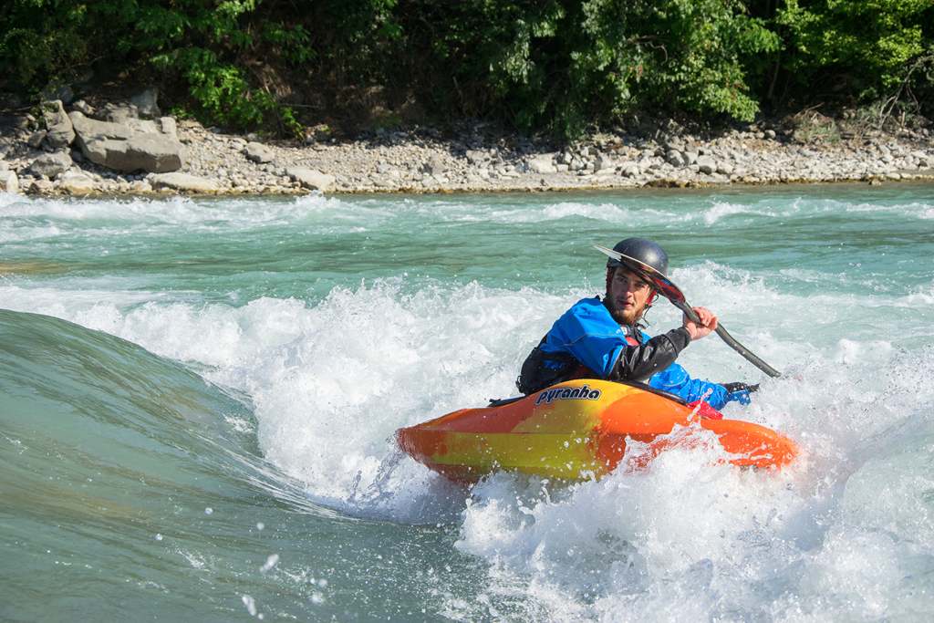
Ljevišta–Dragovića Polje WW IV-V(X), 7 km
Dragovića Polje–manastir Morača, WW IV-V (X), 9 km
Manastir Morača–Međuriječje, WW III+, 6 km
Međuriječje–Dormira, WW III (IV), 12 km
Dormira–Bioče WW I-II (IV, X), 10 km
Bioče–Smokovac WW I-II, 6 km
Smokovac–Podgorica, WW I-II, 6 km
KAYAKING ON RIVER LIM
Together with Ljuča and Lim Rivers is the second place in Montenegro, considering the length and its 93 kilometers of a stream consisting mostly of rapids and foam. The best kayaking conditions are from April until June, although Lim is suitable for kayaking and rafting during the whole year. Part of the canyon, between Berane and Zaton. Lim is most often canoed in the following sections:
Ali-paša’s springs–Plavsko Lake, WW I, 17 km
Plavsko Lake–Murina, WW III-IV, 10 km
Murina–Andrijevica, WW II (III), 13 km
Andrijevica–Berane, WW I-(III), 17 km
Berane–Zaton, WW III (V), 6 km
Zaton–Ribarevina, WW I-II, 23 km
Ribarevina–Bijelo Polje, WW II-III, 7 km
KAYAKING ON RIVER CIJEVNA
This river is not a special challenge for rapids lovers, but there is something that is only this river’s specialty. After the way out of the canyon, running through Ćemovsko polje (Ćemovsko Field), Cijevna River makes a riverbed that reminds of a little canyon and meanders for kilometers with a width that is hardly bigger than the river itself, and its depth doesn’t exceed a few meters.
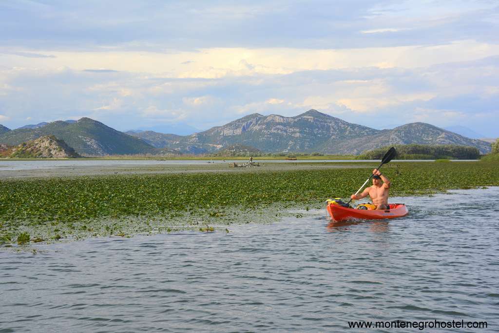
KAYAKING SEASON
As it is for rafting, the water level on all rivers of Montenegro is the basic precondition for kayaking (only the Tara and Lim have a suitable amount of water even in the driest periods). Some rivers, especially in the summer water levels; therefore, spring is the best period. Naturally, with the larger amount of water, rapids rise in their strength and beauty, but also in difficulties and levels of danger; therefore, it is not necessary to create a balance between the skills and the stream’s possibilities. In the middle of April, the rapids of Morača’s upstream are certainly not for beginners.
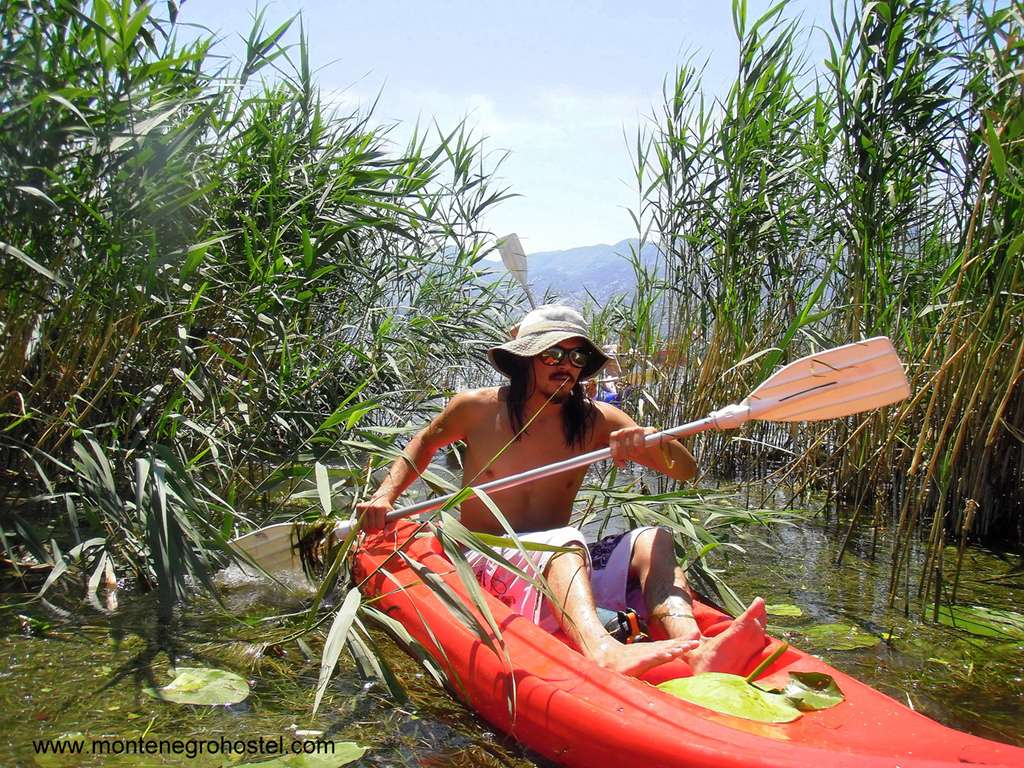
NOTE: As there for rafting, kayaking through the canyons of Tara and Morača, or down the rapids of Lim, there is complete accommodation and transportation infrastructure. Along the streams of rivers Komarnica, Cijevna, and Mrtvica, camping is possible if you don’t organize some type of private accommodation. No story about wild waters in Montenegro seems complete without the rapids of Bršatnovica, Borovi, Čelija, and Donja Vjernovica on Tara, as the longest of all local streams. Route difficulties are WW 3-4 u, depending on the water level, and access to Brštanovica is possible by motor vehicles going from Šćepan Polje or by the river, coming from Đurđevića Tara. Several foreign teams, which analyzed the potential of local rivers for whitewater kayaking, were unanimous in a review that the best, hardest, and most attractive rapids are in the upper stream of the Ibar, near Rožaje.
Montenegro Hostel Team
SAILING
SAILING IN MONTENEGRO
For anyone who has cruised on a boat even for a day or two, it is needless to point out what an amazing experience it is. Freedom to wander, independence from those on the mainland, new perspectives, and the vastness of water and the sky above you are just some of the amazing array of experiences and new feelings it arouses, definitely making sailing a thing one should enjoy at least once in their life. Whether you own a boat of your own or you are looking for a rental ship, here is some advice on what to expect and plan your trip more successfully.
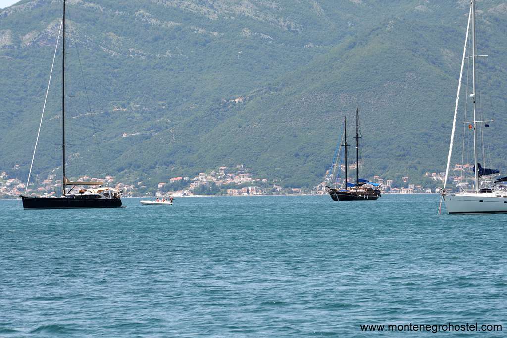
The Montenegrin coast is not long, but it offers many breathtaking sights. Its northernmost part is Boka Kotorska (Gulf of Kotor), an extraordinarily long gulf dotted with historic churches and old villages. The conditions for sailing here are superb due to favorable winds and mountains sheltering it from the strong south winds. Almost all of the coastal villages here provide basic conditions for the mooring of ships, so one can leap from one to another, exploring them both from the sea and the land. The rest of the coastline faces the open sea and therefore has much better beaches and cleaner water, but lacks sheltered coves and adequately equipped marinas.
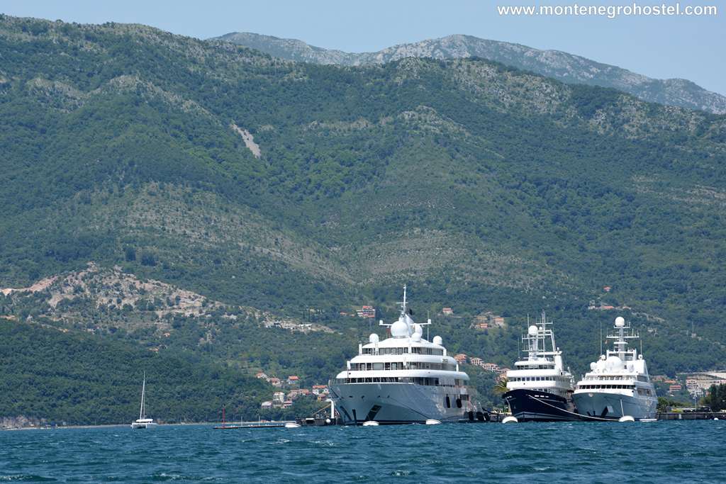
The entry to the territorial waters of Montenegro should be announced to the harbor master's office in Kotor (north) or Bar (south) on VHF channel 16. Sailing from abroad, you should register with the customs at the ports of entry in Zelenika, Risan, Kotor, Tivat, Budva, Bar, and Ulcinj. If sailing in from the north (Croatia), the most convenient port in Zelenika, east of Herceg Novi, serves mostly cargo ships.
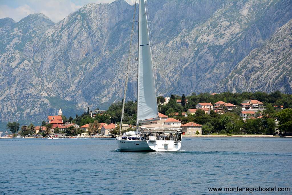
Arriving from the south, your choice should be in Bar, the chief port of Montenegro. As the customs office is hard to locate, you are advised to dock in the marina and inquire locally. The customs formalities are generally dealt with quickly and without hassle. You should visit customs for clearance when you decide to leave. For sailing in Montenegro, you will need a permit from the harbor master's office, which lasts for one whole year.
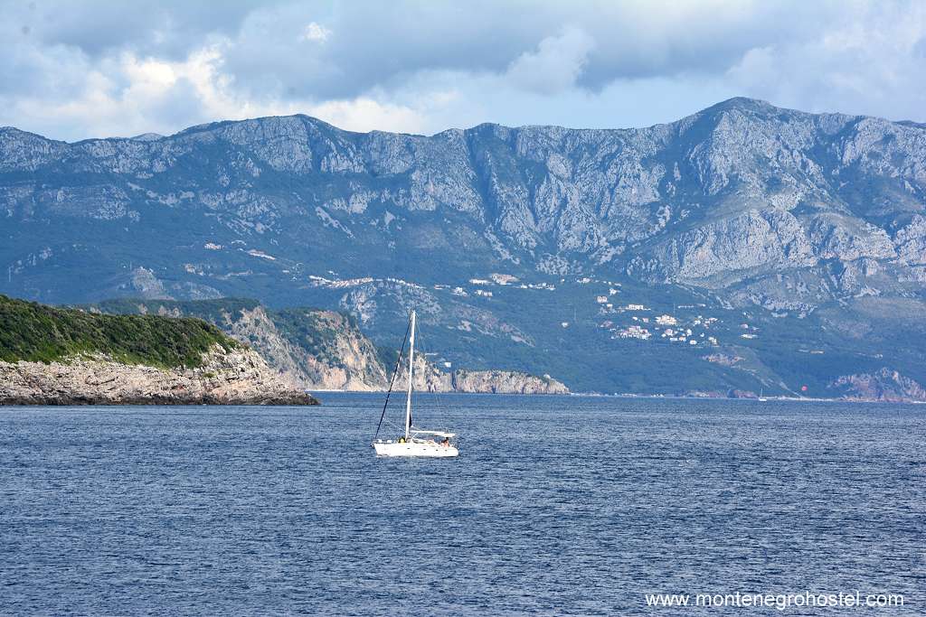
On the whole, Montenegro has favorable cruising conditions. The winds here are the same as the rest of the eastern Adriatic. In summer, during the day, there is a permanent breeze from the NW-mistral (called locally maestral), or NNE bora (bura) of moderate strength. Nights are generally still or have slight bora. Most of the forceful storms come from the west. Sirocco (jugo) grows from the SW, but once at full strength, it blows strongly for several days (most not more than three), bringing rain and creating high waves.
One of the main advantages of Montenegro over other Mediterranean countries is its relative anonymity and thus also lack of sailing crowds. There are not many locals sailing around since most of them enjoy motorboats and yachts. Montenegro has one of the best marinas on the Adriatic Sea for mega-yachts named Porto Montenegro, and very soon it will have several brand new marinas on the highest possible level of quality, like Lustica Bay (located on the Peninsula Luštica) and Portonovi, located in Kumbor next to Herceg Novi.
Montenegro Hostel Team
MOUNTAIN BIKING
MOUNTAIN BIKING IN MONTENEGRO
In Montenegro, there is terrain for all MTB versions and disciplines, except for arranged parks for trial acrobatics. Mountain paths and woodland roads for those that enjoy breakneck descents, combined cross-country shares, long asphalt, macadam, and combined paths, are all of that somewhere near your destination. Finally, in 2007, several biking tours were included in the official tourist offer, among which are Nikšić-Bijela-Trsa-Brštanovica, a round tour around Durmitor, Kolašin-Rikavačko Lake-Podgorica, and Virpazar–Ostros–Ulcinj.
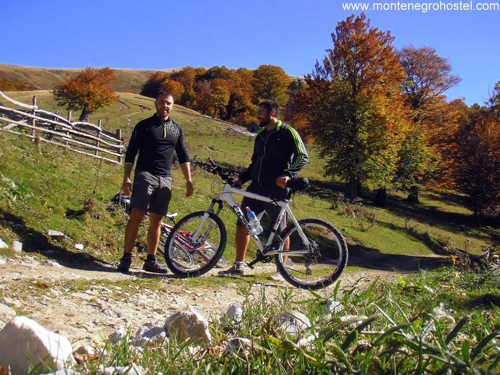
NIKŠIĆ-BIJELA-TRSA- BRŠTANICA
With a total length of about 140 km, this tour is one of the longest in Montenegro. It is attractive because it passes by the most beautiful canyons, Bijela, Komarnica, Sušica, Tara, and also through more and more deserted areas of Drobnjak and Piva. Driving is mostly on asphalt, partly on macadam parts. Passing this route takes two to three days.
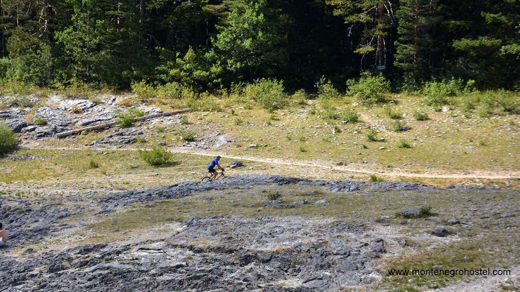
RING AROUND DURMITOR
The road around Durmitor is a very demanding day-long tour, 86 km long. It follows a line of asphalt and macadam roads that embrace this mountain massif, starting and ending in Žabljak. The silence of the canyon Sušice, the verticals of Tara canyon, the coolness of the spruce woods of Montenegro and Štuoc, the sunbath grasslands of Dobri Dol, Sedlana Greda, Vjetrena Brda (Windy Mounts), and wideness of Jezerska Visoravan (Lakes Upland) are just some of the fairy tales that you will enjoy.
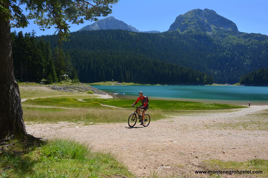
KOLAŠIN-RIKAVAČKO LAKE-PODGORICA
It is a 93 km long ride, driven in one long and exhausting day, or of two relaxed days. 4,255 m of climbs and descents, mostly recommend this other option, with sleeping in Rikavac or Širokar. You will be able to see the first waves of Tara, the rocks, and grasslands of Kuči Mountains, the green reflections of Rikavačko Lake, and the stone peace of Cijevna Canyon.
PODGORICA-RIJEKA CRNOJEVIĆA-VIRPAZAR-OSTROS-ULCINJ
One of the most popular tours in Montenegro will lead you along the south shores of Skadar Lake, a postcard-perfect area. Altogether 110 km long, it is a real waste to rush through this tour in a day. Choose the autumn sun and its palette of colors, plan to sleep in Virpazar, and experience the magic of water lilies, long boats, chestnut woods, sea waves, and dessert. The other part of this tour has entered the list of the most representative, and the view on Skadar Lake from Pavlova strana (Paul's side), above Rijeka Crnojevića, is reason enough to drive 54 km more. But it is certainly not the only one.
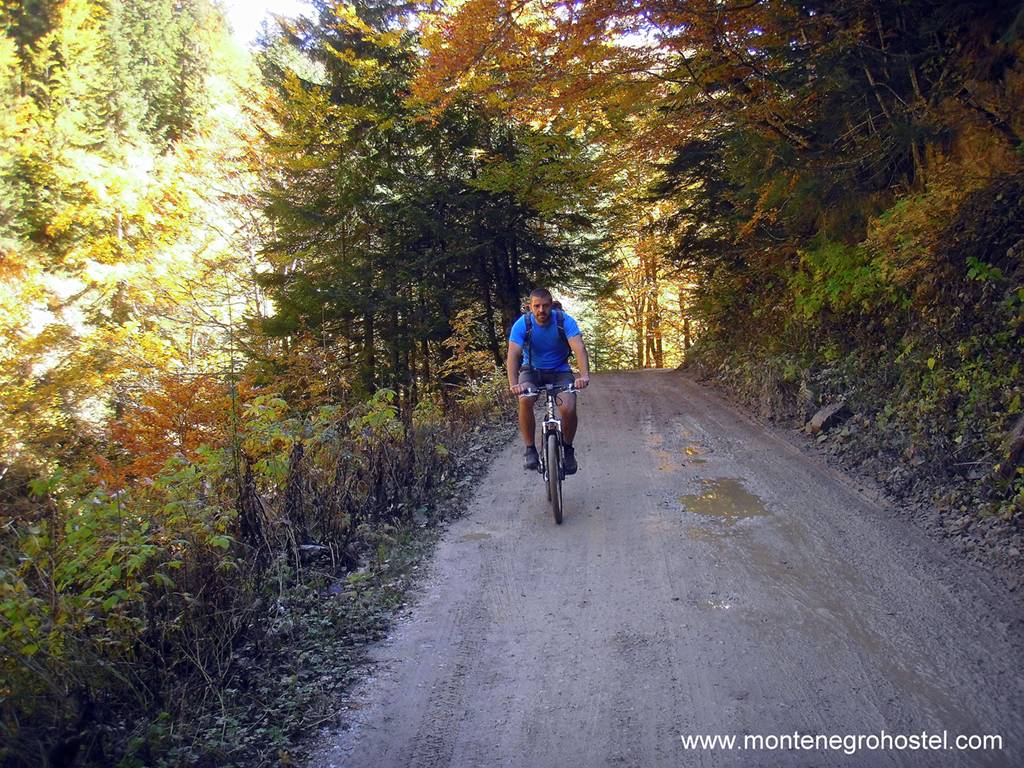
MOUNTAIN BIKING SEASON
Summer is the usual time for spinning pedals along mountain roads and paths, and the Skadar Lake surrounding and areas around Podgorica, Nikšić, and Cetinje are most pleasant during spring and autumn. A huge number of sunny days makes mountain biking in Montenegro possible almost the whole year, the tours only need to be scheduled. It can be a downhill, trial, cross-country, or usual cruising in the area on two wheels.
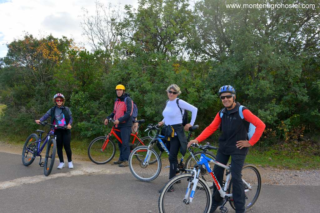
NOTE: Except for narrowly defined zones in national parks, where bans on any kind of means of transport, except your own feet, are effective, all other highways, roads, and paths in Montenegro are open to cyclists. Passing through large and controlled tunnels is forbidden, and although it means prolonging the road for kilometers up and down the hill, this rule should be respected. Most MTB tours are situated along carriage roads of different quality all over Montenegro. Some pass through places where people are fewer and fewer. On one of these roads, not only is there no crowd, but hours will be passed before you come across anyone, as in the area of Komovi that belongs to Kuči, Maganik, Sinjajevina, etc. The bike ride is an occasion to discover life in an area that slowly disappearing.
Montenegro Hostel Team
PARAGLIDING
PARAGLIDING IN MONTENEGRO
As one location paragliding fanatic said, the terrain is wherever a hill with a little valley on the side exists, and in Montenegro, that means everywhere. Some slopes, especially ones above the seashore, are popular because of the combination of heights, landscape beauty, and easy access to the take-off areas, especially landings on some of the beaches. Other locations demand more hiking and caring for the equipment, but they derive an adventure worth every drop of sweat. The adventure of sky silence over the mountain’s tranquility, flying over ground that is rarely walked on.
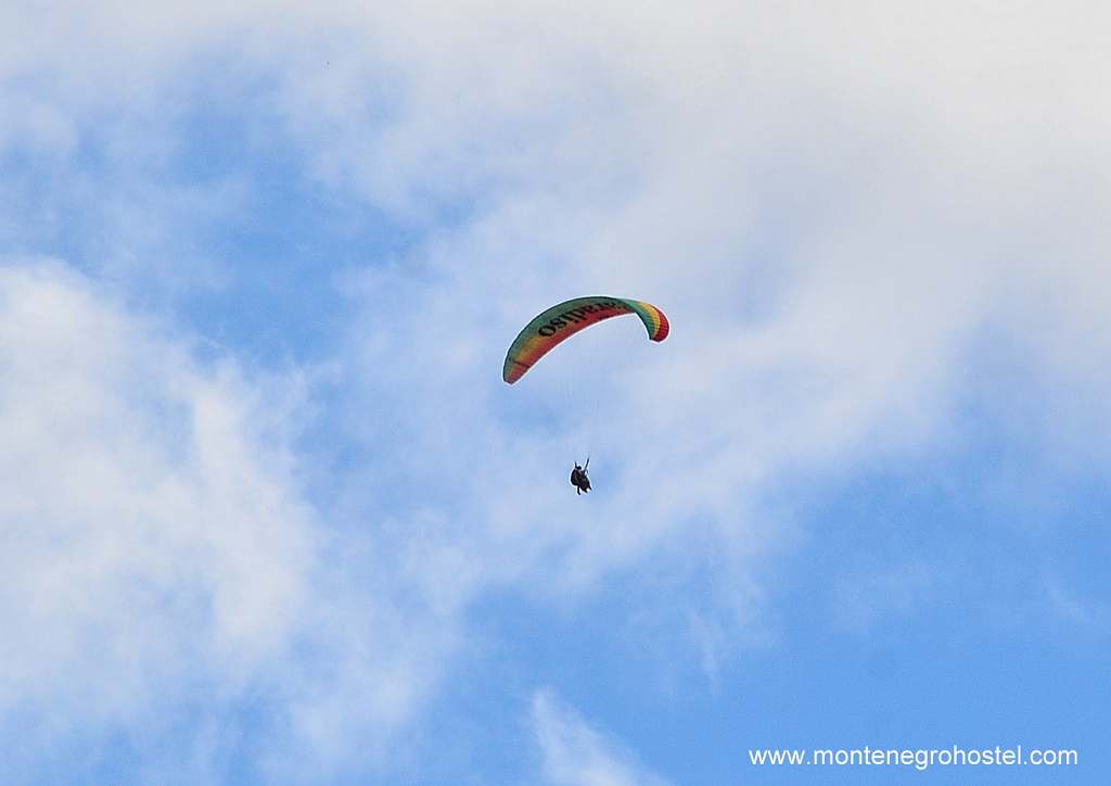
BRAJIĆI
Probably the most popular take-off area in Montenegro, both because of the easy access to the start, as well as the possibility to fly over the Budva Riviera. The start is at 750 m of altitude, which short and rocky flying field of small inclination. Wind stronger than 4 m/s causes a lot of turbulence at the start, which, combined with the take-off area, makes this location not so suitable for beginners. The most frequent zone for landing is Bečići Beach, and the slope is mostly south-oriented.
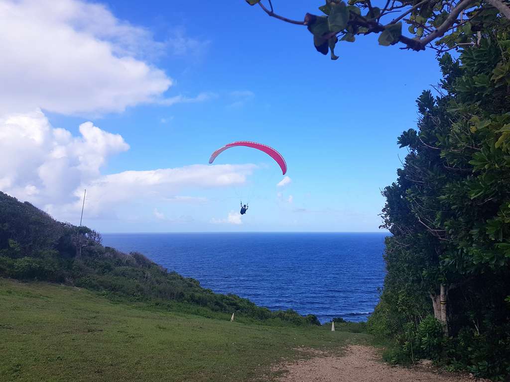
PAŠTROVSKA GORA
To take-off area is on a wide slope, overgrown with grass, in Bijele Poljane, close to the Adriatic Road. The start is at 687 m above sea level, the slope’s orientation is dominantly southern, and, unlike the takeoff areas in Brajići, it is very suitable for less experienced pilots. From the very beginning, it is reachable by car, and the landing zone is a beach in Buljarice.
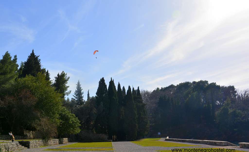
RADOŠTAK
Radoštak dominates over Herceg Novi and Risan Bay, as Orijen’s narrowest cliff. A take-off area is at 1,450 m of altitude, pretty rocky and short, situated about a two-hour walk from Motel Borići. The slope is mostly south-oriented, and a landing zone is most often Sutorina on the beaches in Zelenika and Igalo. A little bit underneath, there is a take-off area in Dizdarica, at around 850 m of altitude, which has the same slope characteristics and landing zone.
SAVIN KUK
Durmitor is not lacking paragliding terrains; the question is whether you are in the mood to carry the equipment on your back. For those without these ambitions, the flying field on Savin Kuk is a perfect solution. Under the very field, at 2,300 m of altitude, arrival is arranged by cable car, and when it’s not operational, there is a good mountain path. The east and southeast-oriented slope opens to the upland of Jezera and represents the start of the south barrier of the entire massif. The landing zone is beneath, at of 1,480 m altitude.
POPADIJA
Popadija is a peak on Prokletije, on the Albanian border. It takes two hours to reach this peak by the path that starts at the Grbaja Mountain home. The flying field is wide and grassy, at about sea level, and depending on the wind direction, it is possible to glide over the north or east slope. The landing zone is a big field, very near the mountain home, but considering the closure of the valley, you should count on pretty strong turbulence. During the landing, be mindful of the local transmission line located in the middle of the valley, in the northeast direction. Flying here is maybe the easiest way to understand why many consider the Grbaja Valley to be the most beautiful in Montenegro.
PARAGLIDING SEASON
Considering the strength and frequency of the winds, the most pleasant period for paragliding in Montenegro is summer. That doesn’t mean that this sport should be forgotten in other seasons. Although there are far fewer days with the optimum weather forecast, autumn colors of the woods or glistening off the snow-covered areas are pretty good to be patient and wait for good flying conditions.
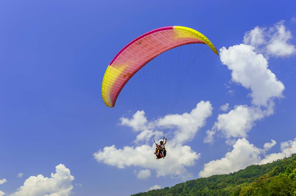
NOTE: Although there is officially no standardized fee for paragliding in this area, to be on the legal side of carefree flying, you should always carry a verified license with you. It can be odd, but many power lines and electrical transmission systems are not all or are wrongly identified on maps. For a paragliding pilot who wishes to mingle with local birds, it is very important to examine a completely planned flight path on their own, from the take-off to the landing zone.
Montenegro Hostel Team
BASE JUMPING
BASE JUMPING IN MONTENEGRO
Base jumps are being made on natural locations or buildings that, by their height and inclination, provide a safe fall and parachute openings. Although the lower limit goes around 40 m, the most interesting jumps require a list of a few hundred meters. Except for the chimney of a power plant in Pljevlja, in Montenegrin cities, there are no buildings for safe jumps. On the other side, its mountains and canyons don’t lack in heights suitable for base jumpers. Bridges on Đurđevića Tara and over Mala Rijeka are popular locations for base jumpers.
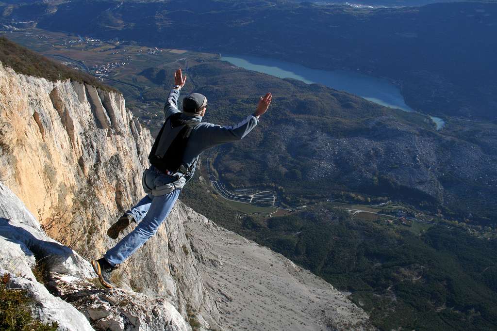
The railway bridge over Mala Rijeka (Small River), with its height of 224 m, is one of the highest bridges in Europe. Problems for jumping can be the wind that is frequent wind in the canyon, as well as rocky and small landings. The bridge in Đurevića Tara is 156 meters high (the biggest arcade), and the landing is on the small islands in the river formed during low water in summer. It is interesting to mention that there were jumps made from the second arcade, 45 meters high. Except for bridges, all the other Montenegrin base jump location is situated on the mountain rock faces. So far, there have been jumps on Prokletije and Durmitor mountains, from Djevojačka stijena in Raopojana Valley and Savin Kuk. Djevojačka stijena (Maiden’s Rock) is characterized by 700, elevation of 700, an overhanging nature of the upper rock part, a relatively undemanding exit, and a spacious and flat landing. That promotes an intro, so far, the most attractive base jump location, especially since the jumps with wing suites here last around 25 seconds. As potentially interesting, there are also Ćurovac over Tara Canyon, Boljske grede, and Prokletije’s Peaks: Presto, Koplje, and Maja Vojušit.
BASE JUMPING SEASON
Although the discipline could take place in any season, calm weather is an obligatory condition. In the spot where a slightly stronger wind can lead to disaster, a good weather forecast is indispensable.
NOTE: The sports parachutist’s license is not a guarantee for a safe jump. Only the experience of many jumps can prepare you for this adventure.
Montenegro Hostel Team
BIRD WATCHING
BIRD WATCHING IN MONTENEGRO
In Montenegro, 348 bird species have been registered so far (of the total 533 registered in Europe until today, or 65% of the European bird fauna). Out of the total number of bird species registered so far, 213 species belong to certain breeding and seven species are possibly breeding, while ten are considered to be extinct, such for example Aegypius monachus. 106 species are considered to be residents, i.e., species that spend the whole life cycle in Montenegro. This number includes two species that are introduced (pheasant and chukar). 107 species of birds registered in Montenegro are breeding migratory birds.
Out of the total number of species (348), 266 species are regularly seen in Montenegro, while 14 species are occasionally seen. The richness of the bird fauna of a country is viewed through the total number of registered species or, more often, through the number of breeding species. In Montenegro, the density index of breeding species, which represents the ratio between the logarithm of the number of breeding species and the logarithm of the country's surface area, is significantly above the Balkan average of 0.435 and amounts to 0.563. This is contributed by the diversity of habitats: from the seacoast, across the salinas, freshwater lakes, semi-steppes, canyons, dense forests, mountain plateaus, and high mountain peaks. On the other hand, Montenegro is located in one of the four most important corridors for birds in Europe Adriatic Flyway, through which millions of birds annually migrate to Africa and vice versa.
In comparison to other European countries, the number of 213 species that breed in Montenegro is relatively high, taking into consideration that Montenegro is one of the smallest European countries. For example, according to its surface, Montenegro is in 39th place, while according to the number of breeding birds, at 22nd place, just below Hungary, which is nearly seven times larger than Montenegro. Also, Montenegro has more breeding birds than the United Kingdom, the Czech Republic, Portugal, Denmark, Slovenia, and Switzerland, for example.
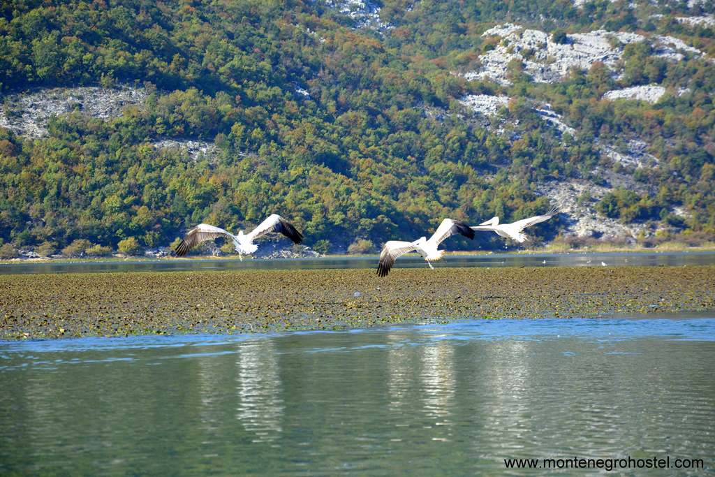
The first preview of the ornithological richness of Montenegro in the form of a list of bird species was published as the Catalogus faunae Yugoslavia by the Academy of Sciences and Arts of Slovenia in 1973, as part of the Catalog of the bird fauna of SFR Yugoslavia. Later, the bird fauna of Montenegro was elaborated in the context of the Diversity of Bird Species in Yugoslavia, with an Overview of Species of International Importance in 1995, and, finally, the List of Birds of Montenegro with Bibliography, which represents the first independent paper related solely to its territory. The most interesting areas for bird watching are Lake Skadarsko, Lake Šasko, Bigradska Gora, and the saltpans of Ucinj and Tivat.
Montenegro Hostel Team