ABOUT NORTHERN MONTENEGRO
NORTHERN MONTENEGRO
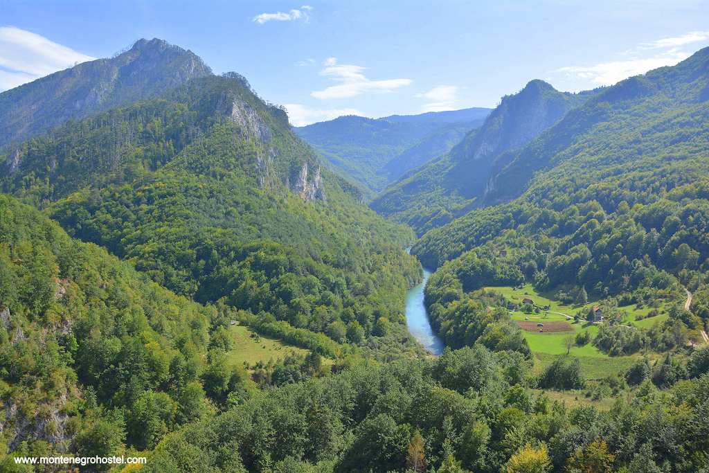
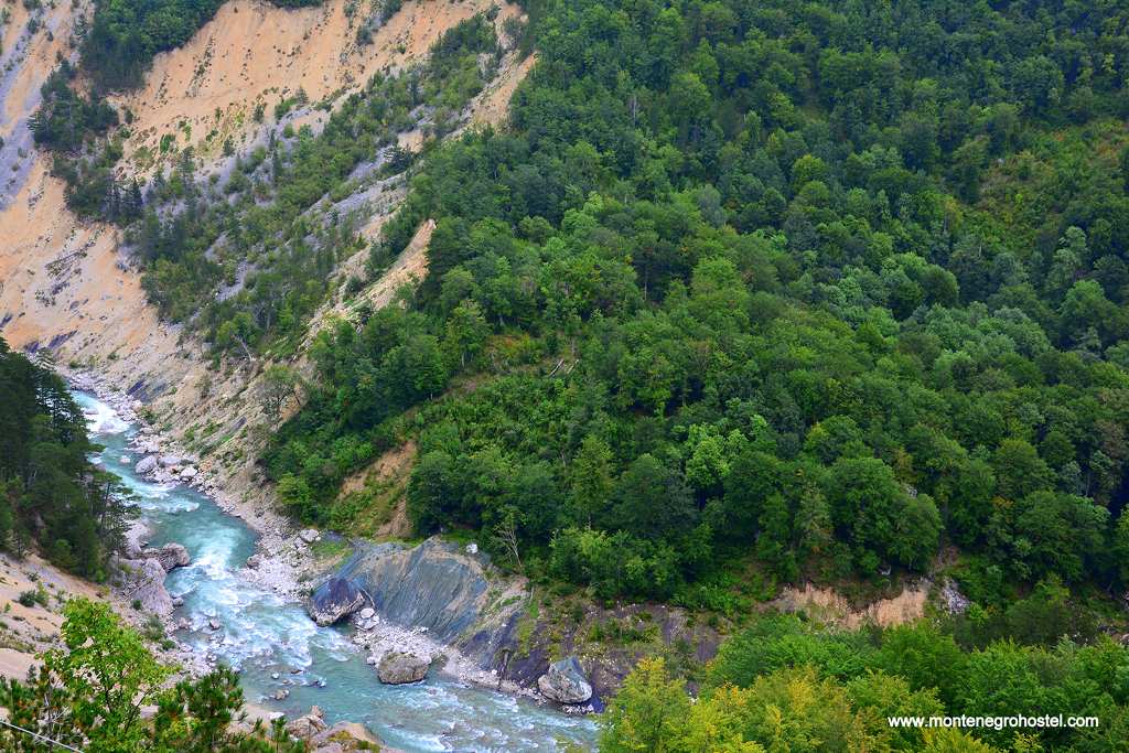
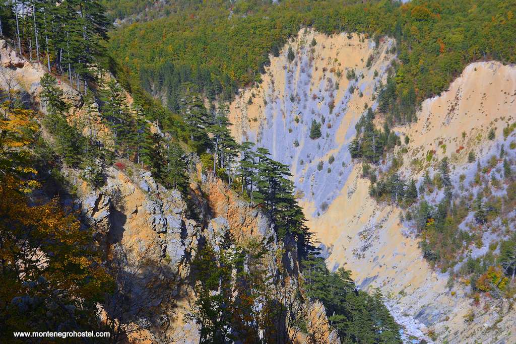
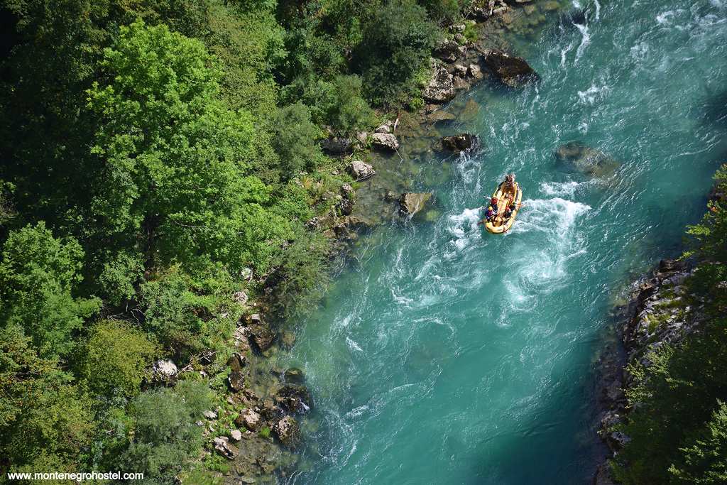
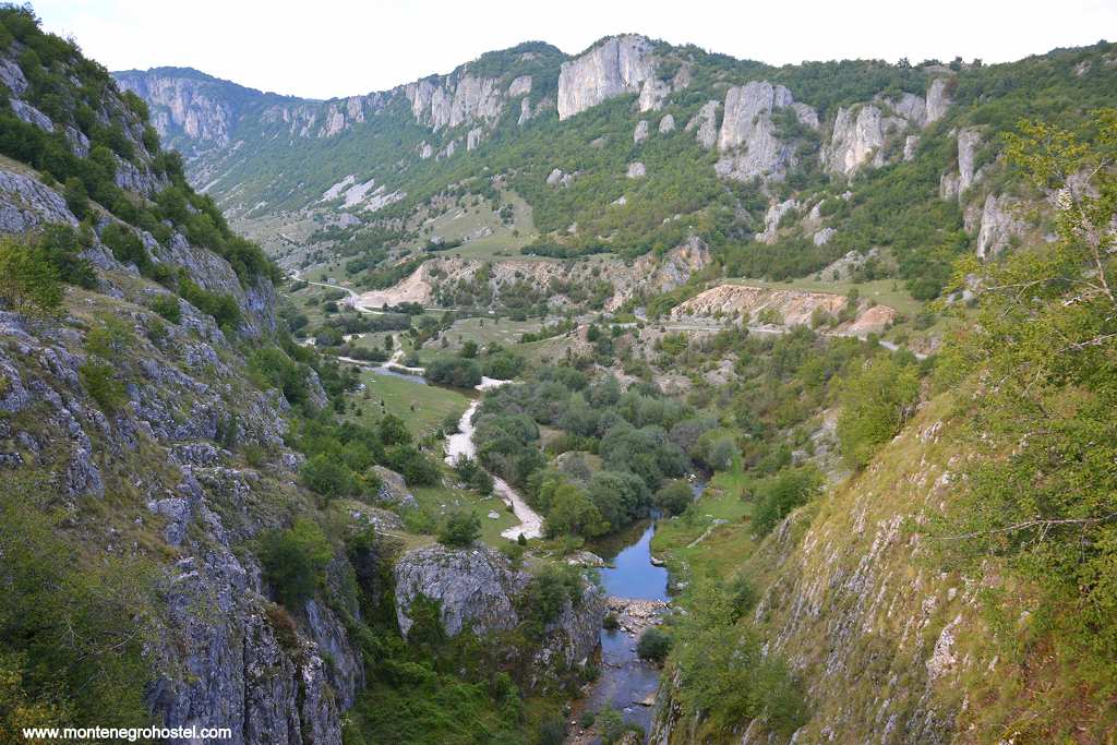
The north of Montenegro consists of contrasting sights carved and arranged to their magnificent perfection by nature. The high mountains are joined by vast tablelands and deep river canyons, all mixed in a memorable array of experiences. The ideal example of this is Mount Durmitor, which is located together with the small town of Žabljak. More than forty of its craggy peaks rise above 2000 meters, among them Bobotov Kuk (2,523 m), the highest in the country. Facing the massif lies the contrasting highland plateau of Jezera, which got its name after the innumerable smaller and larger lakes. Further, both Durmitor and Jezera are bordered by the river canyons of Tara, Sušica, and Komarnica. The canyons of its region are world-renowned, but above all, the most famous one is the Canyon of the Tara. With 1,300 m from its overlooking mountain tops, the river is the deepest in Europe and the second deepest in the world (after the Grand Canyon in the US). Rafting on its magnificent, clean waters, passing through virgin forests, giant pines, and innumerable waterfalls is are once-in-a-lifetime experience.
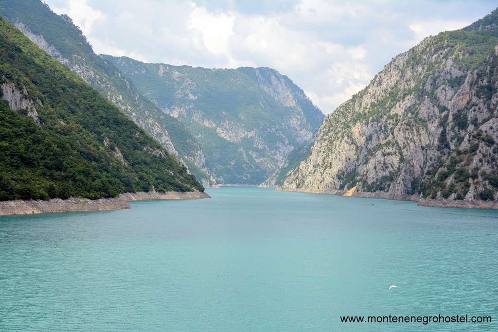
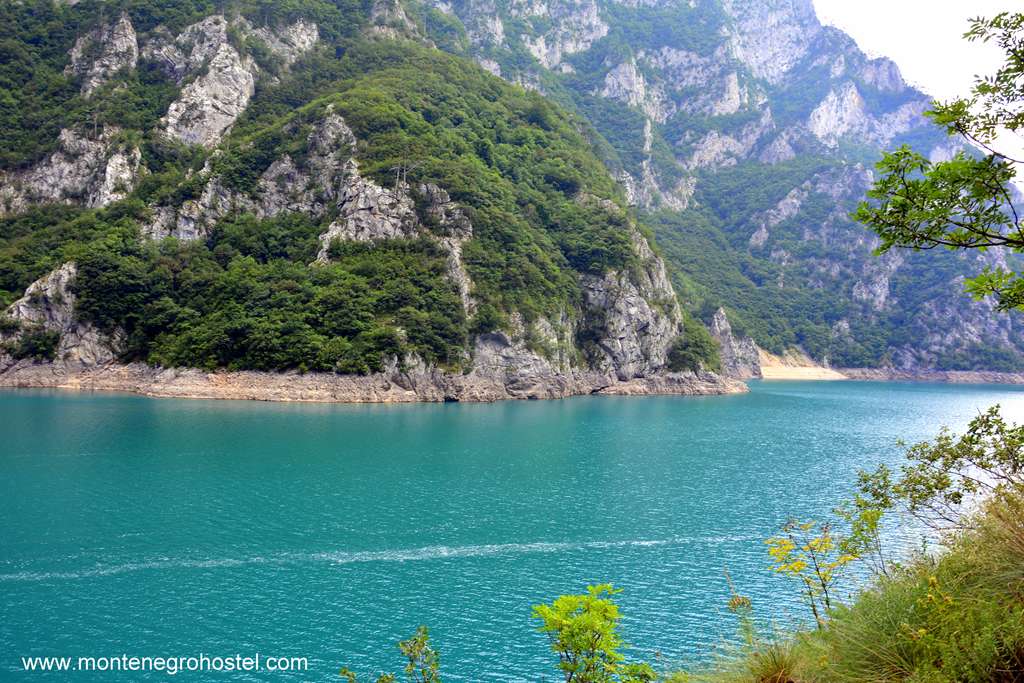
The other canyons also hold some records, like the initial part of the Komarnica canyon, called Nevidio (“Not Seen”). It is so narrow that no living man passed it until 1965, when fully equipped mountaineers disclosed its mysteries. The canyon of the River Piva has been cut in two by the high dam in Mratinje. One side of the dam remained the inhospitable canyon, while the other was transformed into a long lake of staggeringly blue color. There are many fascinating but relatively unexplored mountains in this region, such as Maglič at the very border of Bosnia and Herzegovina, a charming place with its Trnovačko jezero lake just below its peak, Sinjajevina with its vast pastures above the forests, or Lubišnja in the very north with its small villages unchanged by civilization. The whole of this region is scarcely populated, and there and many wild and desolate places, left to nature and wild animals. Knowing that one cannot survive on their own in the wild, the peasant of the north are always willing to help and will gladly treat you in their modest houses and with tasty dairy products.
The climate is harsh and uncompromising: the winters start early and last until May, with lots of snow, which leaves many places cut off from the rest of the world for months. To prepare the people need to work hard, stacking hay for the cattle and piling wood for heating. The pleasant summers are, to some extent, hotter only in the vicinity of Nikšić, where air from Zeta climbs to its wide field. Nikšić, the second largest town in Montenegro, is the cultural and economic hub of the North. It is known for its ironworks, the brewery, and numerous old bridges traversing the rivers that get lazier in this wide field. Historically speaking, this is a part of Old Herzegovina, named after the 15th-century lord Herzeg Stefan (Herceg Stefan), whose seat was the Soko grad (Soko Town) above the confluence of Tara and Piva, on today’s border with Bosnia. It is also the hub of the East Herzegovinian dialect spoken from West Serbia to Croatia, whose resounding beauty captures attention whether in everyday speech or in traditional singing accompanied by which is still played by many here.
Due to Vuk Karadžić, linguist and reformer of the Serb alphabet, this dialect, formed in the middle of the 19th century, has been taken as the basis for the literary Serbo-Croatian language. The historical monuments in this secluded area are scattered in its wild scenery and are sometimes hard to find. Surprisingly, most of them come from the era of early Turkish dominance (16th c.) when many people ran to the security of the places sheltered by mountains and forests. Here, they built new monasteries, the most beautiful of them being those of Piva and Sveta Trojica (Holy Trinity) close to Pljevlja. Though today there aren’t many Muslims left here, Hussein-pasha’s Mosque in Pljevlja with its 42-meter-high minaret remains the most beautiful monument to the long presence of the Ottoman Empire in Montenegro.
Montenegro Hostel Team
PLJEVLJA
PLJEVLJA
The northernmost town in Montenegro is the most important industrial and mining center and contributes almost the entire coal produced in the country. The coal is used to supply the country’s only thermopower plant, which in itself accounts for half of Montenegro’s total electrical production. Regrettably, the high chimneys seen from every part of town make Pljevlja also the most polluted town in Montenegro. The pleasant and fertile area around the confluence of the River Breznica and the River Ćehotina has been settled since time immemorial. During Roman rule, the village of Komini, not far from Pljevlja, developed into the most important town of continental Montenegro.
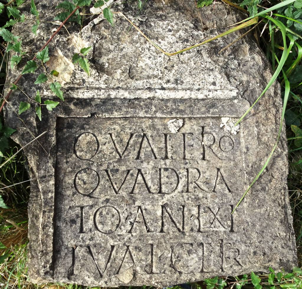
No record of the town today known only as “Municipium S” can be found among the written sources. Its incomplete name has been discovered on the fragment found during archaeological excavations that revealed its size and significance. In the Middle Ages, the settlement called Breznica grew in the place where several caravan roads from the coast merged. The name "Pljevlja" is first mentioned in 1430 and comes from the word Pljevlja, “chaff”. Soon after this, in 1462, it fell into Turkish hands. Retaining its trading role, the place furthermore became the seat of the province of Herzegovina, eventually growing into a prosperous oriental town.
Fortunes changed for Pjevlja in the 19th century. In 1818 great fire devoured almost the whole town, and in 1833, the provincial administration was moved to Mostar. The impoverished Pljevlja became in 1878 the seat of a large Austro-Hungarian garrison, but maintained the Turkish civil administration. The town was liberated in 1912 and became a part of Montenegro, but most of the Muslims could not bear the changes and left for Turkey. This reduced the town’s population to half of its pre-war size. After WWII, Pljevlja, with its ore-rich hinterland, became the mother behind the industrialization of socialist Montenegro, and the face of the town was rapidly changed to its present-day image.
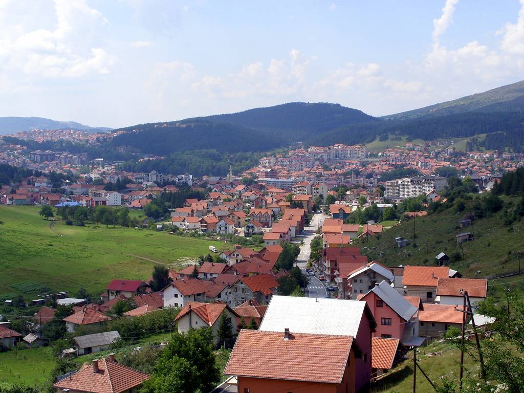
There isn’t much left to witness the town’s rich history. The old quarters are more oriental than in monuments, while the principal streets are lined with apartment blocks of strange inspiration reminiscent of the pagodas. The very center of the town is marked by the elegant Hussein-pasha’s Mosque (Husein-pašina džamija), the most beautiful oriental monument in Montenegro. The gem of Ottoman architecture, labeled as a “mosque worthy of an emperor” by the Ottoman writer Evliya Çelebi (Evlija Čelebija) in his 17th-century travelogue, was constructed around 1580 based on the model of Hussein-pasha Boljanić. Born in the vicinity of Pljevlja, he climbed to the top ranks of the Ottoman Empire, holding the title of vizier and positions such as the administrator of Egypt and the governor of Baghdad.
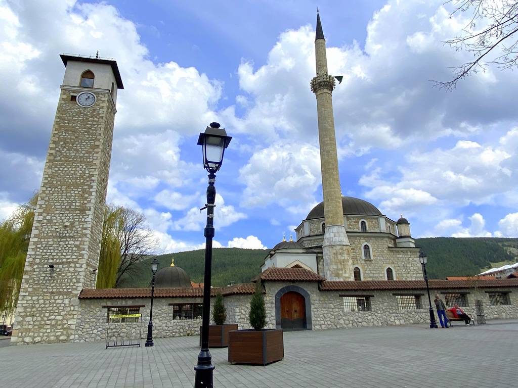
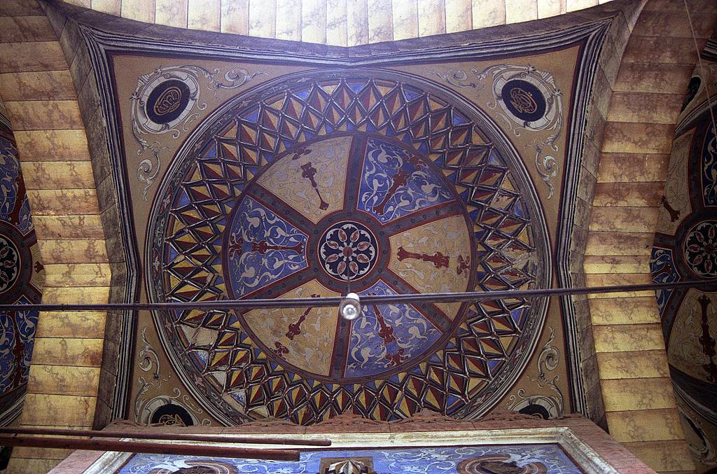
It is assumed that its architect was Hayrudin, who also built the famous Mostar Bridge. The approach to the mosque’s yard is by the covered fountain, used for ritual cleansing. The mosque has a square base with a large central cupola and two decorative ones at its rear. The open porch stands on the stone columns ending in ogee arches, while covered with three smaller cupolas and brightly painted. Next to it stands a slender minaret which was rebuilt in 19 after it was destroyed by lightning. With its height of 42m, it is one of the highest in the Balkans. The interior distinguishes itself with many colorful floral and geometric paintings, of which the most imposing are the ones covering the cupola and the one of the mihrab niche. The courtyard also contains the clock tower built simultaneously with the mosque, and several Muslim and Roman tombstones.
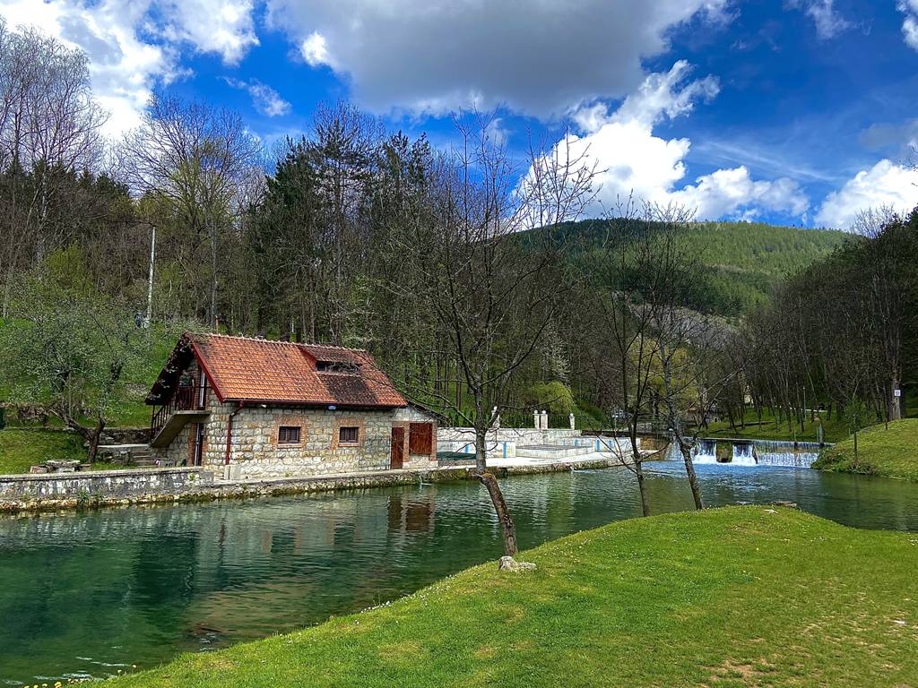
Not far from the mosque is the Milet bašta (Turkish for “People’s Garden”), a park with restaurants of the same name. Another pleasant recreational area in Pljevlja is Vodice, to the east of the town center. The sight rightfully deserves its name since water (voda) is everywhere: a small lake is fed by a fast brook crossed by a couple of bridges. On the outskirts of the town, 1,5km from the center, lies the Monastery of Sveta Trojica (Holy Trinity). To reach it, pass the Milet bašta and head uphill and to the right, passing the large wooded area.
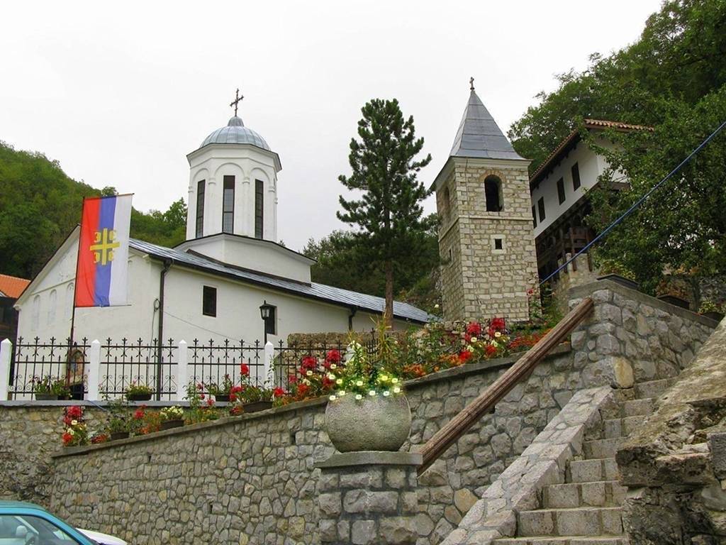
The monastery was founded around 1535 by Visarion, a wealthy merchant from Pjevlja who decided to spend the end of his life as a monk. For his endowment, he chose the rocks at the end of a quiet vale surrounded by forest, which seemingly appears many miles away from any extensive settlement. In 1592, the original church was widened with a narthex and a cupola. In this and the following century, here operated a small but enduring transcribing school which left behind an extensive array of beautifully painted manuscripts. In the 19th c., the monastery got its present look with an outer narthex added to the church and large buildings of monks’ dwellings.
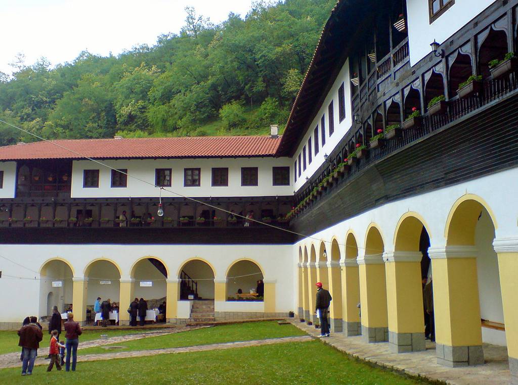
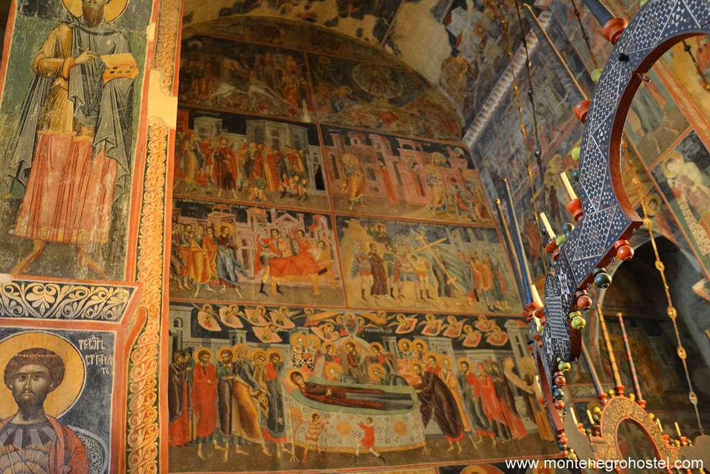
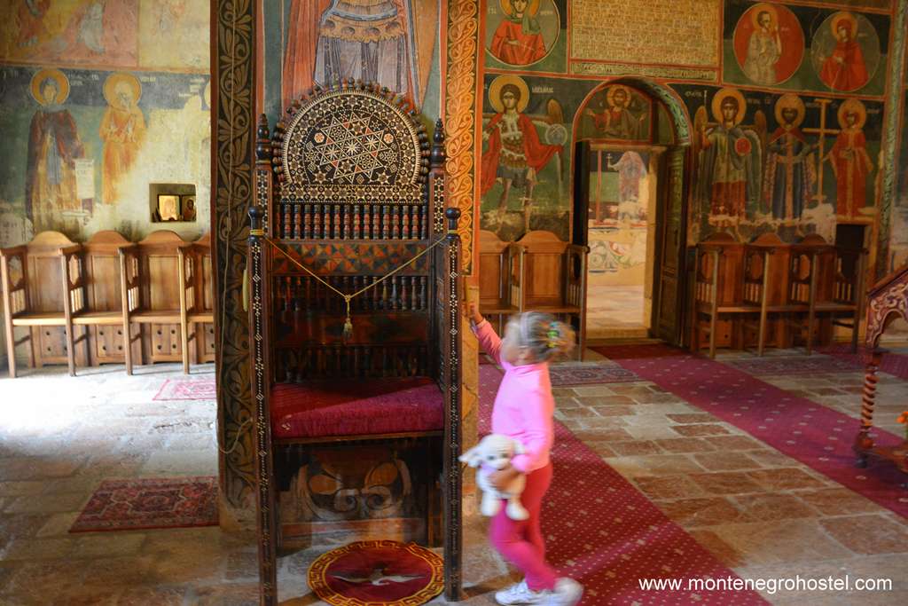
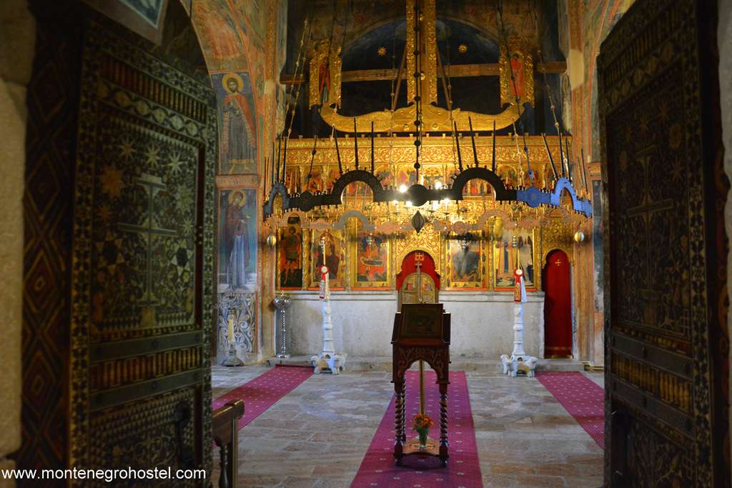
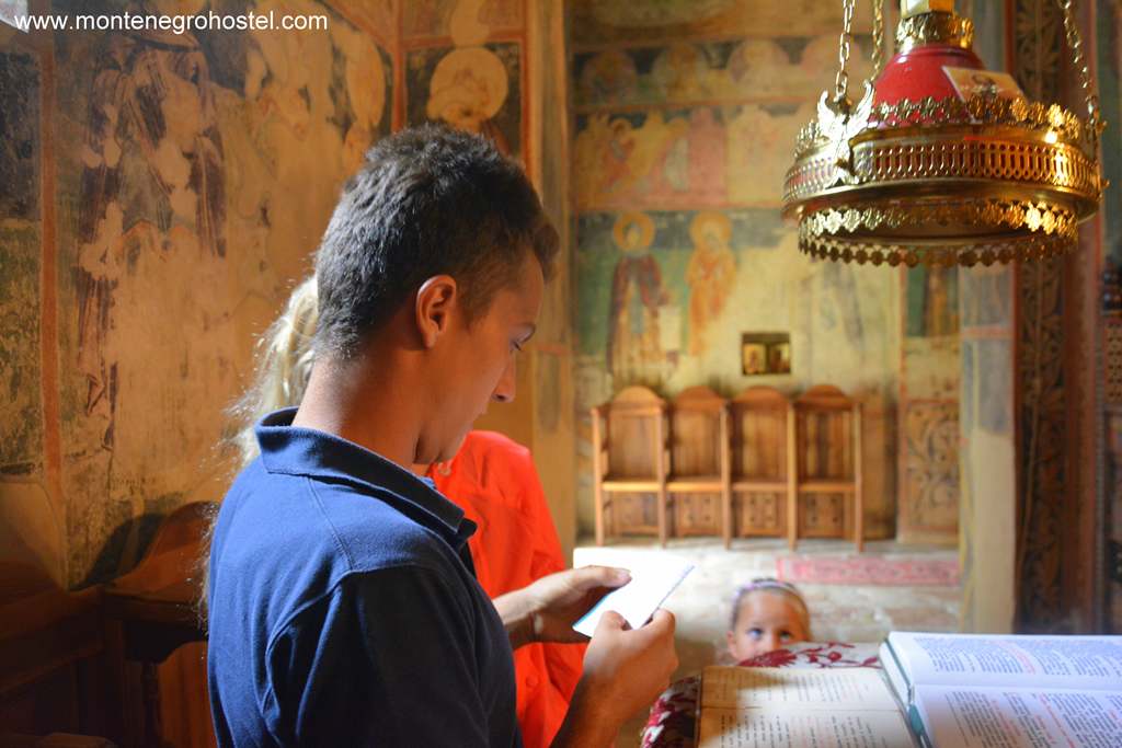
These are excellent examples of folk architecture, while their details are heavily influenced by the Orient. Built into the outer walls of the church, there are several 19th c. tombstones, while on the side hangs a klepetalo, a wooden board that replaces the bells during the observation of the fasts. The interior of the church is covered by colorful, somewhat rustic frescoes by priest Srahinja of Budimlje from 1595. Apart from the usual cycles, such as the extensive Passion of Christ, we find here also the procession of ten Nemanjić rulers, which reflects the atmosphere of national discontent and insurrections against the Turks. The Church Sveta Trojica (Holy Trinity) has one of the richest treasuries in the country. Amongst many worthy items, the most valuable are the two late 16th-century icons by Andrija Raičević (St Stephen and the Three Hierarchs), an inlaid monastery door of oriental inspiration, several 16th-century liturgical objects influenced by the Gothic style, and finally several relics, such as the staff that allegedly belonged to St Sava as well as his left hand.
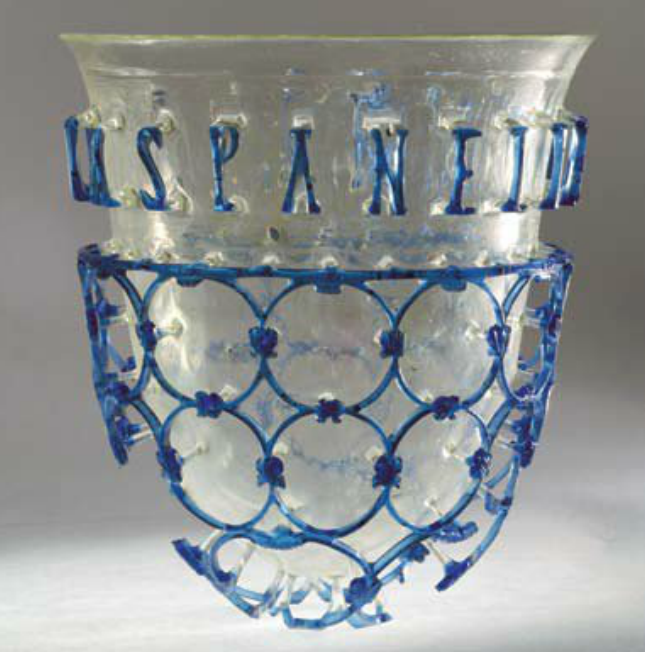
There is a possibility to stay at the monastery in the adapted monks’ cells, ideal for those who prefer the experience to comfort. Pljevlja also has a local museum situated diagonally from Hussein-pasha’s Mosque in the Hall of Culture, where it shares its premises with the public library. The museum has a valuable archaeological collection consisting of the finds from the “Municipium S”. Amongst these stands out the glass vase of diatretum type, one of only a few examples preserved in the whole world.
THE HOLY TRINITY MONASTERY
The Pljevlja's Holy Trinity Monastery is located in the vicinity of the town center, above the banks of the Breznica River. It was mentioned for the first time in 1537 when patrons built the oldest part of the temple, the nave, and the altar space, and in 1952, the narthex with a dome was added. The monastery church got its conical shape in 1875-76. The Holy Trinity Church and its narthex were fresco-painted by Priest Strahinja from Budimlje between 1592 and 1595. The first zone depicts saints, the patrons, and the Nemanjić Dynasty, while the upper part depicts the images of large Church Holidays and Christ's Suffering. The altarpiece was made in 1806-1807 by the Priest Simeon Lazović Bjelopoljac.
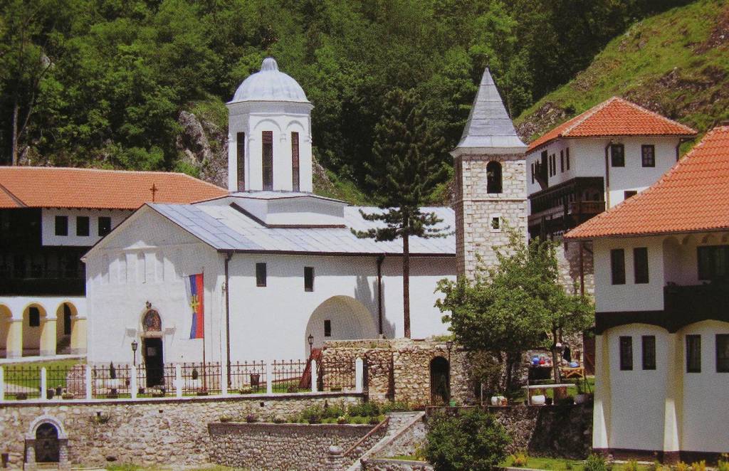
The church's treasury holds a valuable collection of icons, among which are those made by the domestic icon painter Andrija Raičević, then the items of artistic crafts: chandeliers, chalices, censers, miniature carved crosses, etc. The church also holds one of the most beautiful examples of medieval embroidery, Theotim's stole (epitrahilj) from the 15th century. The monastery library holds several copies of valuable illuminated manuscripts, some of which were made in the Monastery scriptorium, as well as rare copies of painted books, including a fragment of Tebnik (Ritual book) from the Crnojević printing house.
HUSSEIN-PASHA'S MOSQUE
Hussein-pasha's Mosque is located in the center of Pljevlja. It was built between 1585 and 1594 thanks to Hussein-Pasha Boljanić, a Turkish dignitary who performed several significant functions at the Emperor's Court in Constantinople. The Mosque is surrounded by tombstones. It is a rectangular building in shape with a low dome placed on a rectangular base. In front of the main facade, placed on four solid columns, is an open porch covered with three domes.
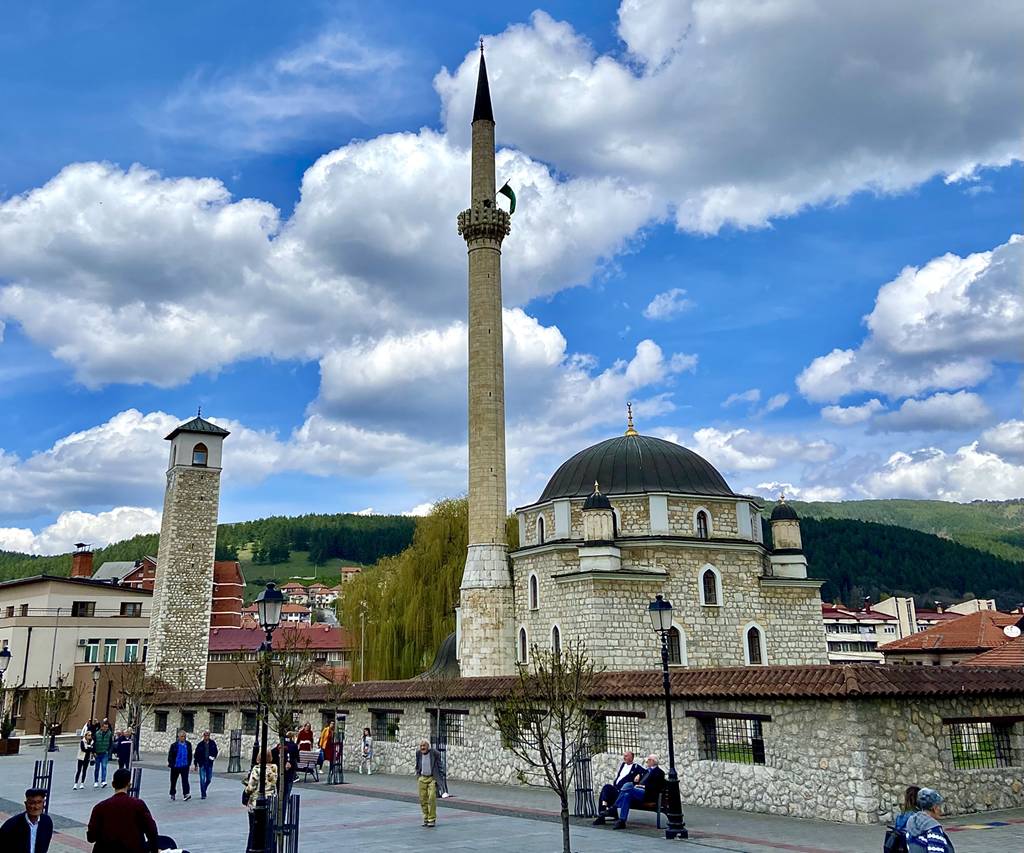
The span between the columns is connected with oriental pointed arcs. The mosque is rich in ornaments in the form of stalactites and customary Turkish perforations. There is also a richly decorated mihrab (a prayer niche), a member (a pulpit), and a makefile (a gallery). Internal walls are painted with floral ornaments and quotes from the Kuran. It is made of finely dressed stone. Along the south side, there is a thin and tall minaret, and in front of the entrance to the mosque is a fountain. The Hussein-pasha's Mosque holds several printed books in Arabic and Turkish. The manuscript book Kuran, made most probably in the 18th century, written in Arabic letters and adorned with gold-plated miniatures, is particularly valuable.
Montenegro Hostel Team
TARA RIVER
TARA RIVER
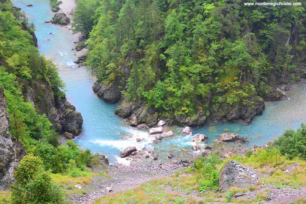
With its length of 150 km, Tara is the longest river in Montenegro. Its headwaters are two brooks descending from the peaks of Komovi, then the river rapidly presses northwards in a long bow and ends at the other end of the country at Šćepan Polje, where it joins with Piva and forms the River Drina. However, a feature that transcends national borders and rings awe around the world is that in the second part of its course, Tara has cut an astounding canyon, whose sides are up to 1,300 meters high and rank as the highest in Europe and second in the world. The clear green water that becomes turbid only after heavy rains, interchanging gorges and fields, marvelous woods of birch and pine, numerous waterfalls, and white waters famous with rafters are some of the highlights of the river, but the uttermost recognition of its beauties came in 1977 when Tara canyon was added by UNESCO to the list of the world’s ecological biosphere reserves.
Tara’s course that passes through Kolašin and Mojkovac, the pleasant meadowland dotted with houses and orchards, slowly grows narrower while the mountains rise higher. The canyon formally starts at the entrance of the Durmitor National Park, 15km north of Mojkovac. Close to the small hotel “ Ravnjak” is the confluence of the fast and noisy river Bistrica and the river Tara. Not far from here, immediately after the first rapid, is an interesting wooden bridge at Djavolji laz, one of the narrowest points of the canyon. The first two kilometers upon entering the national park, the road winds through Crne podi, a pristine wood of centuries-old black pines. These giants rise to 50 m high and stand close above the road, blocking the sunlight and clinging incredibly to the steep rocks high above the river.
The village of Gornja Dobrolovina lies nestled in a widening at the end of the woods. It is best known for the Monastery of Dobrilovina, a few hundred meters to the right of the road. The modest monastery church was built in 1602 but has since been ravaged several times by the Turks, and nothing of the original interior decoration has survived. On the other side of the road starts a forest path leading to Lake Zabojsko (5km away), hidden in the woods on the slopes of Mt Sinjajevina. The road continues steadily northwards. A good place to rest is the Ćorbudžak spring that bursts strongly just below the road. Some 10 kilometers further down the road is Splavište (sometimes also called Šljivansko), a starting point for many of the rafting tours with small camps alongside. One kilometer further along the roadside stands a memorial to Vojvoda Džaković (Duke Džaković), who died here in the 1875 war while not allowing the Turks to cross the river. Next, the road crosses the rocks from which springs Ljutica (Fear-some), a river only 170m long but rumbling a dazzling amount of water, some 1000 liters per second, which makes it one of the most buoyant springs in Europe.
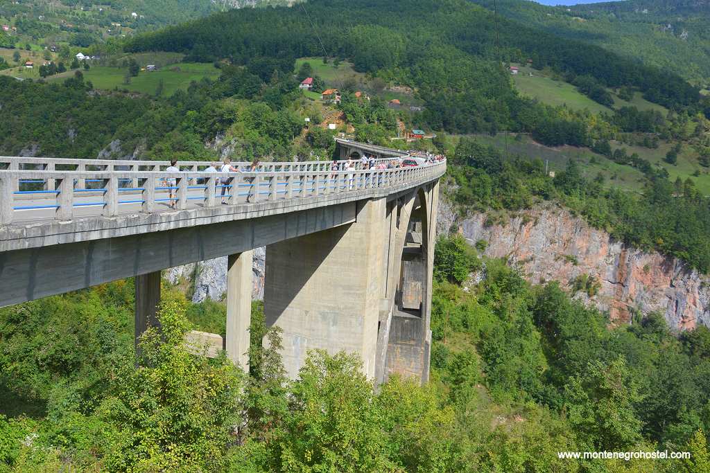
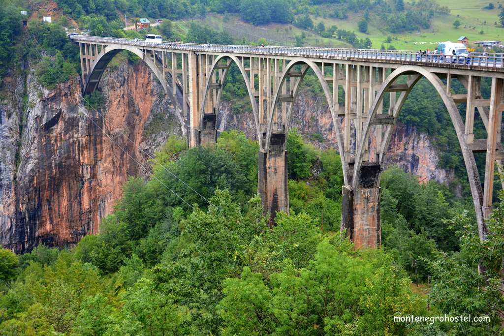
The road now leaves the river and slowly ascends to the Djurdjevića Tara Bridge, probably the most memorable point in the canyon. The bridge was constructed in 1937-40 according to the plans of engineer Mijat Trojanović, and at the time presented an admirable constructional achievement. The total length of its arches spans 116 meters. In the middle of this arch, the bridge rises 151 meters above the river. From this location, open dramatic views over and along the canyon. The bust of Lazar Jauković on the western end of the bridge stands as a reminder of a sad story about a life irreversibly connected with this fascinating construction. Jauković, born in the vicinity, was one of the engineers who built the bridge. Just a few years later, in 1943, he was entrusted by communist partisans to blow it up and prevent the arrival of enemy forces. Jaukovic did the job well and blew up only the smallest arch. For this act, he was later captured by the nationalist četnik forces and shot on the bridge.
From this point, the road leaves Tara, on the side continuing to Pljevlja, and on the other climbing to the Jezera plateau and Žabljak. The rest of the sights described from here on can only be reached by those rafting down the river. Some five kilometers further down stands the Greek Bridge (Grčki most), where the old road crossed the river since Roman times, and which was very busy continuously up to 1937 and the construction of the new bridge. On the right bank of the river, there is also a small medieval cemetery with stećak gravestones. Not far from here, deeper in the woods, are the remains of the Roman sanctuary dedicated to the god Mithras. The path that branches to the right from the bridge leads to the Archangel Monastery, which, following centuries of lying in ruins, has been renovated at the beginning of the 21st century.
Continuing down the river, one comes to the Bijela vrela (White Springs), a natural phenomenon. These springs funnel water through underground tunnels from Žabljak for ten kilometers, passing, unusually, under the riverbed of Tara and emerging on its right bank. After the two rapids, Tara reaches Lazin kamen (Laza's Stone), its narrowest and deepest point: here the river shrinks to just 4 to 6 m wide, while its depth reaches 12m. River Draga is the most important tributary of Tara in its flow through the canyon. It descends from the Ljubišnja Mountain with a gradient of 88 m per kilometer, forming a small canyon 6 km long, known for its large number of eagles’ nests. Next comes Radovan Luka (Radovan's Port, 24 km from Splavišta), the sandy beach on the left bank. Behind it is the flat terrain that gives home to a camp and a small motel, a usual overnight stop for rafters. While the right bank remains steep, the left one gradually opens, forming a wide amphitheater in which nests the village of Tepca.
Tepca lies more than a thousand meters below the rest of the terrain to the south end, enjoying an unusual form of solitude. At the side where this amphitheater closes, the canyon is at its deepest, measuring 1,343 m from the river to the Veliki Štuoc peak rising above the left bank. Further down, one reaches Sige Bajlovića, cascading waterfalls descending into Tara from a height of 35 meters. Its waters originate from a still unexplored cave some 100m uphill that has a small lake in it. River Sušica, which has also carved an attractive canyon, flows into Tara from the left. The Nozdruć spring and waterfall on the left side mark the exit from the area of the Durmitor National Park. Sige Jovovića, also on the left, is the largest waterfall in the canyon with a fall of 40 m.
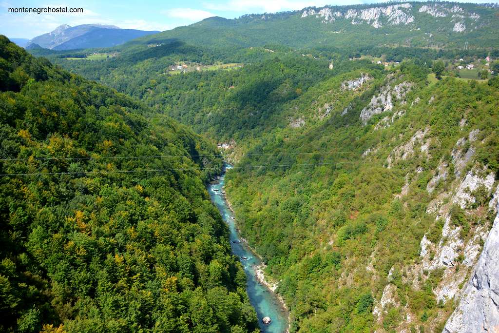
Some five kilometers down to the river lay the Brštanovića and Encijan camps (the latter being on the riverbank that formally belongs to Bosnia and Herzegovina), 50 km of rafting from Splavište. These camps, and one in Grab, which also provides lodging in cottages, are the most common places for those preferring the shorter (and cheaper) rafting. From here, it is a few hours' ride to Šćepan Polje, where Tara’s green-gray waters unite with Piva’s dark blue in a foaming whirlpool that ends their long runs, forming the River Drina.
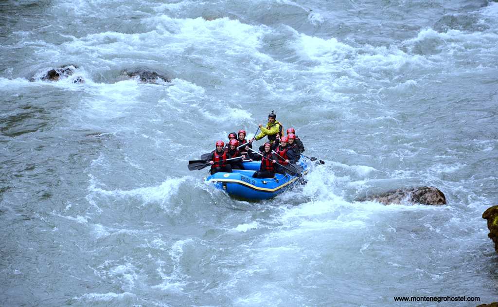
There are several ways to descend the Tara, longer and shorter, and on different rafts. Those that include passing through its most spectacular part start from Splavište, a one-day tour goes as far as Radovan Luka, two tours will take you to Brštanovića, and three days to Šćepan Polje. In earlier times, real wooden rafts were used to transport the logs down the river. Here, during the rafting, all the work is done by skillful skippers together with the guests who can enjoy Tara’s clear green waters, the magnificence of its canyon, and some of the river’s wildest rapids.
Montenegro Hostel Team
DURMITOR
DURMITOR
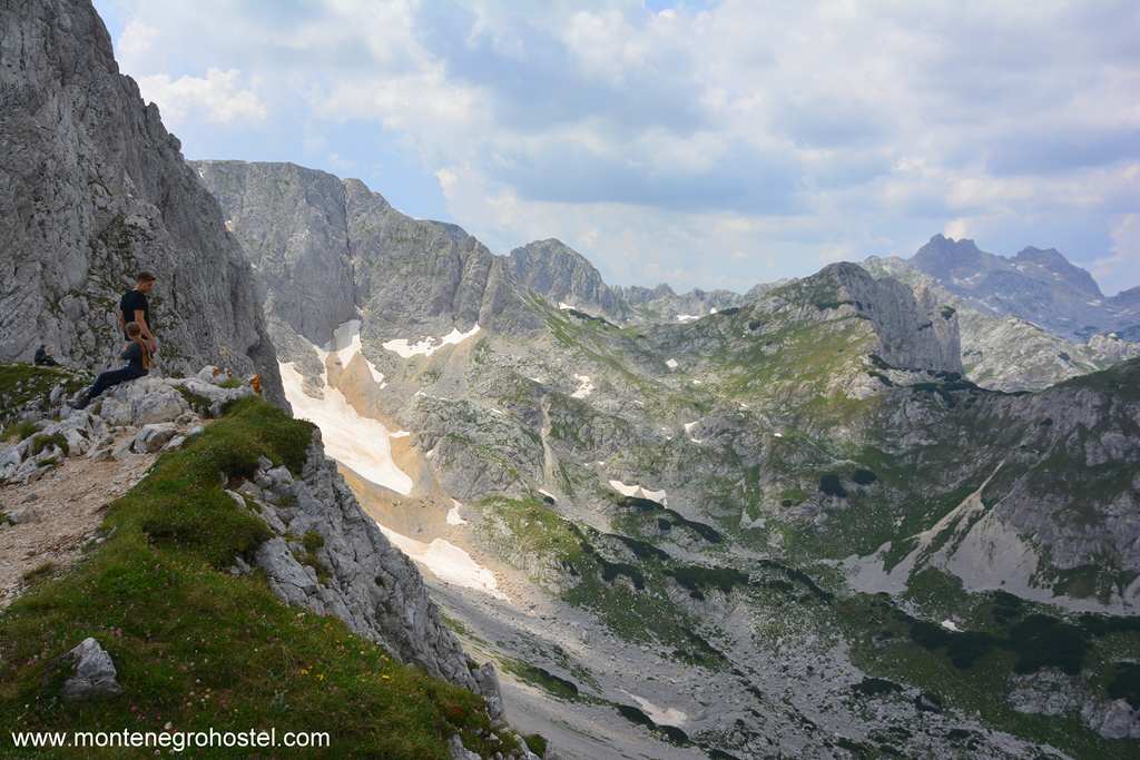
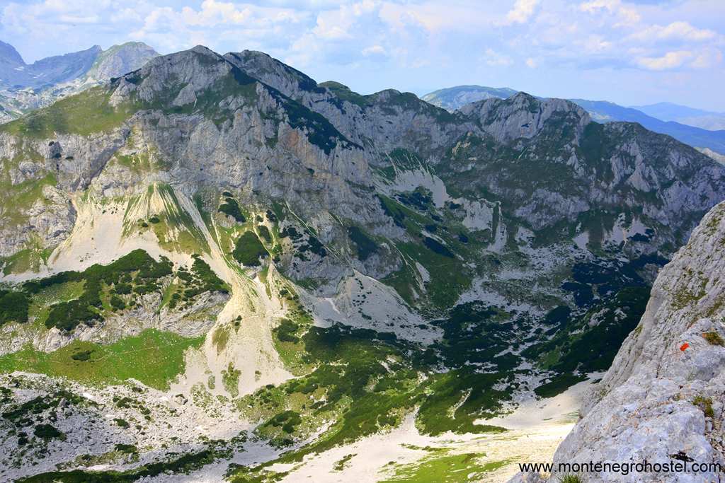
The mountain massif of Durmitor is a cluster of 48 rocky peaks above 2,000 m, crowned by 2,523 m high Bobotov Kuk, which is the highest point of Montenegro. Its exceptionally stunning looks are because its rocky sides rise suddenly from the high tableland of Jezera and Pivska Planina and have granted it the nickname of Soa nebeska –“The Pillar of Heavens”. The 20 by 10 km massif is one of the largest in the Dinaric Alps, and its furrowed scenery contains several exceptionally beautiful “mountain eyes” (gorske oči). In summer, Durmitor offers many opportunities for walkers, hikers, and alpinists, while as a winter resort, it attracts many skiers. The canyons of Tara and Sušica rivers on the massif’s north and west side separate it from the rest of the world, Mount Sinjajevina lens to its south, and the serene grasslands of Jezera (Lakes), where most of the villages are, spread to its east.
The lower regions of the massif are covered in fir, pine, and juniper. In some places, you will see an interesting feature, an inversion of forest cover in which shrubs of birch appear above the level of conifers. In the fields and clinging to the rocks, there are many interesting and endemic flower species to be found, such as Nikola’s violet or Tara bellflower. In contrast to an abundance of flora, the wildlife is rather scarce. Chamois is the most common; there is a fair number of foxes and rabbits, and rarely wolves or bears. On the other hand, birdlife is faring better, so you are likely to see a goose, a partridge, or such giants as the grey mountain eagle and white-headed vulture. Lots of water in lakes and ponds, and excellent grazing pastures at higher altitudes, made this area attractive for sheep and cattle breeding even in the driest of summers. This can be witnessed even in the name “Durmitor,” which derives from the Latin "dormire" and "dormitorio" and is connected with spending summers sleeping in the mountains, a method used by the shepherds to this day.
Today, the surroundings of Durmitor are settled mostly by the Drobnjaci clan, which has expanded here from the original grounds further to the south. Durmitor was almost the outer world until the 1880s when it was described by scientists from Russia and Serbia. The first man to climb Bobotov Kuk as an alpinist was Austrian Oskar Baumann in 1883, but tourism on Durmitor started only after the mountain was visited in the 1920s by mountaineers from Belgrade and Zagreb. Their delighted reports about its beauties spread rapidly, and soon more followed in their steps. After a successful 1932 German-Yugoslav movie, “The Phantom of Durmitor,” commercial tourism started, and the first hotel was built in 1940. The area was declared a National Park in 1952, and in 1980 it was listed among UNESCO’s World Heritage sites.
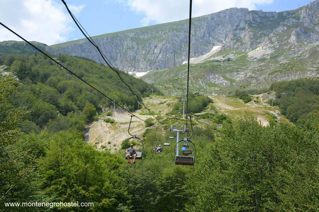
The center of the Jezera plateau and tourism on Durmitor is the town Žabljak, keeping its olden looks with many nice wooden houses with steep roofs. The logs stacked at the front of the houses warn about the winter colds and the snow that can reach a height of several meters. The town is young in origin. It came to be in 1870 when, in the place of an old caravan stop, a school, a church, and the home of the clan captain were built. Scattered around its modest center are old and new hotels as well as groups of weekend homes. The town’s main sight is the white stone mausoleum rising from the cemetery overlooking the town. It was built in memory of 2441 men and women from the area who gave their lives in WWII, amongst them four were honored with the title of National Heroes, whose busts you can see inside. Behind them is a relief by Rade Stanković depicting the uprising against the occupation. Rising just to the south of the town is the peak Javorovača (1,529 m), with two ski-lifts leading to its top from where you will enjoy a panoramic view of the Jezera plateau.
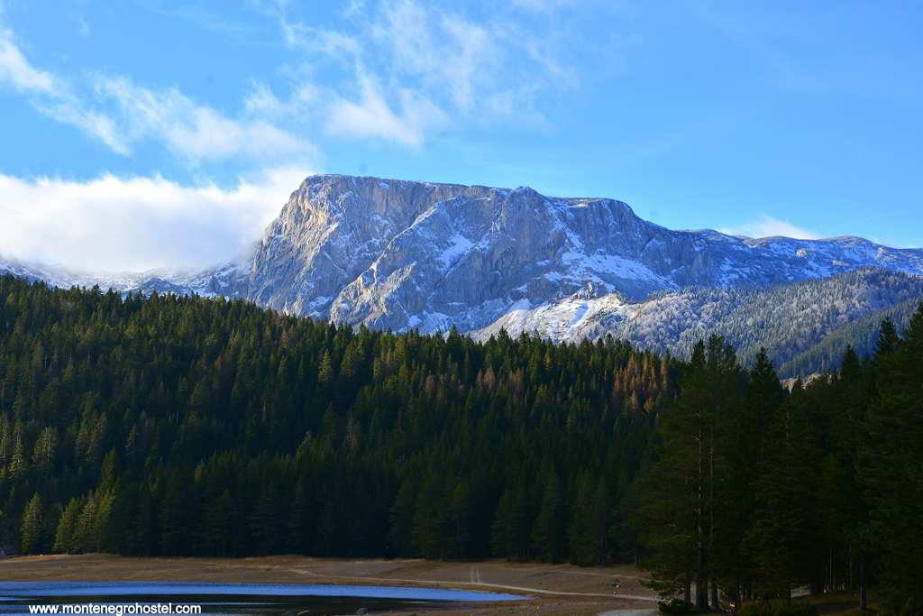
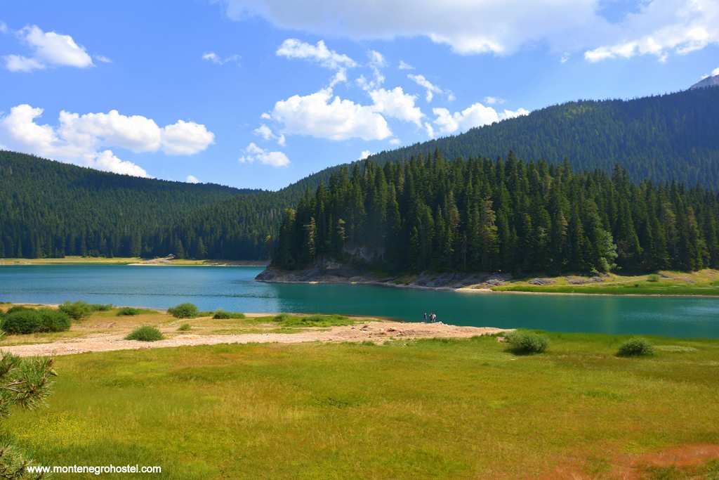
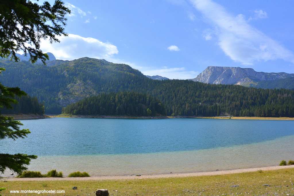
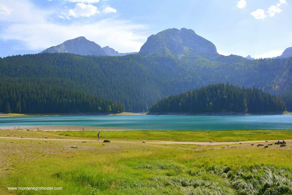
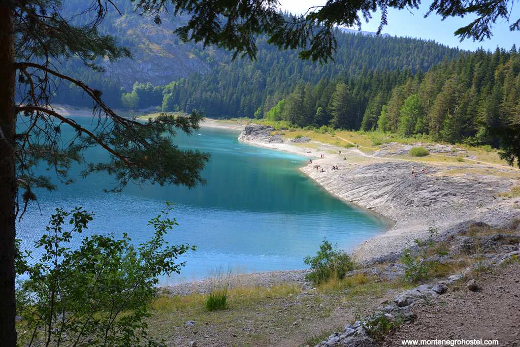
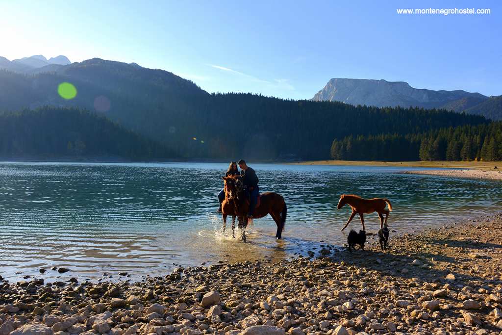
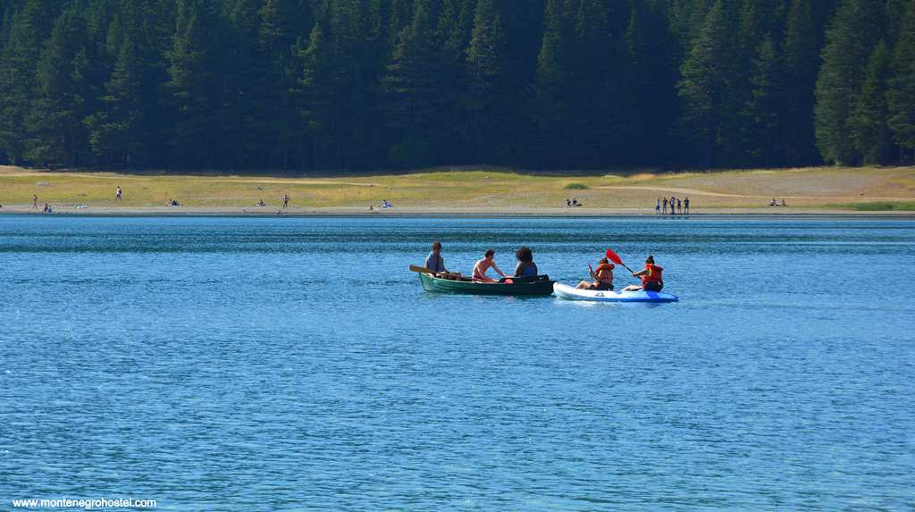
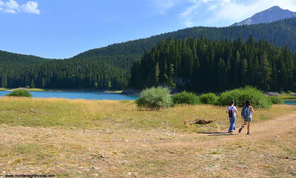
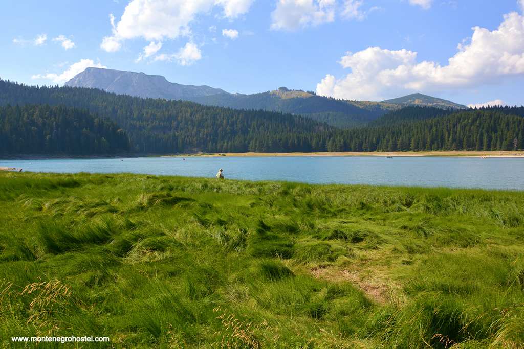
Walking towards the mountain, you will pass the seat of the National Park administration (the building with the blue roof) located just in front of the car ramp. It houses the national history collection (Prirodnjačka zbirka), presenting the flora and wildlife of Durmitor; it also has a nice souvenir shop. Behind the ramp, you enter the zone of the highest protection. A few minutes walk from here, you will reach the shores of Crno jezero (“Black lake”), whose dark blue color is due to its depth (49 m) and thick forest surroundings. This beautiful lake lies at the foot of the massif, making a picturesque sight, especially in nice weather when the steep Medjed and other peaks reflect on its calm surface. The lake consists of two parts, the large one (in front of you) and the “Small Lake,” connected by the narrow strip of water which breaks in dry summers.
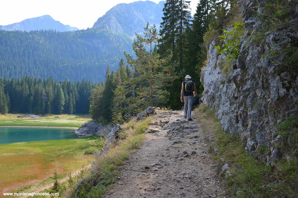
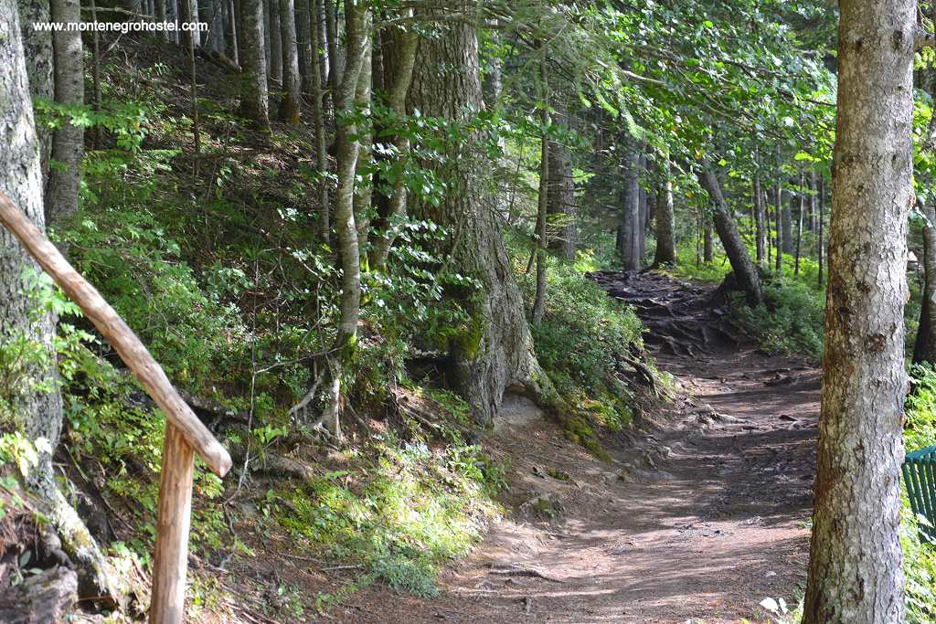
The water in the lake is very refreshing, even on the hottest summer days, and never rises above 22 ℃. The best way to enjoy Black Lake’s many beauties is to take the circular route around it (lasting roughly one hour). Another pleasant route is a half-hour walk from Blak Lake along the stream "Mlinski potok" stream through thick pine and fir woods, which will take you to Zminje jezero (“Snake Lake”). This lake of dark green color is abundant in marshy vegetation and surrounded by tall firs and spruce, some over 300 years old. In its clean find, trout and triton- a rare species of amphibian. A day-and-a-half walk along the road to Tepca village to the north of Žabljak will guide you through inspiring pastures and woods and to the Ćurovac viewpoint. On the road, keep going right until the fourth fork, where you should turn left. From the road, there is a marked path to Ćurovac (20 min). Watch your step, for in front of you opens a 1,100 m deep abyss with stunning views of the river Tara. Far below to the left is the village of Tepca, nestled in the only widening in the canyon. Though it might seem within a stone’s throw, it is more than an hour on foot.
From Black Lake and its restaurant, there is a two-hour walk through the woods to the foot of Savin Kuk. This is the focal point of skiing in winter, but in summer it is interesting for a ride with the ski-lift to "Savina voda" spring at 2200 m. The legend tells that water appeared in a strangely high place when St Sava made a cross with his stick, with a request to God to drench the thirst of the pupil he climbed with. A short ascent will take you to the top of Savin kuk (2,330 m), from where one enjoys views of almost the entire massif. For those who come to Durmitor by car, there are several interesting spots to visit, all within a short drive on the Jezera plateau. Driving on the road south toward Šavnik, take the first sharp left turn. This will lead you to Vražje (Devil’s) and Riblje (Fish) lakes, with their grey waters contrasting with green marshland and golden grassland surrounding them.
The legend has it that a winged horse lived in Vražje Lake and would come out at night to make love to mares. After finishing the act, he would kick them in the belly so that they could not have offspring like him. When Vojvoda Momčilo, a hero of epic songs, heard about this, he snuck up to the lake one night, waited patiently until the stallion did his work, and then suddenly jumped on the mare and escaped. The mare gave birth to the winged horse Jabučilo, who served his master in his many adventures. Above Riblje Lake stands Grčko groblje, a necropolis with several interesting stećak tombstones covered in colorful moss. The name (“Greek cemetery”) is misleading. The term “Greek” was used by the locals for all things very old, which they didn’t know to whom it belonged. If you liked this one, you might want to see another necropolis (with the same name) one kilometer further in Bare Žugića village.
Returning on the southbound road towards Šavnik, you will reach the village of Donja Bukovica with its Roman Bridge standing across the river Bukovica. It is a single-span bridge, whose stone is almost untouched by two millennia of its existence. Its height of ten meters depicts the force of the river in springtime. Departing westward from the road towards Plužine, which lies behind the west face of the massif, the unknown and rarely visited side of Durmitor. First, you will pass the fantastic shape of Stožina Hill and then the Valovito jezero lake, found in the depths underneath the stone peaks. After the Sedlo pass, you will enter the green vale of Dobri do, with several katuni (seasonal shepherd’s dwellings) still in function. The road improves from Lokvice, where you will find an interesting restaurant run by the local cooperative, where all produce is fresh and drinks are cooled in the wooden trough filled with snow and ice from the mountain. The road continues further across the Piva plateau.
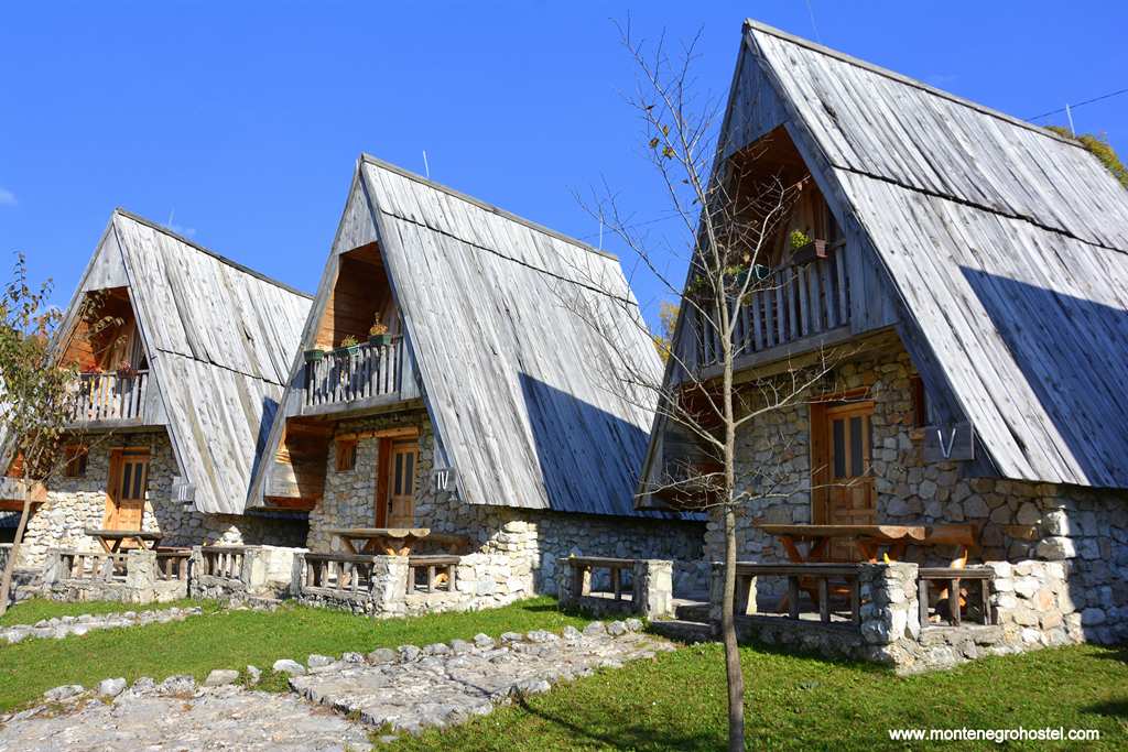
A one-hour ride to the northwest of Žabljak via the restaurant Momčilov grad (Momcilo's Town) will guide you through some stunning views and the village of Crna Gora. This village stands isolated in a triangle of land bordered on two sides by the canyons of Tara and Sušica and on the third by the mass of Durmitor. On all three sides, one enjoys excellent views. Additionally, there are several wooden houses with steep shingled roofs, which are fine examples of local architecture. Note that these houses were built entirely with wood, without using even one nail. By far the most beautiful way to enjoy Durmitor is to hike through its massif. Numerous well-marked paths crisscross it, two mountain sanctuaries for those surprised by a rain of nightfall (one in Lokvice and the other by the Debeli namet), and two mountain huts in Škrka valley and Sušica canyon, on the west side of the massif. Be sure to take with you a detailed map and enough waterproof clothes, as the weather can change rapidly.
We recommend several interesting tours, but there are several possibilities to combine on your own. The easiest reach is to the quaint "Jablan jezero" lake and then to the top of the Crvena grade (Red Cliff 2,164 m) and back. The tour to Obla glava by Stari katun, one of the valleys with summer homes of shepherds (katun), will allow you to descend to the Ledena pećina (Ice Cave) in which snow and ice melt only in the warmest of summers. The return is around Čvorov Bogaz Ridge and through Lokvice. Our third recommended tour will take you steeply up Medjed (Bear) ridge with an excellent view of the Black Lake lying directly underneath you and in the middle of the rocky massif. The gently ascending ridge tour will take you from Mali Medvjed (Small Bear 2,170 m) to Južni Vrh (South Peak 2,287 m, 4 hours to this point), after which the path descends to Debeli namet, a patch of everlasting snow, the last remains of mighty glaciers that shaped the looks of Durmitor. The route returns to Black Lake via Struga and Mioč poljana. The latter is also along the way to your next route, whose first part takes you to the foot of Savin Kuk.
The ascent to its top is either on foot or by ski lift. The route Šljeme (2,455 m), the third highest peak in the whole massif, has a very dangerous climb through Kotao and afterward continues along the ridge. The return is via Čista strana. The fifth tour leads us past the "Zminje jezero" lake through Donja and Gornja Ališnica (Lower and Upper Ališnica) to the top of Planinca (2,330 m, 4 hours in all), commanding views of the glacier-circ valley of Škrčka Lakes. A one-hour descent will take you to its mountain hut (open from the 1st of June to the 1st of October).
This valley joins with the canyon of the river Sušica to the north. The river starts from the Sušičko Lakes and continues northwards to the Tara, disappearing underground several times. Both the river and the lake got their name after their occasional drying up. The tour to Bobotov kuk from the side of Žabljak is very long and takes 6 hours one way, so those who are not in excellent condition climb it from the west side of the massif, either from the mountain hut in Škrka (3 h) or from Uredni do, to which you can drive. Starting from the latter, you will pass Šareni pasevi, a natural phenomenon where you can see numerous geological layers brought to the surface by tectonic movements.
On the other side, you see zupci (Saw Teeth), a series of very steep peaks. After Zeleni vir pool starts to ascend first to Djevojka (Girl) and then to Bobotov Kuk (3 hours in all) with rewarding panoramic views to all sides. Skiing in Durmotor is located on the hill of Savin kuk, where there are seven ski-lifts and several slopes. In winter, every hour, there is a bus going from the center of Žabljak to the foot of the Savin Kuk. There are two more ski lifts on Javorovača, closer to the center of the town.
Montenegro Hostel Team
KOMARNICA
KOMARNICA
River Komarnica and Piva are often considered as one waterway with two names because at the place of their confluence, Komarnica is several times larger than Piva, but the latter is the one that gives the name to the joint flow. From its source on the south side of Mt. Durmitor to the Piva Monastery, where it changes its name, the flow of Komarnica is characterized by abrupt changes in appearance and direction. It starts as a small stream running from north to south through a wide valley, continues bursting through the magnificent Nevidio Gorge, then as a sizable river through a wide canyon, gently turning into a calm lake. In its widest and deepest part, between Nevidio and Piva, its steep eroded limestone walls divide mountain Treskavac in the north from Vojnik in the south, presenting a considerable natural obstacle between the Drobnjak and the Piva clans.
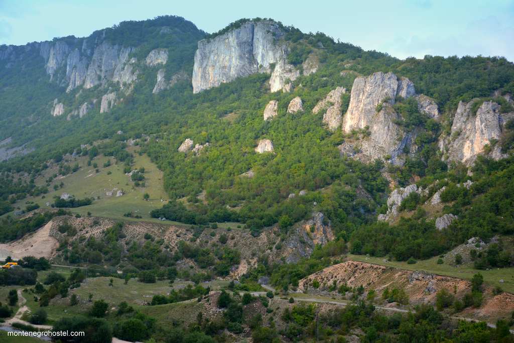
The best starting point for exploring the canyon and its south side is the “Ethno Village Montenegro" huts in the village of Gornja Brezna (Upper Brezna, 24 km south of Plužine). From this idyllic setting, one can follow several marked trekking paths to Mt Vojnik (1,997 m), ride a bicycle across this wide tableland, or enjoy excellent viewpoints over the canyon, whose depth reaches 600 meters. The other side of the river is rather inaccessible for all those without a 4x4 vehicle, as there is no road. One can descend to the calm on the other side of the Borkovići village, but that’s where the asphalt road ends. The most fascinating part of Komarnica is Nevidio Gorge. The name roughly translates as “not seen,” faultlessly explaining the phenomenon.
Here, the stream cuts its way between two vertical rocks whose sides draw ever closer and almost meet at the top at their narrowest; they are just a few meters apart, giving the impression that one can leap to the other side. If one didn’t know this gap in the terrain, several hundred meters deep, could easily be unseen (therefore the name). This incredible wonder of nature, since its creation, remained unseen by the human eye and was the last gorge in Europe to be explored. The first men to pass it were a group and speleologists in 1965. From that very day to nowadays, canyoning in Nevidion is one of the most wanted activities in Montenegro. Every year, a couple of thousand tourists pass its 3,5km of rocks and water in July and August, when the temperature drops, and the sun rarely breaks through, creating vegetation specific only to this micro-region.
To embark on this adventure, one needs mountaineering equipment, experience, and a guide. Those less adventurous can enjoy its mysteriousness best at its beginning near the village of Komarnica. One arrives here from the direction of Šavnik or Žabljak, passing two memorable villages, Petnjica and Pošćenje. The former is best known as the place of Vuka Karadžić's (1787-1864) family origins. Vuk Karadžić was the reformer of the Serbian alphabet and collector of folk songs and stories, whose father moved to Serbia from here.
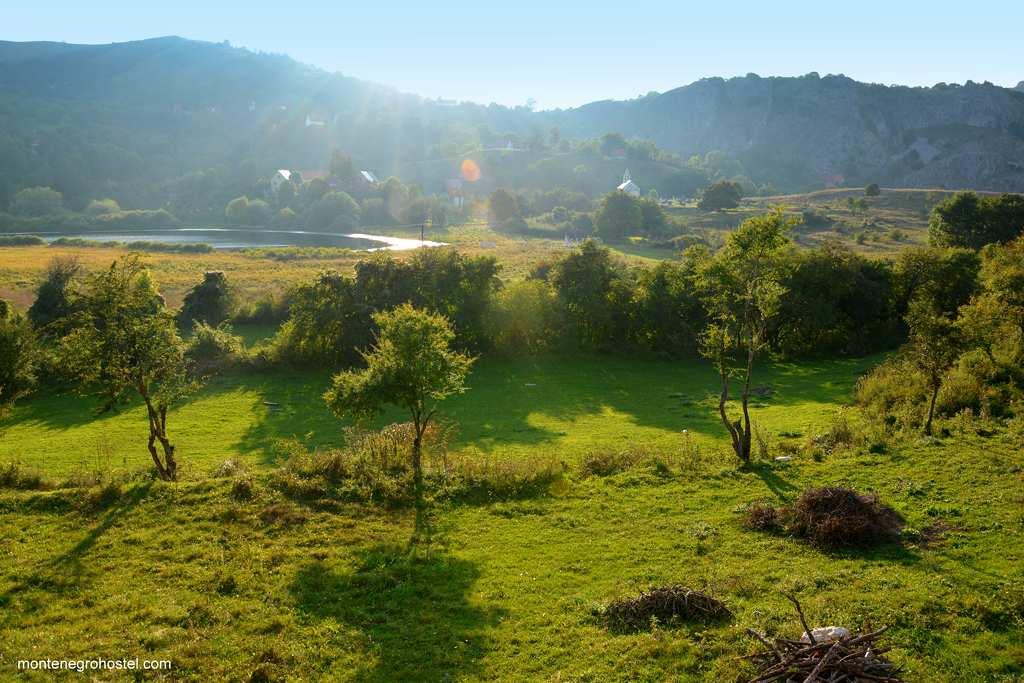
The peasants from Petnjica still treasure the memory of their illustrations compatriot. The adjacent Pošćenje lies on the slopes next to two green lakes and has a fine collection of stećak gravestones scattered around its church. Just around the next curve, the scenery changes dramatically. The wide view of the Komarnica valley emerges, ending with a precipitous wall of "Boljske grede" cliffs. Taking the left branch of the forking road will lead you to the short bridge over Nevidio, with fantastic views of its depths. The right branch descends into the valley passing the Skakavac (Grasshopper) waterfall, being the highest in Montenegro, with its 65 m, but exists only during the season of the snow melting. From this side, unequipped tourists can approach the beginning of the Nevidio Gorge.
Montenegro Hostel Team
PIVA
PIVA
Piva is the name for a river, a region, and a clan that lives on both sides of the river. Though the name sounds very similar to pivo (beer), the correlation is only accidental, while the name Piva meant “drinkable” in Old Slavic. River Piva is officially only 34km long, from the Piva monastery, where its source is, to the convergence point with Tara at Šćepan Polje, where they form the Drina River.
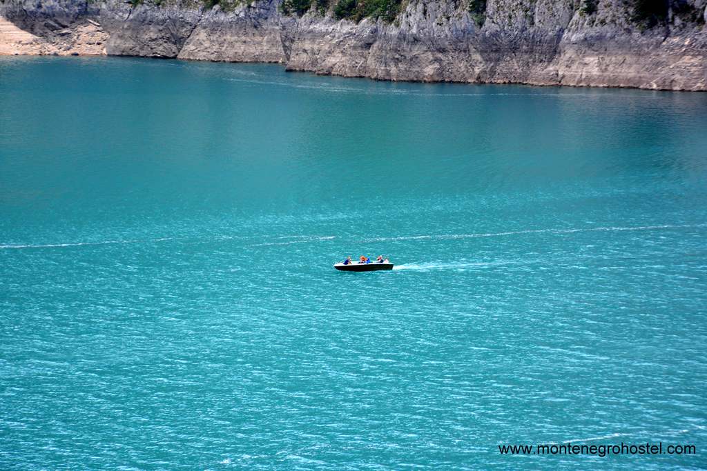
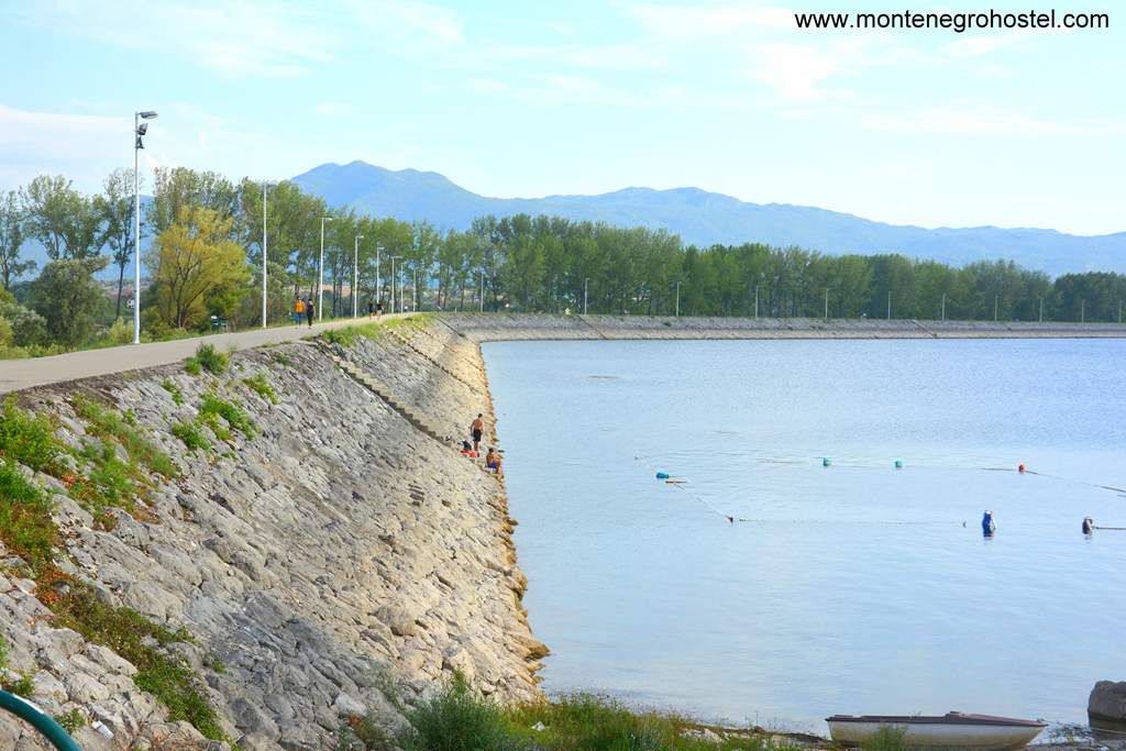
However, it was dammed in 1976 at approximately half of its course and became one with the river Komarnica, forming an exceptionally elongated lake (40 km) of incredible turquoise green-blue color, which seems to change from moment to moment depending on the light. The formation of Pivsko Lake changed the life of this area dramatically. The water flooded the most fertile ground, and a part of Piva Canyon became a deep lake (up to 188m) expanding into neighboring valleys, while the climate changed to a milder one.
The center of the region is the tiny town of Plužine (pop. 15,000), built simultaneously with the dam and therefore totally new. From here, the road splits in two directions, one continuing along the lake to the north and the other ascending sharply to the Pivska Planina (Pivska Mountain), a vast tableland backcountry of raw wilderness. The town is also where the canyon begins and the last place to fill in your tank for the next 60 km, which is uninhabited. Plužine also has a hotel, several restaurants, and is a good base to enjoy the lake, with locals organizing boat rides and excursions such as the one to the Velika pećina (The Big Cave).
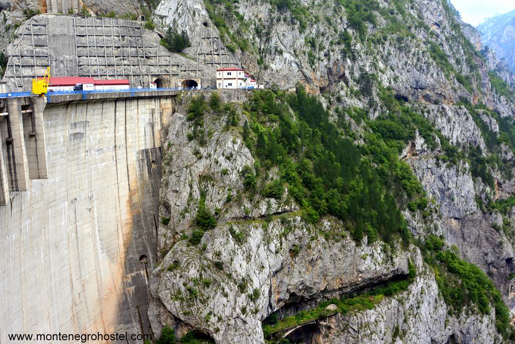
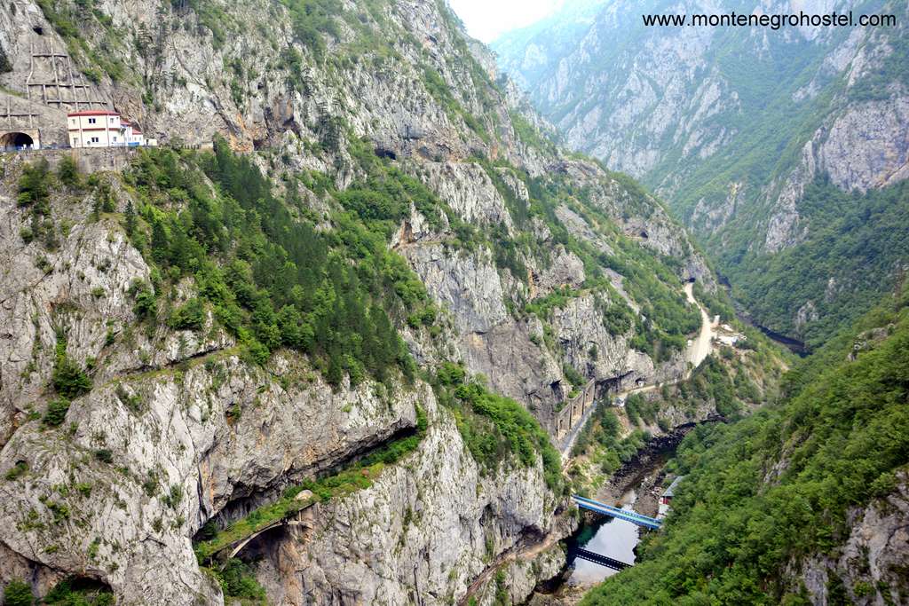
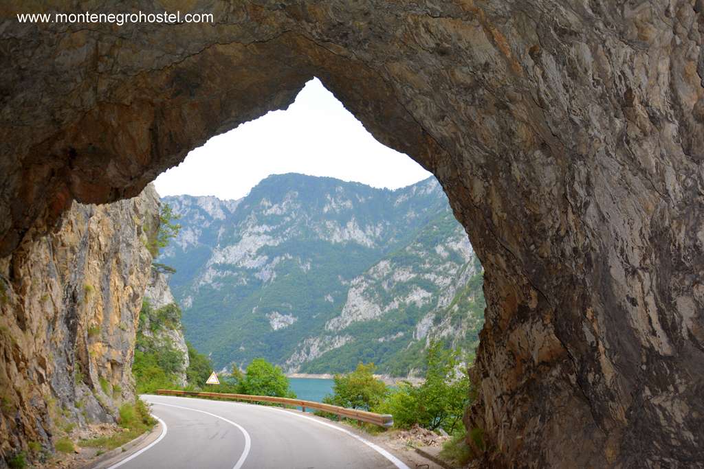
Piva Canyon is one of the most staggering places in the country. The road hacks its way along the lake, pressed on the other side by sheer rocks of sun-shadowing heights or passing through a multitude of tunnels. After 16km, one reaches the hydro-electrical power plant “Piva” (also known as “Mratinje” for the village that lives above it). The dam is 220m high, the highest in Europe, and was a huge engineering success at the time of its construction. Its tall wall, crossed by a road, makes a sharp distinction between the calm waters on one side of the chasm, with a small river at its bottom on the other.
From here on, the experience is even more outstanding as you can view the real proportions of the canyon that reaches a depth of 1,200 meters. The journey climaxes with the 122m long span "Kostova greda" bridge, an astonishing feat of engineering that seems to fly over the abyss at a height of 145 meters. Soon afterward, the canyon wanes through the wilderness of the deep forests is still there. Rivers Tara and Piva join at Šćepan Polje, where the border crossing with Bosnia and Herzegovina is situated. If you are going rafting on the last part of Tara, you will have to pass the border control as if you are leaving the country, but will take only the road forks immediately to the right check-point (the sign reads “Crkvičko polje”) and leading to Brštanovica, Grab, and other camps popular with rafters.
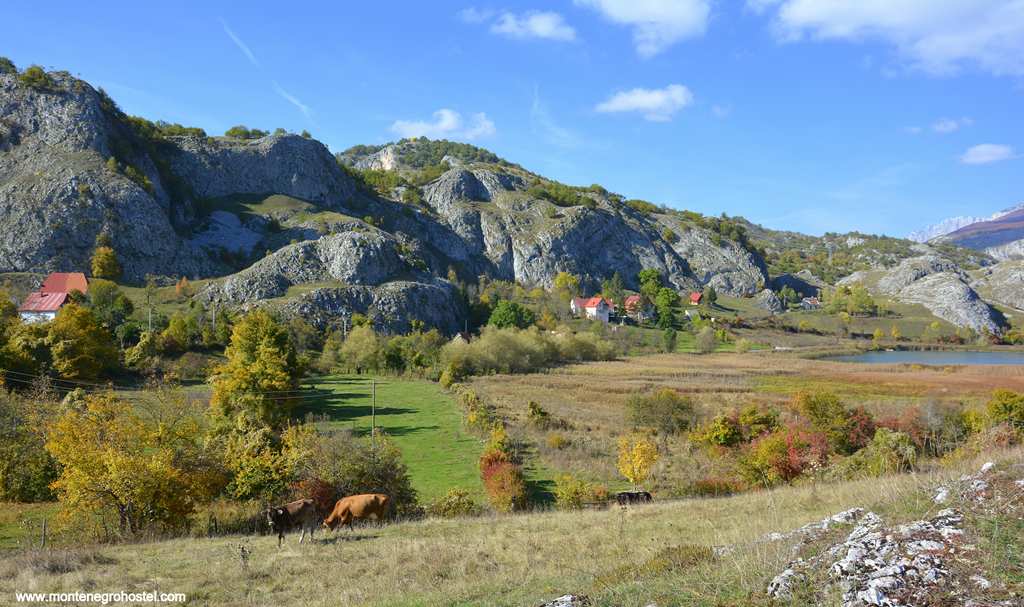
Pivska Planina (Pivska Mountain) is a desolate tableland with an average height of 1,200 m from which rise peaks up to 2,500 m. On three sides it is framed by canyons: to the west of Piva, to the north of Tara, and to the east of Sušica. The scenery is moonlike, a limestone terrain dotted with sinks and with just a few forests. Surprisingly, there are 15 villages in this uninviting and unique region, all of them living from farming, mostly sheep. The village of Trsa has a central position.
The school “Milogora” and the shop are on the road, while the houses lie behind the first hill. Together with camp houses, these make Trsa a good starting point for further exploration. To the south and a bit higher is Pisće, whose cemetery by the church holds several old stećak tombstones with intriguing symbols. To the north of Trsa, the road leads across the wooded rise of Milgora to the village of Nedajno. This scenic village lies at the edge of the amazing Sušica river canyon, a deep, always green scar between the two plateaus. From here one enjoys superb views over the Sušica and Tara canyons and the village of Crna Gora on the other side of the gap, seemingly just a couple of hundred meters away but 15km far.
PIVA MONASTERY
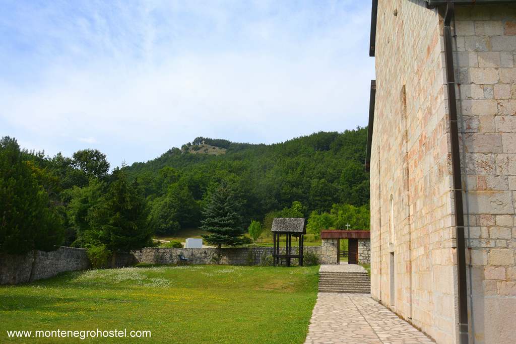
The 16th-century Piva monastery has for centuries represented the hub of clan life in Piva, while its spiritual and artistic importance radiated further away. The sober, stone complex is today located just by the Nikšić-Plužine road. However, its original location was more concealed, lying in a forest next to the source of the Piva River. To preserve it from being flooded, while the building of the dam was being carried out, the monastery church was disassembled and relocated uphill to its present position.
The whole process was very sluggish due to the complications of putting off and putting up 1260 square meters of the monastery’s precious frescoes. In the end, the works lasted 13 years (1969-1983), exactly as long as it took the 16th-century builders to complete the original construction. The only reminders of the relocation process are the numbers preserved on every single block of stone by which they were identified and put in their original place. The monastery was built in 1573-86 by Savatije Sokolović, the metropolitan of Herzegovina and a member of the family that gave several heads to the Serb patriarch in 1687. For the people of Piva monastery became their holiest place, which they guarded against the Turks. Generation after generation donated to it as much as they could until the monastery grew to be the greatest landowner in pro-socialist Montenegro. After WWII, Nothing of that wealth survives.
All of the lands were nationalized and, as most of them disappeared under the waters of the lake, there's no hope of their retrieval. Today, the fraternity in the monastery consists only of an abbot and one monk. The church was erected at a supposed place where St Sava, at the time still Prince Rastko Nemanjić, decided to join a group of Russian pilgrims and go to Holy Mount Athos to take his monastic vows. For his endowment, Savatije chose experienced builders from the Adriatic coast who were familiar with the Romanesque style, popular with the Nemanjić rulers, which the metropolitan wanted to imitate.
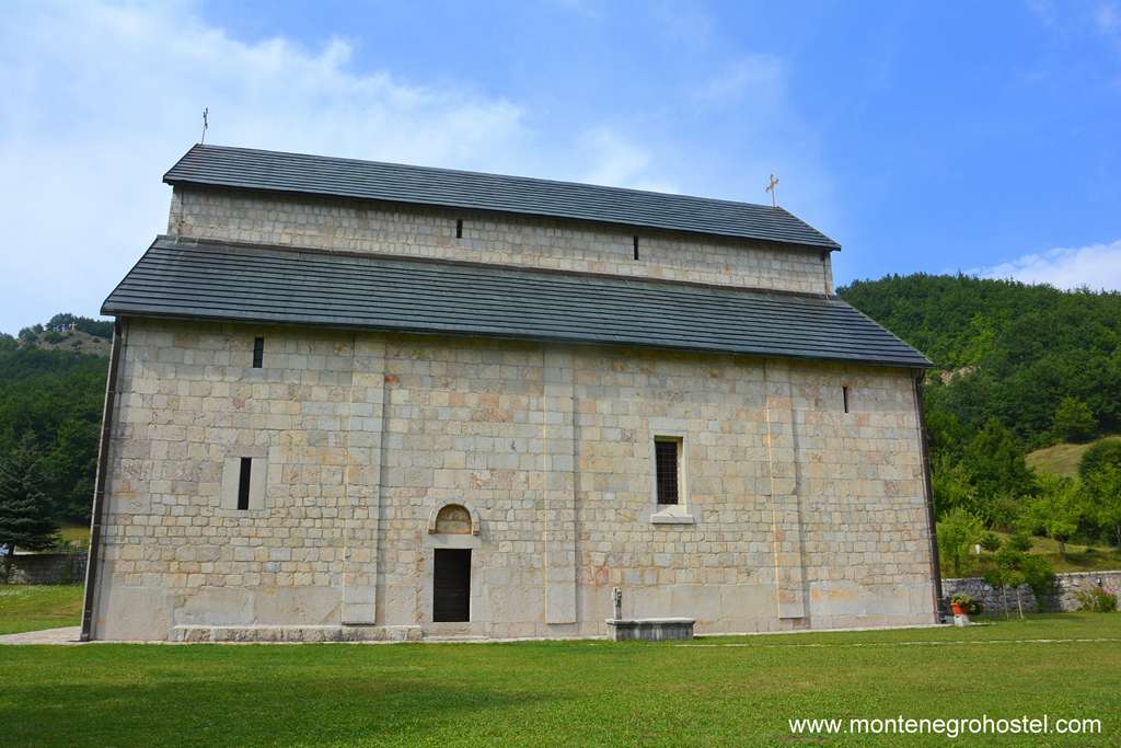
The result is one of the largest Serb churches built under Turkish domination, a simple three-nave basilica of white stone skillfully cut into rectangular blocks. The plain and unornamented exterior seems like it was designed to hide the wealth and opulence of its interior. It took some years until this huge church was fresco-painted. The artists chosen for the job were among the best masters of fresco-painting one could find at the time. The first space into which one enters from the west is the elongated narthex. Its ceiling and upper zones were painted by priest Strahinja of Budimlje in his naive style. However, the most beautiful frescoes, the ones in the three lower levels, are not his but the work of painter Jovan, completed in 1626.
These rank as top achievements in orthodox art by this accomplished painter and the whole epoch. Amongst them, the most memorable is the one to the left of the door leading to the nave, where we can see St Sava in front of the Virgin and Christ renouncing earthly powers (symbolized by the crown and the ruler’s belt cast underneath his feet).To the right and up of the entrance is a painting of Saint Kosmas the Hymn-Marker binding a book, shown with precisely drawn book-binding tools. Entering the nave, one passes the beautiful wooden door inlaid with ivory arranged in fantastic shapes.
Most of the nave walls were decorated in 1604-1606 by a company of Greek painters. By the south door are two portraits, one of metropolitan Savatije holding the monastery church in his hands, while the other is mysterious of a “Turk”, possibly of Savatije’s relative Mehmed-pasha Sokolović, who at that time held the position of the Grand vizier of the Ottoman Empire. While during his life, Mehmed-pasha made possible the building of a monastery of this size, later on, the portrait was occasionally saved. In the middle of the nave hangs a splendid chandelier of inlaid wood decorated additionally with ostrich eggs and two-sided hanging icons by Master Longin ( these being just the copies, the originals are kept in the treasury).
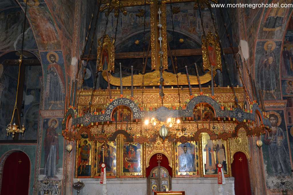
The splendidly carved and gilded iconostasis is considered to be one of the most beautiful of its time, especially the lofty central crucifix for which alone, the legend says, the unnamed carver got 25 pairs of oxen. The iconostasis was completed in 1638 when Longin painted the last of its outstanding large icons depicting (from left to right) St Demetrios, Mother of God, the Assumption, Christ, and at the end St Sava and his father St Simeon, which was scratched during one of the Turkish raids of the monastery. In front of the iconostasis stand tall marble candlesticks with lions’ heads as their base, which, once again, draw their inspiration from the Romanesque models. The monastery’s treasury is equally rich.
Here, one can marvel at the church utensils such as the silver ciborium and five-loaf bread (petohljebnica) created in fantastic Gothic shapes, the crosses with meticulous wood carvings, and the abbot’s throne of inlaid wood. The original icons by Master Longin also include the Assumption of the Virgin, and the famous handling of colors (note the blue angels darkened by Christ’s red shine). Also displayed are the silk Sakkas, a vestment worn by the bishop-a fine Venetian work, and the metropolitan’s crown stripped of almost all of its jewels during the heretic times of communism. The Psalter printed in 1494 at the Cetinje printing house is one of the first Serb-printed books. The exhibition ends with two items not related to the church but to local history- the bag and the powder cartridge once owned by Bajo Pivljanin, famous for fighting the Turks in the 17th century.
BAJO PIVLJANIN
Bajo Nikolić Pivljanin (1630-1685) is one of the best-known personalities in Serb epic poetry as a prototype of a brave outlaw fighting against the Turks. He was born in the village of Rudnice in Piva, where, barely out of his teens, he had a free-killing Turkish landlord in the place now called Bojovo Polje (Bojovo Field). He gathered around him a group of men who waged a silent guerrilla war on the border of Venetian possessions in Boka Kotorska and Dalmatia with the Ottoman Empire. They attacked Turkish caravans, robbing their lords and burning down their border forts. From their bases in Boka, they would infiltrate Turkish territory where they looted for their livelihoods, while also defending Perast and Kotor from Turkish raids. Usually, under Venetian rule, Bajo and groups similar to his were very useful in times of war, but a menace in times when the Republic tried to keep good relations with the Sultan, since they knew nothing else but to fight. After a debacle in trying to settle them in Istria, Venice found a good use for them in the new war during which Bajo lived his most glorious days, fighting across Dalmatia and Herzegovina. When in 1685 pasha from Shkoder raised his army to punish Montenegrins and Highlanders for their rebellion against the Turks, Bajo’s company came to help, and this is where he heroically met his end on Vrtijeljka, on the threshold of Cetinje.
Montenegro Hostel Team
NIKŠIĆ
NIKŠIĆ
Montenegro’s second-largest city is situated in a large karst field, a feature that made it an important place and crossroad throughout its history. A late Roman-era town of Anderva stood here until it was destroyed during the barbaric invasions. In the 5th century AD, Eastern Goths, who wrestled the area from the Byzantines, built a fortress here, calling it Anagastum, probably after one of their leaders. The Goths soon departed for Italy, and their places were taken by the Slavs, who adopted the previous name of Onogošt. In the Middle Ages, the location was an important stop on the caravan routes from the Adriatic to the hinterland and was visited by several kings of the Nemanjić dynasty. With the Turkish onslaught, a demographic change occurred, as witnessed in the change of the name. The Old Onogošt became known as Nikšić after a clan that settled in the area.
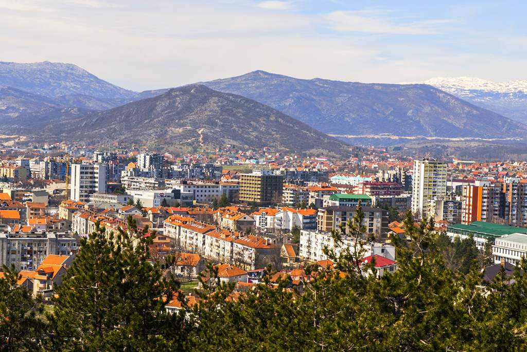
Turks captured the town in 1465 but, less than a century later, had to wage constant battle with the surrounding Herzegovinian clans, who attacked the city regularly. In the end, the Turks decided in 1703 to rebuild the medieval fortress and surround the town with walls. Frequent attacks and sieges by Herzegovinians and Montenegrins finally found success in 1877 when Nikšić fell to Montenegro. The Muslim population left, and the fortress fell into decay while the city’s new masters laid out a practical radial streets plan. They built European-style edifices and started the first industrial enterprises, of which the best known is the brewery, established in 1896. However, the real boom that made the town what it is today followed WWII, when it became the seat of several large factories, and the ironworks as the most important. The demand for workers was grave, and the town’s population rose tenfold from 1945 to 1985. With the founding of several faculties during the 1990s, Nikšić also became the center of learning. Today, students are its second most important feature, the undisputable first being Nikšićko pivo, a very palatable beer popular well beyond the borders of Montenegro.
The main attractions of Nikšić are suitably grouped at the entrance from the direction of Podgorica. Facing the bus station is a fine park with Turkish baths in its middle. Interestingly, the baths were built after the Turkish departure and in a European style. Behind the park lies the Palace of King Nikola, built in 1895 by architect Josip Slade, the chief engineer in Montenegro at the time, who also drew the above-mentioned plans for the laying out of the Nikšić streets. This neo-renaissance edifice nowadays houses the local museum. On the ground floor is a permanent exhibition of paintings by Ilija Šobajić. The upper floor presents the history of the town and its vicinity, era by era. It begins with archaeological findings, continues with fine Illyrian and Roman collections, the Middle Ages, and the 19th century, which are followed by a large collection of folk costumes and armory from the period, and ends with a large section depicting battles waged in WWII.
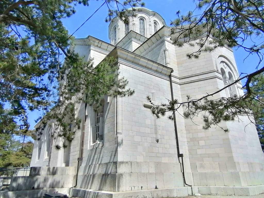
Next to the museum, elevated on a small hill, stands the grandiose Church of St Vasilije of Ostrog. Before climbing up to steps to its entrance, take a minute to examine several stećak tombstones lying scattered at the foot of the hill. The Church was built in 1900 with the funds donated by the Russian Emperor. The architect of this grand temple was also a Russian, Mikhail Preobrazhensky, who mastered the style of the local churches. The church was built in memory of Montenegrins and Herzegovinians (Nikšić being the most important town in Herzegovina, acquired by Montenegro) who fell in the 1875-78 wars for the liberation of this area. Until a decade ago, this was the largest church in all of Montenegro. The airy interior is unpainted but boasts a fine iconostasis. In the square at the front of the church stands a high column with a statue of the Virgin Mary, the latest in the series of Russian donations to Nikšić.
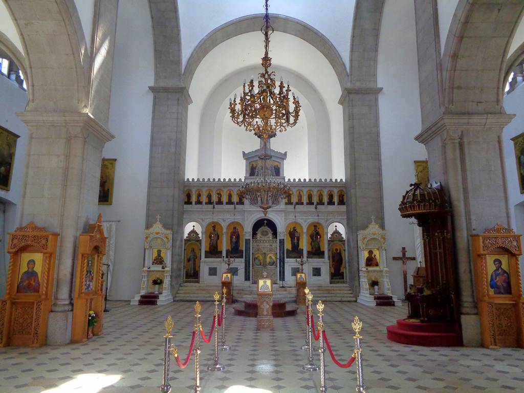
To the north of the church is the Old Cemetery, nicely kept and with many interesting 19th-century tombstones that are decorated with folk motifs. In its center is the Church of Saints Peter and Paul, a modest edifice dating from the 15th century. In its interior, there are remains of slightly younger frescoes. You can see some more stećci, most of them with a colonnade design, scattered around the church (some fragments are even built into its walls) and indeed all over the cemetery. In the backdrop behind the church and the museum, one can see the wooded hill of Trebjesa, with its walking and bicycle tracks. Upon reaching halfway up the hill, a motel that shares the same name can be found, from whose terraces one can enjoy the pleasurable view of the town. On the other side of Nikšić stands the old fortress, called Bedem (“Wall”) by the locals. Its upper fort resembles a long wall that lies along the full length of the low, elongated hill. Once, there was also a lower fort where the Turkish Nikšić used to be, but today it is hardly noticeable amongst the private houses and their yards.
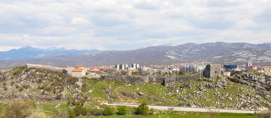
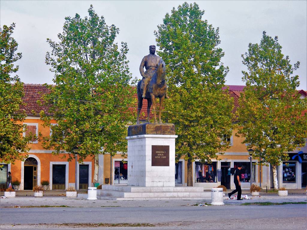
What can be seen today was built in 1703 by the Turks, and some locations where the medieval fort and the one built by the Eastern Goths used to stand when they founded that city. Seemingly, its design is not too different from the forts of the earlier era, but a closer inspection reveals that its towers have been built to house cannons. The center of the town is the Trg Slobode and the streets around it, which combine one-storied houses with the social realist buildings of the post-WWII era. The central feature of the square is a new equestrian monument to King Nikola. Continuing along Njegoševa Street. You will reach a colossal “House of the Revolution” (Dom Revolucije), a grandiose project by the local communists. The work on it started in 1975, but it faltered due to its sheer size and was never completed. To the left of it, Radoja Dakića Street. will lead you to the 19th-century mosque, one of the rare Islamic places of worship in Montenegro that survived even when it lost its congregation.
The surroundings of Nikšić are unusually rich in old stone bridges. Several streams and rivers that flow through its fields are bridged by approximately a dozen of them. Taking almost any road from Nikšić, you are bound to cross some of them. The largest amongst them is Carev most (“ Tsar’s Bridge”). It lies on the old Nikšić-Podgorica road streaming to the river Zeta, which is now reduced to a canal but was once a much mightier river, judging from the length of 269 m and 16 arches of its imposing structure. It was built in 1894 again from the donation of the Russian Emperor; therefore, its name, although its imposing size could give inspiration to this name as well. To reach it, start in the direction of Podgorica and then follow the road going straight to Kličevo. The oldest and most interesting among old stone bridges is the so-called Roman Bridge over the Moštanica River, whose unusual openings testify to its antiquity. It is assumed that it was built in the 8th century AD on the road from Dubrovnik to Nikšić.
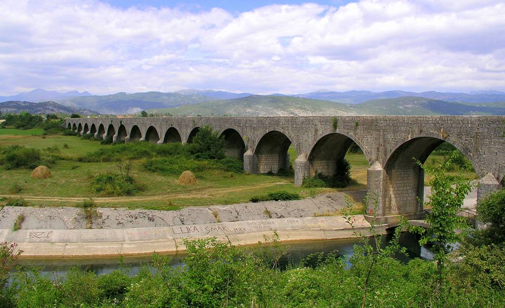
To reach the Roman Bridge, take the road towards Trebinje. After passing parallel with another old bridge, "Vukov most", take a left turn to the spot's airport. The bridge is behind it, close to the local houses. Taking the road from the center of the city towards Foča will lead you across Duklo Bridge (Most na Duklu). This bridge, which stands over the Zeta River after its convergence with the Bistrica River, was built in 1807 by Hajji Ishmael, a rich Turk from Nikšić. The unusual feature of this bridge is that its arches are of different heights, one of them being significantly lower. The road to Foča will also take you to the village of Vir (“Whirlpool”), which got its name after an interesting natural phenomenon.
A 94 m deep hole filled with water is linked by a small stream with the nearby river Zeta, forming Europe’s largest estuary. The estavelle sometimes discharges water from its spring through a stream into the river, and on other occasions receives water from the river, depending on its water level. To the west of Nikšić lie two large lakes, Krupačko and Slansko. The former is a popular place for refreshment during the summer heat, and its beach bars offer possibilities for various water sports.
STEĆAK TOMBSTONES
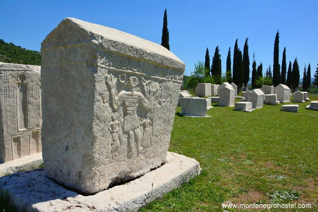
Stećci (pl. of stećak) are medieval tombstones found in Bosnia and Herzegovina, Western Serbia, South Dalmatia, and North Montenegro (historically a part of Herzegovina). These are large stone blocks standing above graves, most of them with carvings and some with Cyrillic inscriptions. The oldest date is from the 11th c., and by then they already had all the distinctive features that endured until their end in the 15th century. These are large tablets, single stone blocks, some in the shape of sarcophagi, with decorations depicting crosses, rosettes, swords, shields, and bows with arrows, scenes of tournaments and hunts (characterizing the noble rank of the deceased), saints, geometrical patterns, wines, sun, moon, stars, people dancing kolo or the figure of the deceased with one hand raised in greeting.
The inscriptions on them remind the reader about the deceased and warn him about the transience, cursing those who dare to desecrate his grave. Though an art form characteristic of medieval Bosnia and its immediate surroundings, stećaks are wrongly associated with the so-called “Bogomils”, a Christian sect active in medieval Bosnia. They were also created by the Bosnian Orthodox and Catholics, and later even by the first converts to Islam. Most stećaks in Montenegro are to be found in old cemeteries, and the most interesting necropolises are in Nikšić, Grahovo, Velimlja, Pivska Planina, and Sokol above Šćepan Polje. They are usually located in old graveyards or on higher ground.
Montenegro Hostel Team
