EASTERN MONTENEGRO
EASTERN MONTENEGRO
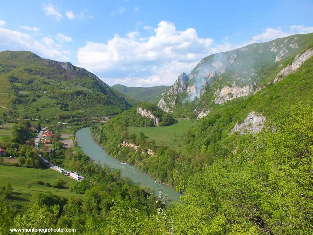
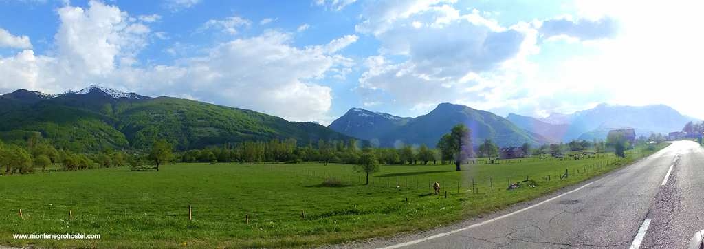
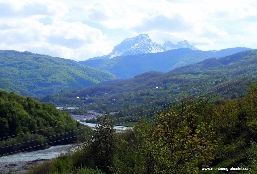
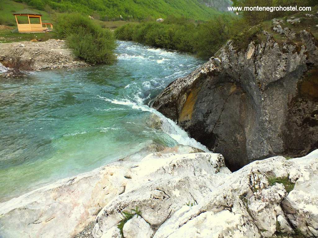
Except for a few locations, this part of Montenegro is off the tourist map for foreign travelers. One may add, unjustly, as it abounds with natural beauties, such as fast rivers and high mountains, but also monuments from previous centuries and villages. Most of these attractions are unexploited and visited only by an adventurous few. This is mostly due to the relative isolation of the region; the second reason lies in the fact that a large part of the region ranks amongst the poorest in Montenegro, with underdeveloped infrastructure and derelict industrial facilities. The region’s main artery from times immemorial is the river Lim, which spills out from Plavsko Lake (Plavsko jezero), flows northwards passing Andrijevica, Berane, and Bijelo Polje, and continues further into Serbia. Most of its flow passes through a valley, not particularly wide but wide enough to constitute the flattest piece of terrain in the whole of his mountain region.
The river has its other face too, with several sections where it speeds up and rushes through several small gorges (the best known of which is Trifan, some 5km downstream from Berane) that make it popular with rafters. With modern roads built across the mountain ridges, the valley has lost some of its former importance, but in previous centuries it represented a distinctive whole and played an important agricultural and commercial role. In the early Middle Ages, it was a hub of the Serbian state, and there are several monuments bearing witness to this era, such as the Đurđevi Stupovi monastery close to Berane or the church of Saints Peter and Paul (Sveti Petar i Pavlo) in Bijelo Polje. Later on, the region was taken by the Ottoman Empire, which was an important transit zone towards Bosnia.
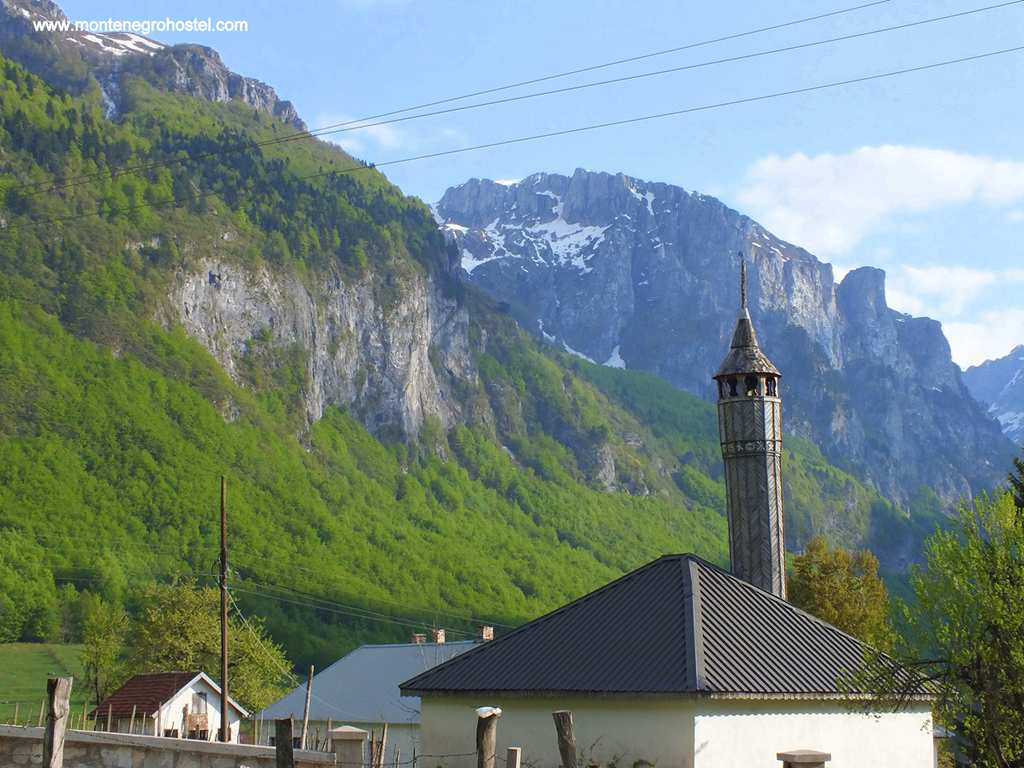
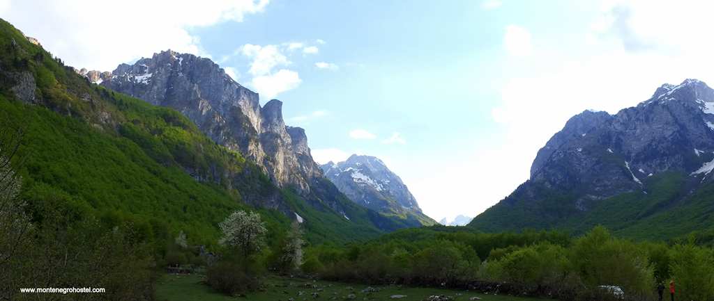
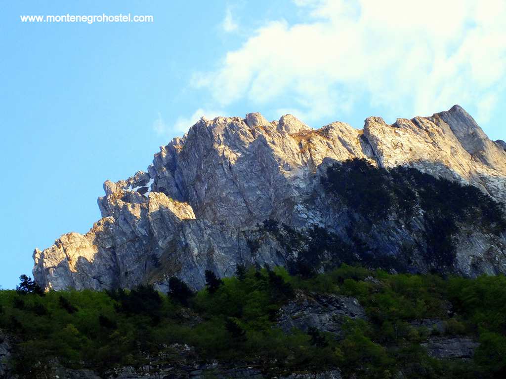
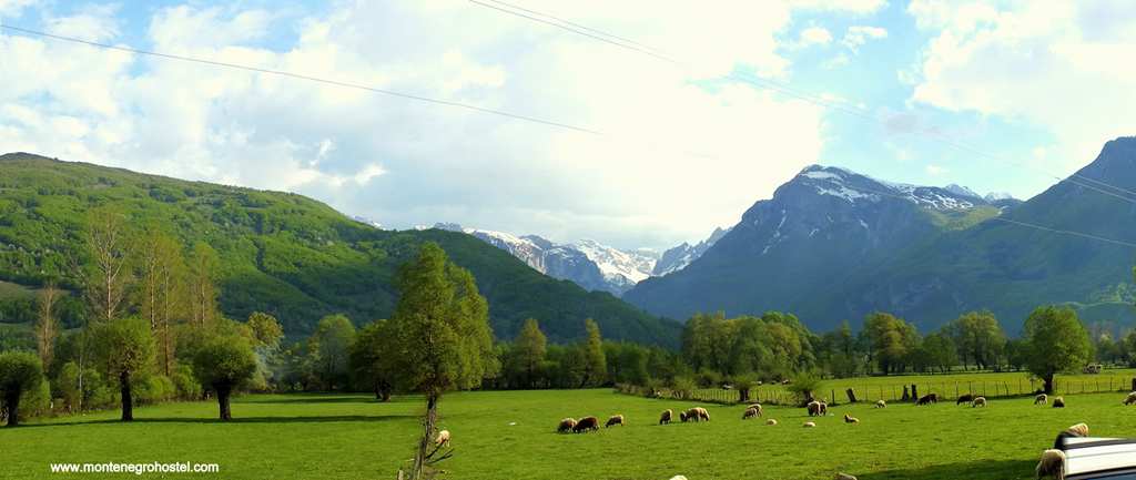
The Ottomans remained here until 1912, and their influence is still widely encountered, most importantly in the numerous Slav Muslim population (Bosniaks) but also in many mosques of a specific mountain type that imitate the pattern of local houses with their stepped shingled roofs. The area of Plav and Gusinje in the south of the region is an alpine-looking valley at the foot of the Prokletije Mountains. Once prosperous trading spots, these two towns were plunged into bare survival by new borders that left them at the dead-end of the road. Alongside Durmitor, Prokletije is the most fascinating mountain ridge in Montenegro. Their sides rise steeply from the surrounding fields, capped by hostile stone peaks that attract many mountaineers and alpinists.
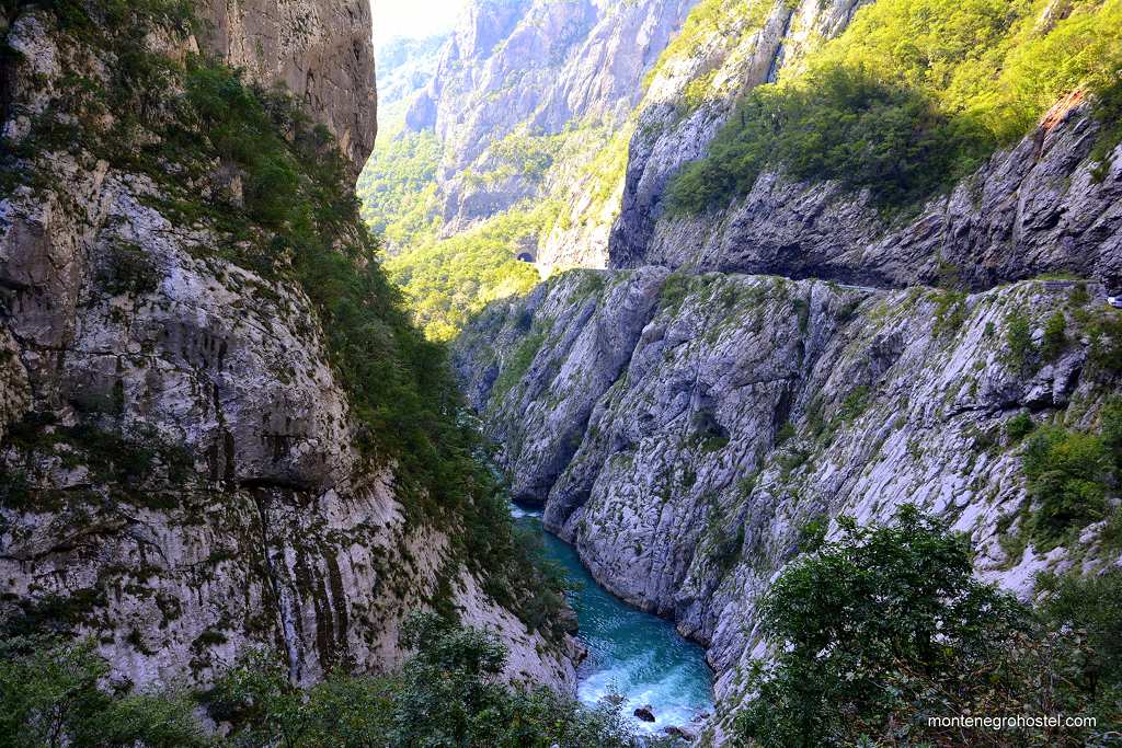
Much more spectacular than the Lim is the river Morača. In the first part, it descends quickly between Mt Sinjajevina and mountains Žurim and Stožac, forming a pleasant but narrow dale crowned by the impressive Kapa Moračka (Hat of Morača) peak towering at 2,226m. After passing the Morača monastery, an excellent piece of art from the 13th century, the cliffs rise higher, announcing the beginnings of the forbidding Morača canyon. The motorway and railway, which run along the whole length of it, provide stunning views of its peaks and chasms. Equally impressive is the canyon of the river Mrtvica, which joins Morača from the right, impenetrable until a few decades ago, and now one of the favorite routes of seasonal hikers.
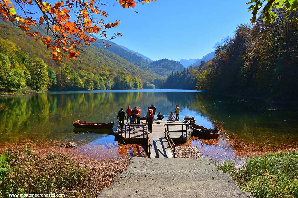
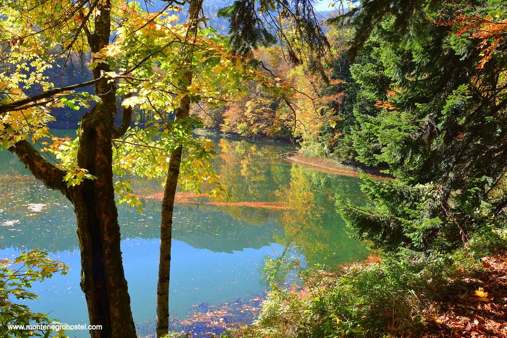
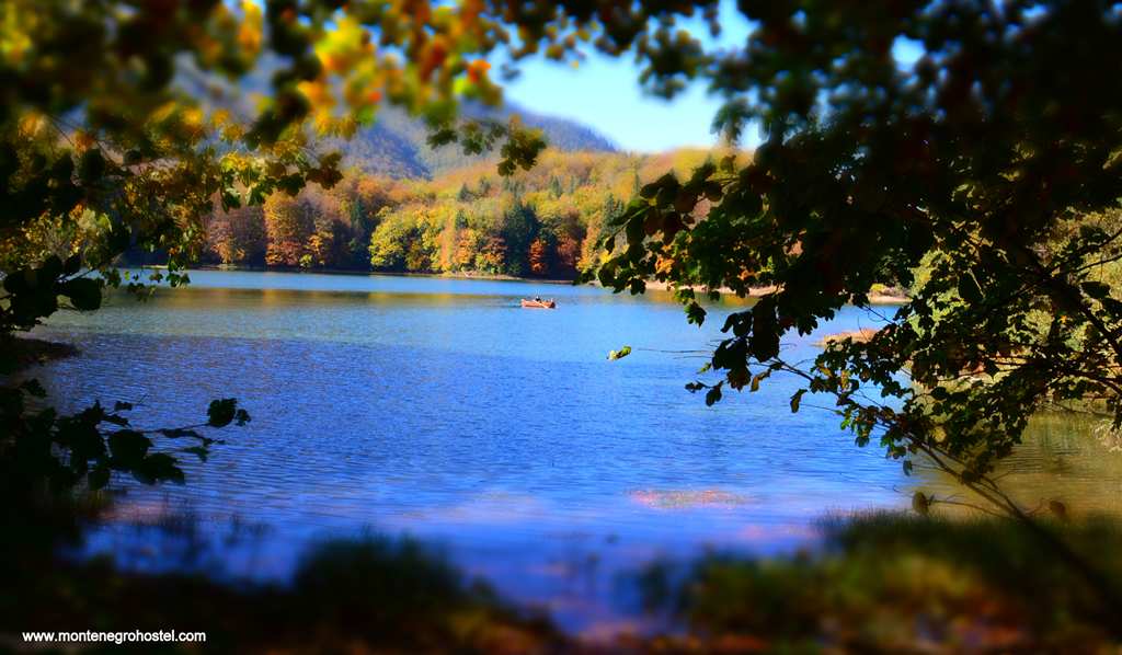
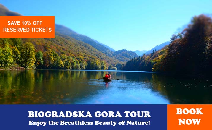
Between the rivers, Lim and Morača, flows Tara with the towns of Mojkovac and Kolašin on its banks. The latter lies below Mt. Bjelasica and is quickly developing into a mountain and ski tourism center. Bjelasica is widely known amongst nature lovers for its Biogradska Gora National Park with beautiful Bigradsko Lake and deep, pristine woods around it.
In the far east of the country lies the small town of Rožaje, populated almost exclusively by Muslim Bosniaks. With several good hotels, the town offers possibilities for hiking in high mountains such as the imposing massif of Hajla (2,403 m), and even better for winter sports at its improving (and potentially huge) skiing resorts.
Montenegro Hostel Team
KOLAŠIN
KOLAŠIN
Traveling from the seaside via Podgorica through the canyon of the river Moraca, and later by the river Tara, Kolašin is the first town in the mountains you will come across. Just an hour’s drive from Podgorica makes a world of difference. At an altitude of 965m, the climate here is much colder, while the forests around the town generate a pleasant cool breeze. The hottest summer days are easy to bear, while in the winter, there is plenty of snow in the mountains. The position of the town is fascinating as well. It lies on a plateau between the mountain giants, Bjelasica to the east and Sinjajevina to the northwest. The same plateau is the watershed between Tara, which continues northward, and Morača, which descends to the south. All of this creates the potential for Kolašin to become a perfect spot for a weekend break for people from the capital and a town with the most promising future in tourism.
The town was founded in the mid-17th c. as a Turkish military outpost in the middle of the rebellious clans of Bosnia and Herzegovina. Therefore, its history in the next two centuries was comprised of almost innumerable Christian raids on the town and Muslim efforts to subdue the highlanders. Since most of the residents of Kolašin were converts to Islam from the very same clan they fought against, the fighting was fierce and ruthless, providing epic singers on both sides write lots of heroes and their deeds. The town was annexed by Montenegro in 1978, and the Muslims moved out, and Kolašin started all over again. The central square and a couple of streets around it were all that was created in its slow development. Disregarding its potential, Kolašin is still just a small mountain town whose sleepy atmosphere is broken only by lively cafe life in which skiers and mountaineers mingle with the locals.
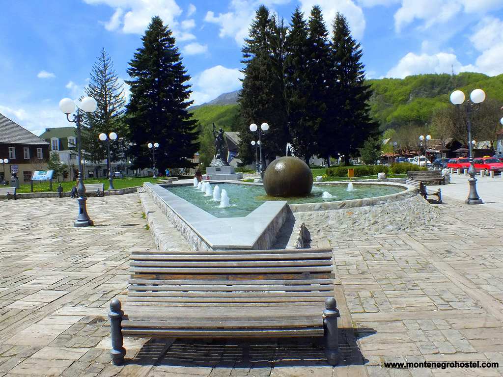
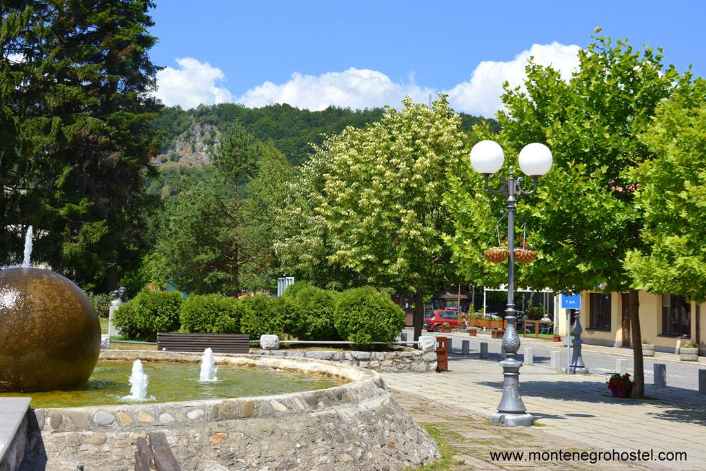
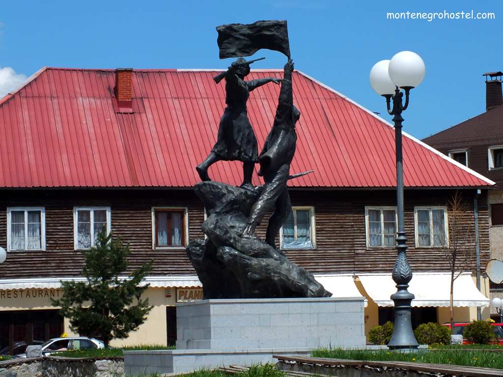
The central square, Trg Boraca (Fighters Square), is the focus of town life. Its edges are formed by one-storied houses whose stoic appearance warns of the long, harsh winters. In its center is the social-realist monument to the fallen in WWII, and behind it a modernist edifice of the local town council that, with its sharp angles, imitates the rooftops of the neighboring houses. Next to the small hotel is the seat of the National Park “Biogradska Gora”, which covers the most magnificent part of the info-center one can obtain maps and souvenirs.
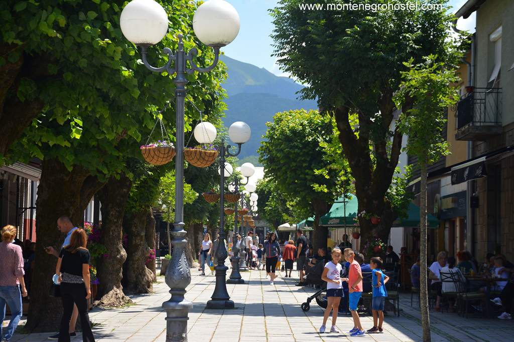
Close by is also the tiny Town Museum with an ethnographic collection of the region, a collection of history before 1941, and a section on the partisans in WWII. On the farther side of Trg Boraca stands the tall hotel “Bianca”, the pride of the local tourist offer and the classiest meeting spot in town. On the other side of the square is Četvrte proleterske Street, in which most of the town's cafes are concentrated. At the end of the street is another small square, and then to its right, a mound on which the town church was built shortly after 1878 stands.
MRTVICA RIVER
Mrtvica River is the chief tributary of Morača, flowing in from the west near the village of Međuriječje. The small but potent Mrtvica forces its way between the steep sides of the mountains Maglanik (2,139 m) and Stožac (2,226 m), forming a 9-kilometer-long canyon. The average depth of the canyon is around 600m. However, if measured from the peak of Mt. Maglenik, which lies 4km from the river, the canyon depth excels even that of the River Tara. This hostile ravine remained virtually inaccessible until the mid-1980s, when the army drilled through the rock in its side, making it possible to track its flow for the first time in history. Since then, the spectacular canyon of Mrtvica has become one of the most visited mountaineering tracks in Montenegro, but has remained unknown to wider audiences due to its isolation.
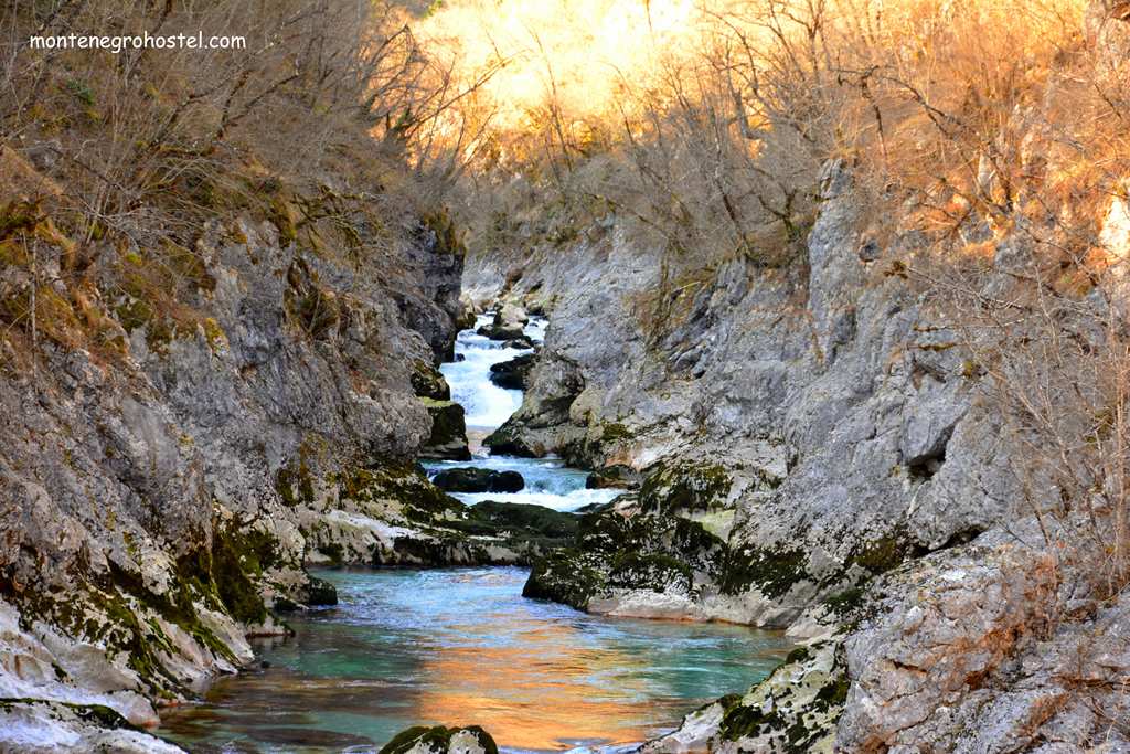
With its richness in trout and sprouts, the river also attracts the attention of anglers. The experience once claims that angling here demands a lot of knowledge and patience since the fish is very wary. The wilderness surrounding the canyon of Mrtvica is captured in the very sound of its eerie name, dead (mrtvo). There are several explanations for it, all coming from the associations flared by its hostile looks, but the most convincing one is connected with the change of water quantities in it. Though during springtime and early summer, the river is very abundant in water fed by the snow melting in the mountains, as soon as this season is over (at the beginning of July), the river suddenly “dies”, turning itself into a stream no larger than a brook or even dries completely in its upper course.
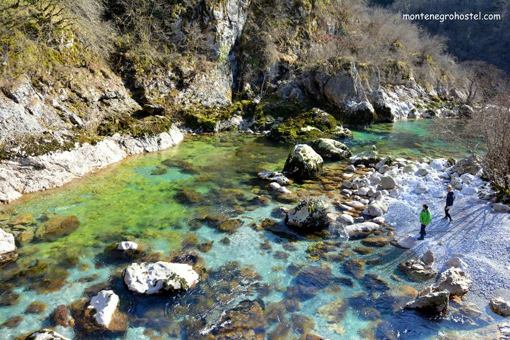
More vivid answers to the question are given by local legends. One says that the river got its name after many dead bodies ended up in its waters following a battle with the Turks, another that a great flood carried away everything from the village of Velje Duboko, even the dead in their graves. To reach the starting point for hiking from the direction of Podgorica, one should pass the sign announcing the Medjurječje village on the Podgorica-Kolašin road and then look carefully for a red sign that directs you to the left. Be very cautious since the turn is at a sharp angle and has to be made on a busy road. The same turn is much easier from the direction of Kolašin.
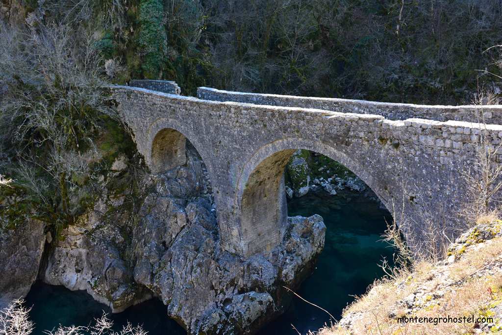
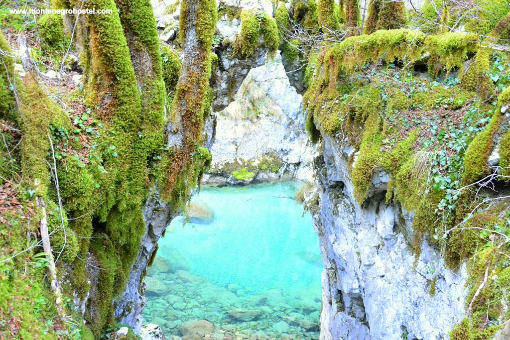
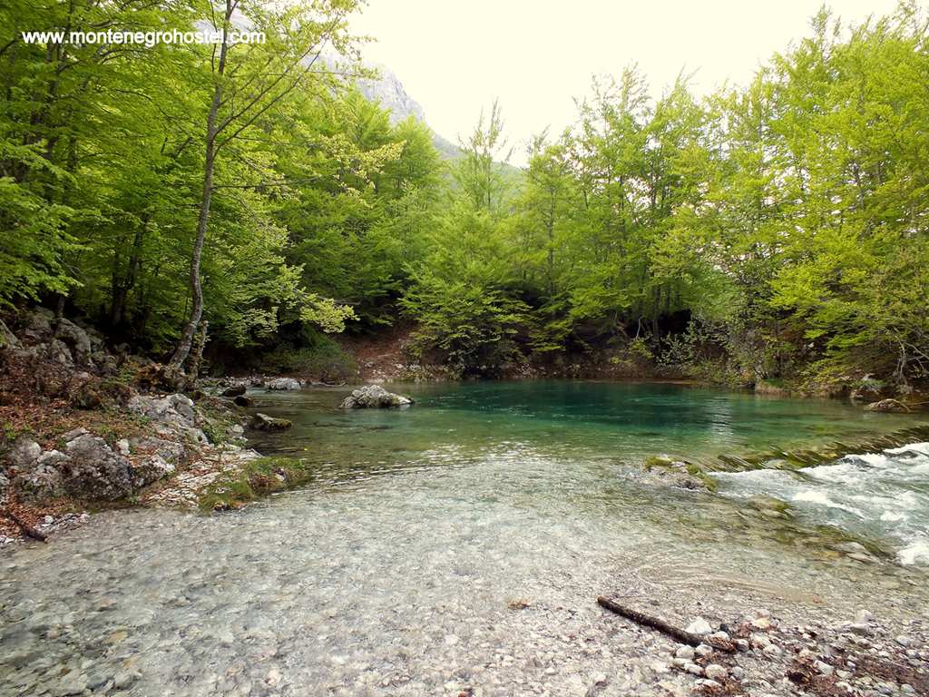
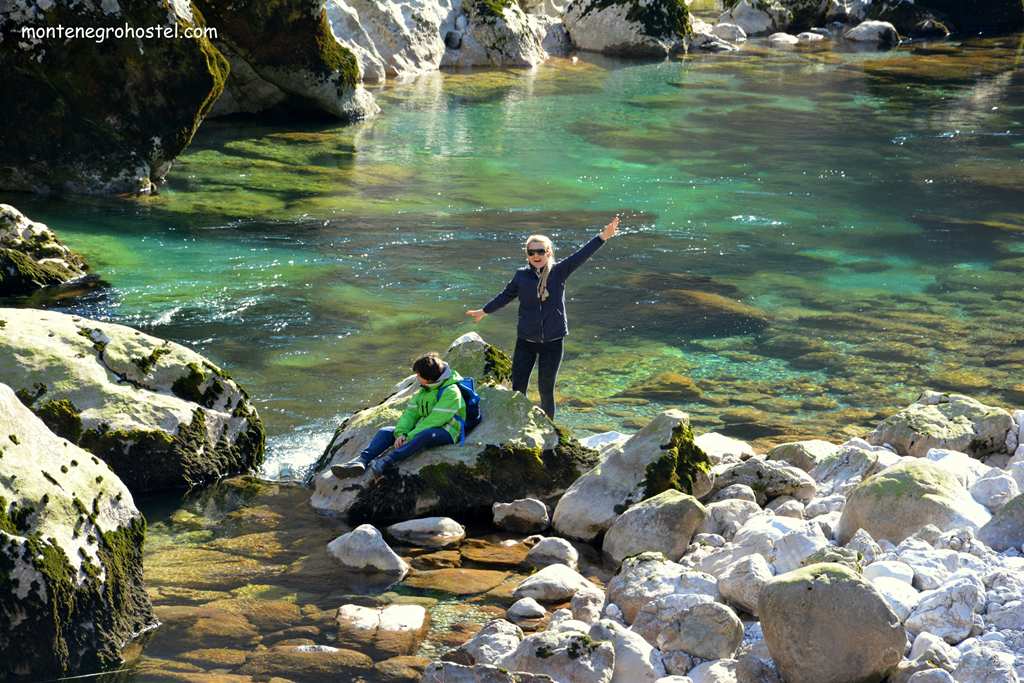
The walk through the canyon takes some 5 hours in one direction. The marked path starts from the confluence of two rivers, both remarkable for their clean, cold water. After some 15 minutes through the rich vegetation, one reaches Danilo’s Bridge (Danilov most), built by Prince Danilo in 1858, “for the soul of his mother Krstinja, as it is commemorated in large Cyrillic letters on a stone tablet. With its two arches high above the enchantingly green waters of the Zeleni vir (“Green Whirlpool”), it is certainly one of the nicest pack-horse bridges in the country (not being wide enough for a cart), not least for its unique setting. The bridge is part of an old track that avoided the canyon and used to be the only connection for several villages deeper in the mountains. From here, the hiking trail climbs up through the greenery past the old mill and shortly afterward reaches a gravel road. This road begins from the closed hotel “Medjurječje” and leads some two kilometers along the river to the homestead of Milivoj Bulatović, where it ends.
Passing these lonely houses, after a few minutes walk, one reaches the new, wooden bridge from which remarkable views along the river can be enjoyed. Further on and deeper into the canyon, where there is very little sunshine and where it’s always chilly, is the Bijeli Narini cascade, famous for its beauty as the water bubbles and breaks on the rocks (note that this phenomenon is far from impressive in high summer). Continuing the hike reaches the most attractive part of the canyon with the narrow path cut into the primeval rock rising vertically above the green river. The tour ends in the village of Velje Duboko (Great Deep), which is nestled in a picturesque valley in front of the canyon. The village, with small houses surrounded by walnut, plum, and apple trees, is a much-needed break from the inhospitable conditions of the canyon. It is one of the chief villages of the Rovići clan that got its name from the looks of their settlements (rovati-to dig into).
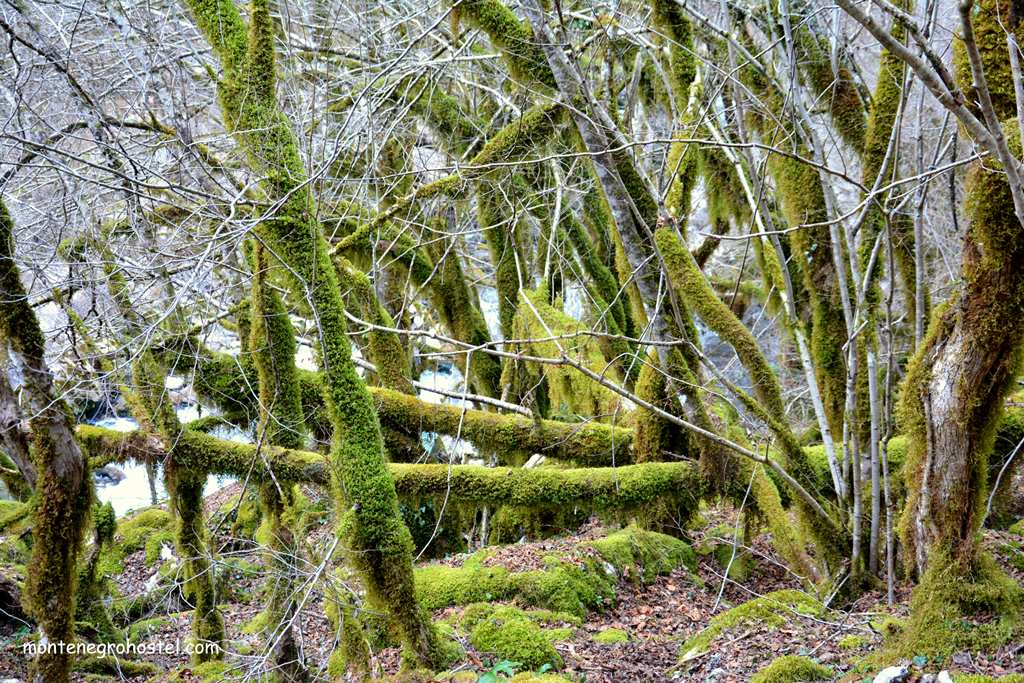
Velje Duboko is a good starting point to reach Kapetanovo Lake high in Mt Žurim (6 km, 3 hours walk). The picturesque glacial lake lies 1,678m above sea level, a desolate place stripped of most vegetation and surrounded by a katun settlement. It is quite a large lake (480 by 360 m) and has a distinctive, dark green, almost black water as a result of its depth (max. 37 m) that also keeps it cold throughout the year. From here it’s a half-hour climb to the smaller Manito Lake underneath the top of Mt Stožac and a 2-hour climb to the peak of Kapa Moračka (2,226m) overlooking the source of the river Morača. The other way to reach Kapetanovo Lake (Kapetanovo jezero) is a 5-hour walk from the Krnovo pass on the Nikšić-Žabljak road.
MORAČA MONASTERY
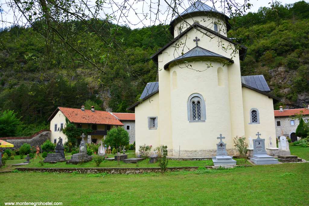
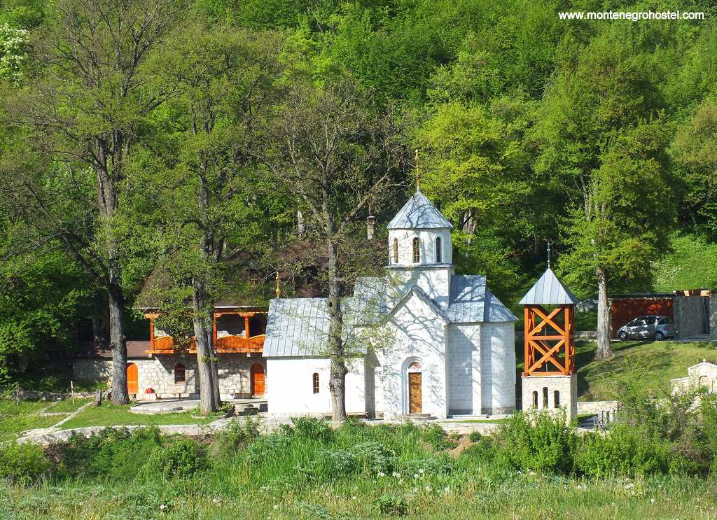
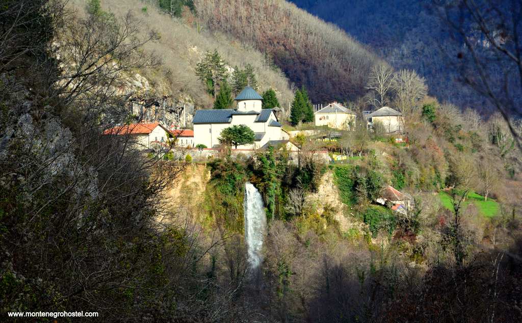
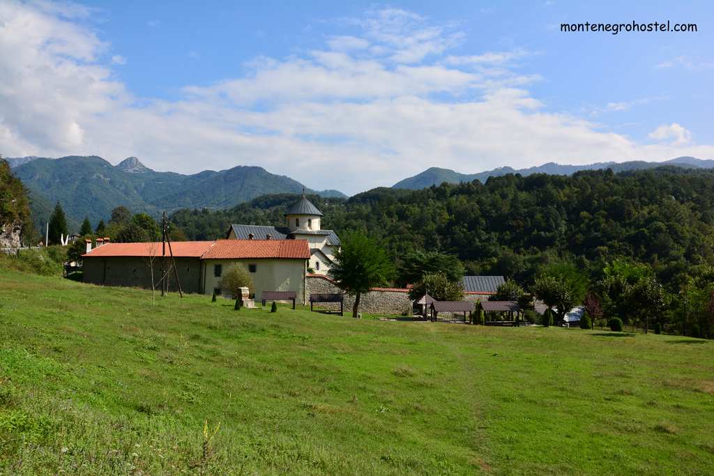
Morača Monastery is set in a spectacular position right at the beginning of the dreaded canyon of River Morača, in the very midst of the highest mountains of Montenegro. The position is further emphasized by the scenic Svetigora waterfall, some 25m high, plunging noisily just behind the complex, making it one of the famous motifs in many pictures. The monastery was founded in 1251-52 by Prince Stefan, son of Vukan and grandson of Stefan Nemanja, the founder of the Nemanjić dynasty. Its main church, dedicated to the Assumption, is a fine example of a mature Raška style of Serbian medieval ecclesiastical architecture-single nave with a narthex, cupola above the square base, semicircular apse, and a chapel on each side.
The details, such as the main portal and the double windows, are Romanesque. The builders from the town of Kotor brought a revival look. The monastery was looted (including its copper roof) and burnt down by the Turks in 1504 and remained in ruins until the renovation of 1574, when the best Serb artists of the time were summoned to help. In the 16th and 17th c., it became an important artistic and cultural center and played an important role in political life. Most notable of such events was when, in 1608, Serb patriarch Jovan came to the monastery to convene with the local clan leaders and request help from the Savoy dynasty against the Turks, but the scheme met with no response. In the 1877 war, the monastery was the site where the advancing Turkish army was stopped with a heroic defense led by its abbot Mitrofan Ban, the future metropolitan of Cetinje.
The western portal of the Church of Assumption is made of dark stone and with somewhat naive representations of the Virgin Mary, the Crucifixion, and beasts of hell. Above the door is the original inscription by the patron and a fresco of the Virgin surrounded by angels. This painting is one of the rare surviving medieval originals, as almost all other frescoes here date from the time of the renovation by copying the themes represented by the destroyed medieval ones. The western front of the church is additionally decorated with now blanched wall paintings, including the large representations of St. Demetrios and St George on horseback. These frescoes, as well as those in the narthex, date from 1616 and are the work of Georgie Mitrofanović, who was invited to the famed Monastery of Hilandar on Holy Mt Athos. Before you enter, note the fine door from the same period, influenced strongly by the contemporary oriental arts.
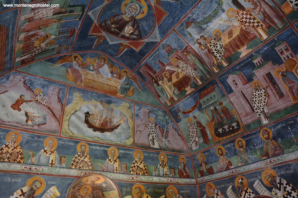
The most impressive compositions in the narthex are the huge Tree of Jesse on the north wall, the Last Judgment, as well as the Christ sitting on the throne in the composition known as the “Emperor of the Emperors”.The walls of the nave were painted by priest Strahinja of Budimlje. The Dormition of the Virgin, see above the door, and scenes from the life of St Elijah on the north wall. One of the rare surviving original frescoes from the 13th c. is the Ravens feeding Saint Elijah hidden in the draconian (to the left of the altar), regarded by many as one of the masterpieces of its time. The frescoes of the Annunciation and the Deisis are from the same period. The splendid iconostasis, with its remarkably large icons and the gilded crucifix that alone took 11 years to carve, dates from the very beginning of the 17th century. One should also note the portrait of Vukić Vučetić, who led a group of local donors who paid for the renovation.
In the church are displayed some of the monastery’s many valuable icons, such as those by the painter Jovan. One portrays St Sava and his father, St Simeon (Nemanja’s monastic name), with the life of St Sava, depicted in the smaller pictures around it; similar to it is the one representing St Luke painting the icon of the Mother of God, in which one can also see the construction of the monastery. The small chapel to the left of the narthex is dedicated to St Stevan, the protector saint of the Nemanjićs and Prince Stefan. Its excellent frescoes are also the work of painter Jovan from 1642. Among them, the most important is the one depicting St Stefan leading the patron (carrying the model of his church) to the Virgin. The small Church of St Nicholas, lying closer to the entrance of the monastery compound, was built in 1639 on the foundations of the medieval tower, which once guarded the gates. The monastic tradition holds the church to be even older than the main one, but this was probably invented at the time of construction, as the building of new churches was prohibited in the Ottoman Empire.
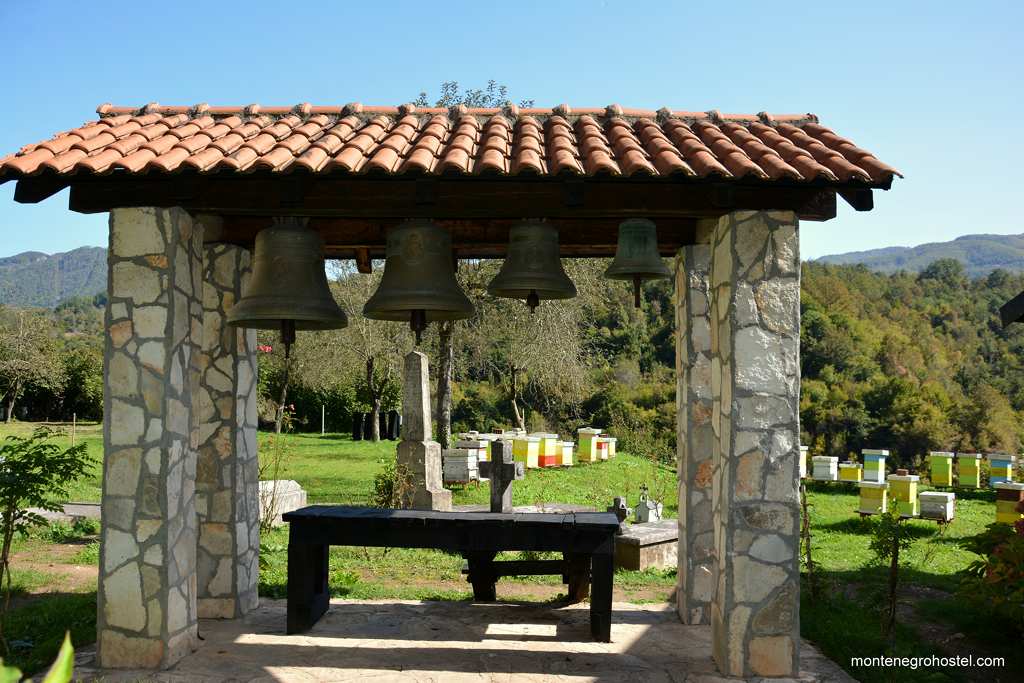
Its frescoes, dating from 1639, the work of painter Jovan, rank amongst the best of their time. The main subject on its walls is the life of miracles of St Nicholas, displayed with some interesting iconographic solutions such as the scene of Nicholas saving the boy from the Saracens, in which the Saracens are portrayed as Turks dressed in contemporary fashion and all seated on an oriental rug. In other frescoes, the saint helps the seafarers, gives sight back to Serbian king Stefan Dečanski, and introduces Prince Stefan to the Mother of God. Also notable are the frescoes of St Sava and St Simeon, as well as the large composition of the Assumption above the entrance. Not a long way up the river is the Monk’s Bridge (Kaluđerski most). This half-ruined piece of amateur engineering was built monastery fraternity in 1842 at the point where the river gets very narrow. One of its arches collapsed and was replaced by a wooden construction, which still stands, giving it a hazardous look, but is nevertheless still in use.
BJELASICA
Holding a central position in eastern Montenegro, this giant of the mountain can be seen from all around. Its main ridge spans 29 km from Mojkovac to Andrijevica, with its highest peak being Crna Glavat (Black Head, 2,139m). The mountain got its name after the snow-caps on its tops, which remain gleamingly white (bijela) during most of the year. The eastern part of the mountain is protected as the Biogradska Gora National Park with Biogradsko Lake (Biogradsko Lake) as its central and most easily accessible feature. To reach it, look for a green sign announcing the park some 14km from Kolašin in the direction of Mojkovac. Take a right turn immediately after the sign across a narrow bridge. The road climbs 3km through a deep virgin forest, where trees as tall as 60m and up to 500 years old block almost all sunlight.
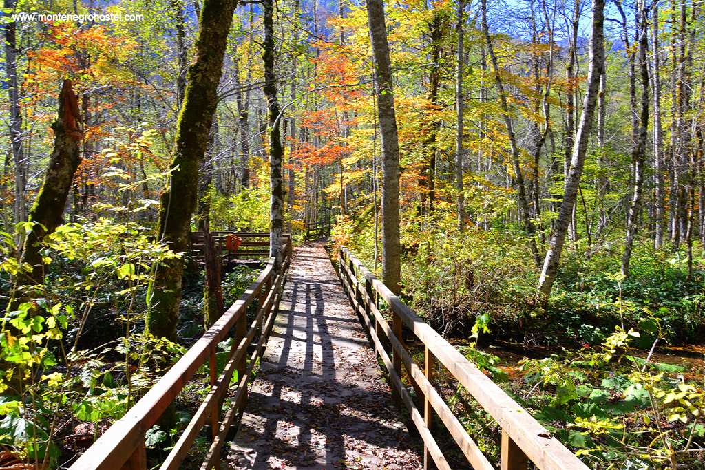
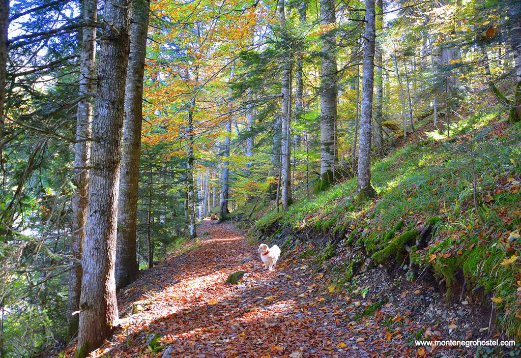
The road ends on the shore of Biogradsko jezero (1,094m) with its tranquil green water surrounded by an unspoiled forest of maple, birch, fir, and 84 other tree species. Here one can find souvenirs and a map shop, a restaurant, and several small cabins that can be rented. On the shore of the lake is also a pier with boats for rent. The lake is surrounded by a 3,5km long trail suitable for an easy, relaxing walk passing over several bridges and pontoons snaking across many streams feeding the lake. Fishing is allowed but only on Tuesdays and Sundays with a proper license. The catch is limited to three pieces. Fishing on the other lakes on Mt Bjelasica is not allowed.
Ski center Jezerine is located some 8 km to the east of Kolašin and has 2 ski centers, Kolašin 1600 and Kolašin 1450. The 45 km of ski slopes make Jezerine one of the largest ski centers in the region. The ski slopes are well-kept and can be quite demanding, with some descents reaching gradients of up to 60 degrees. For the less experienced, there are the mid-way slopes. Approximately one hour climb uphill from Jezerine lies Eko Katun Vranjak, a group of 21 small cottages built to resemble the nearby traditional shepherds’ lodgings. The cottages are directly below the peak Trojeglava (Three-headed, 2,072 m), from which are open magnificent views southwards and eastwards. Vranjak is also an ideal starting point for hiking to the other major peaks of Bjelasica.
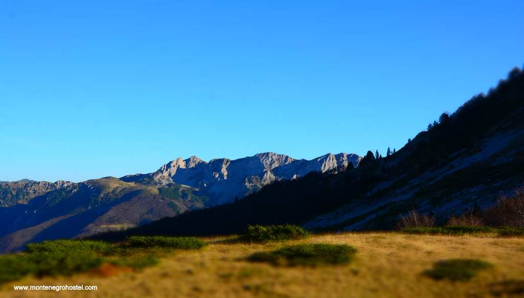
Mt Bjelasica offers excellent conditions for hiking with its various changing terrains, such as deep forests, clear grassy pastures, and rocky peaks. Many clear springs provide plenty of water, and its woods offer shelter from the sun on hot summer days. Altogether, there are ten marked hiking trails, with most of the tours starting from Kolašin or Mojkovac and some from the side of Berane and Andrijevica. The shortest way to Crna glava (Black Head) peak is from Jezerine by the way of Zekova glava (Rabbit's Head) and Pašića jezero (Pašić's Lake) (3h), while the route from Lake Biogradsko across Dolovi Lalevića and Svatovsko groblje (Wedding Cemetery) takes 4 hours.
Apart from the peaks, the usual destinations for hikers are the five glacial lakes of Bjelasica, the most scenic being Pešića jezero (Pešić's Lake 1,820 m) and somewhat smaller Ursulovačko jezero (Urusulova's Lake 1,895m). On the mountain, there are five mountain huts all run by societies from the surrounding towns. Some are pretty old, while others are brand new and up to the highest standards in their class.
Montenegro Hostel Team
BERANE
BERANE
The town of Berane is the center of the Upper Lim Valley. It lies in the region known since medieval times as Budimlje, a prosperous country that lay in the middle of the medieval Serbian state. The town itself is the youngest in the whole of Montenegro. Its beginning lies in the year 1862 when the Turks built their barracks in the field near the village of Berane to watch over the region of Andrijevica, won by Montenegro in 1860. The town grew around officers’ houses, but the orthodox population did not settle in larger numbers until its liberation in 1912, when Berane became the seat of the district and got a high school, the only such institution in this part of the country. From 1949 to 1992, the town was renamed Ivangrad after Ivan Milutinović, one of the leading communists and leaders of the uprising in WWII.
Though quite large, Berane is uninteresting apart from the weird blend of oriental neglect witnessed in crumbling old houses, socialist blocks, street sellers, as well as utterly chaotic driving. The main street, Igumana Mojsija Zečevića (Prior Mojsije Zecevic), is a wide pedestrian promenade filled with cafes. At its upper end is a square with the seat of the local community. Facing it is the House of Gavro Vuković, a local chief and the first minister of foreign affairs of Montenegro, which was built in 1913 in a modest variation of the current European fashion. To your right is the building housing the Polimski muzej (Polim Museum) with an interesting collection of archaeological, historical, and ethnographic items. The most interesting is the 14th c. chain mail, old firearms, and costumes from the Lim region. By far the most interesting monument in Berane is the Monastery of Djudjevi stupovi (George’s Towers), the seat of the Orthodox bishopric. It is located on the western outskirts of the town. Follow the sign to get off the main road to Andrijevica and then take the third street to your right.
The church dedicated to St George was built at the end of the 12th century by Župan Prvoslav cousin of Stefan Nemanja. The unusually long but harmonious church is a result of three building stages. The part with a cupola is the oldest and was done by maritime builders, who were preferred by the Nemanjićs. The higher part with a belfry was added around 1219 when St Sava established here one of the seven bishoprics of the newly founded autonomous Serbian Orthodox church.
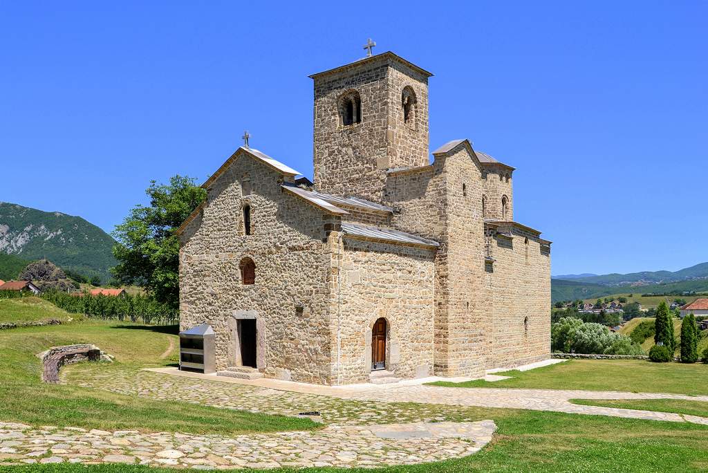
Originally, the edifice boasted not one but two towers, the feature that earned it its name. On the west side, the church ends with the outer narthex from the 18th century. The interior is plain and comprises only a few centuries that survived five annihilations of the monastery. Djudjevi stupovi was an important center for local Christians, especially of the Vasojevići clan. It was here that, in 1829, Abbot Mojsije Zečević led the assembly that revised and collectively adopted the traditional clan laws. This seat of commandments, known as Vasojevićki law (Vasojevic's law), presents a short, easily comprehensible, and merciless rule of survival in those cruel and lawless times. Some 15km to the east of Berane is Mt Cimljevica (1,963 m), under which is located the ski center Lokve with a freshly reconstructed hotel of the same name and three ski-lifts leading to five skiing paths.
GUSLE-THE CALL OF THE PAST
Gusle is a Serb national instrument of ancient origin, similar to a fiddle but with only one string (or, exceptionally in some areas, two strings) where the sound is produced by pulling the bow over the string while holding the instrument in one’s lap. The created sound is sharp, dramatic, almost unpleasant, and contrary to the looks, it takes a lot of skill to make it. But the sole sound of the gusle is not important on its own, as it is always accompanied by the singing of the guslar. His chant is a kind of lament repeated over and over, highly intonated and hypnotic, more a recitation than a real song. This comes from the fact that with the gusle, one always sings epic songs, telling the deeds of heroes and heroic acts, and it has been so for centuries. The oldest songs accompanied by gusle come from the Middle Ages and sing about the Kosovo Battle and the legendary hero Kraljević Marko. Their glory days were during the times when they replaced both books and newspapers for the poor and illiterate peasants, singing about the lost freedom of the Serbs and encouraging men to do new heroic acts. The instrument and its songs are still alive today, telling stories of current events from its own, archaic point of view. Guslarske večeri, the “Evening of guslars” is still a usual kind of pastime in many towns, and guslars are still highly revered and appreciated. In Montenegro, it is almost impossible to imagine a home without a family-owned gusle hung on the wall, usually richly carved with interesting national symbols, and mythological or historical representations.
Montenegro Hostel Team
BIJELO POLJE
BIJELO POLJE
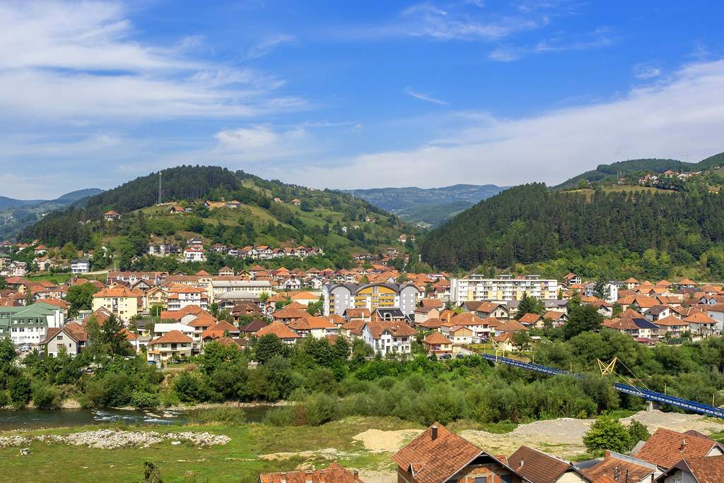
If visiting Montenegro by car, it is almost impossible to miss this town that owes much of its prominence to the Podgorica- Belgrade road, which passes through it. This “White Field” in the valley of the Lim River, which was named after its abundant daisies (bijela rada), was well populated already in the Middle Ages. However, the town itself appeared first in the late 16th c. as a trading post next to the monastery of Nikoljac and was initially called Nikolj-Pazar, but this name gave way to the name of the field in which it spread. The face of the small Oriental town changed drastically during the days of socialist Yugoslavia when it was industrialized and rebuilt to a great extent. Today, it is best known for the sparkling mineral water “Rada”, which is drunk all over the country.
The best-known historic monument of Bijelo Polje is the Church of Saints Peter and Paul (Crkva svetih Petra i Pavla), which lies immediately to the left of the main road from Podgorica towards Belgrade. This unusually looking small church was built in 1195-99 by Prince Miroslav, brother of Serbian ruler Stefan Nemanja, who governed a region from here to Dubrovnik, known at the time as Hum and later Herzegovina. When in the mid-13th century the seat of the bishop of Hum was transferred here, the church got its two high towers (25 m), an obligatory element of cathedrals. After the Turkish conquest, the church was turned into a mosque, one tower was pulled down, while the other was kept as a minaret. It remained a Muslim shrine until 1922, when it was returned to the Orthodox community. This is the tiny church of odd shapes that has a rectangular apse and a blind dome and is the earliest example of western pre-Romanesque tradition in Orthodox architecture, a clear sign that it was constructed by builders from the Adriatic coastline invited hereby Prince Miroslav.
The main stone portal still bears the original Cyrillic inscription with Prince Miroslav’s dedication. Only a few fragments of the original fresco painting remain to this day. The one just to the left of the entrance is by far the most important. Here we see the remains of the portrait of Prince Miroslav, with the model of the church in his hands. By using this image, the modifications on the interior walls are shown. Even a mihrab, a niche designating the direction of Mecca, still endures on the right-hand wall. The few remaining frescoes were painted around 1320 and are fine examples of the monumental style prevalent in Serbia at the time. Church of St Peter and Paul is also known for its connection to Miroslav Gospel (Miroslavovo jevandjelje, a 12th c. illuminated manuscript, which is listed on UNESCO World Heritage- Memories of the World. The Gospel is one of the oldest examples of the Serbian edition of the Old Church Slavonic language and contains 300 splendid miniatures from Byzantine and Romanesque traditions. During the centuries, it was kept in the Serb Hilandar monastery on Mt Athos, it was then carried by the Serbian army in WWI to Greece, and is today kept in Belgrade’s National Museum as one of its most valuable works of art.
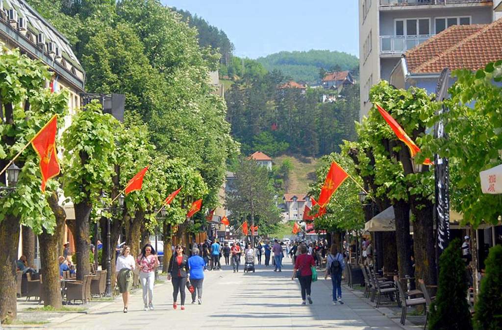
The town’s center is a square with a pleasant park highlighted by a social realist monument to the fallen in WWII. The main town street, the pedestrian Ulica Slobode (Freedom St), branches from the square. On the lower side of the square begins a small street in which one can see the reconstructed House of writer Risto Ratković, the nicest example of oriental architecture in the town. Regrettably, the house is closed for visits. One block above the square lies Radnička Street (Labor St) with its Local Museum (Zavičajni muzej) located in the whitewashed house (1905) of the old high school. In the museum, one can see Neolithic artifacts found in the surrounding area, an interesting example of a plow from the Roman era, medieval weapons, various folk costumes, a numismatic collection (mostly Roman, Medieval Serbian, and Montenegrin coins), and finally documents, photos, and weapons from WWII.
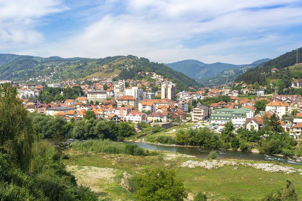
The other ecclesiastical monument of Bijelo Polje, the Nikoljac Church, lies on the opposite side of the town from the church of St Peter and Paul’s. The church, which once belonged to the monastery of the same name, was built around 1560 and was one of the largest Serb churches constructed under Ottoman rule. Its form is that of a basilica with three distinctive parts and a large octagonal cupola. Apart from the faded frescoes on its western façade, the rest of the exterior is painted in white, while the roof is covered with gray shingles. The interior, on the other hand, is the most impressive in the whole of Montenegro since it is completely covered in frescoes from the late 16th century. The frescoes depict the cycles of the living Christ, the life of St John the Baptist, and the miracles of St Nicholas, but also some unusual scenes such as the eternal suffering of sinners (to the right of the entrance), amongst them a dishonest innkeeper and a miller with the tools of their trade hanging from their necks. The highlight of the church is without a doubt its splendid iconostasis: opulently carved and ornamented in gold, with an inspired work of crucifixion surrounded with seemingly freestanding stars and angels, as well as several exceptional icons dating from the 16th to the 19th century. The most interesting of these icons is one of St Nicholas with scenes from his life, painted by Radul, one of the most talented icon-painters of his day. Note also the unusually tall 16th-century candlestick of white marble standing in front of the iconostasis.
Montenegro Hostel Team
ANDRIJEVICA
ANDRIJEVICA
The miniature town lies on a small plateau overlooking the river Lim. Even at its height of 800m above sea level, it is still overshadowed by high mountains covered in deep green forests. In the Middle Ages, a church was built here by Andrija, a prince of the offshoot branch of the Nemanjić dynasty. His church, called Andrijevna, survived until 1765 when it was leveled to the ground during a Turkish punitive expedition against the Vasojevićki clan, which inhabited this area. When Montenegro acquired control over the Vasojevići in the mid-19th century, the ground of the valley of Lim, where previously stood Andrijevna Church, once again became an interesting site for the center of a rural region that had no other town. All grew only one house at a time. Between the two World Wars, it grew even faster as the seat of a large country was located here. This continued until in 1960 all of the administration was transferred to Berane or Plav, and the town started slowly to die out.
All the town’s amenities are located on its main street, which also serves as the road from Berane to Plav. Side by side stand houses of traditional design with white-painted walls and shingled roofs, socialist apartment blocks, and family houses of newer origin. In front of its few shops, one can often see small mountain horses patiently waiting for their master to finish his shopping. However, even such a small backwater town is undoubtedly the most important settlement around and is, therefore, a convenient place to stop for supplies before beginning a trip to the mountains surrounding it, the most notable amongst them being Komovi. The only historical monument in Andrijevica is Knjaževac, a nice park whose main feature is a stone church built by Prince Nikola in 1887. Facing it are two monuments: the smaller one with an eagle atop, erected in memory of the fallen in the 1912-1918 wars, while the other, more abstract, commemorates the inhabitants of the area who died in WWII.
MT. KOMOVI
Together with the Durmitor and Prokletije massif, Komovi is one of the most impressive ranges in Montenegro and indeed in the whole of the Dinaric Alps. The mountain is bordered by Tara to the west and Lim to the east, from where it ascends to 1900 meters, where a series of smaller plateaus above the forest level make it perfect for katuni, the shepherd’s summer houses of which are remarkably almost all still in use. From the tableland rise to the bare rocky peaks Kom Kučki (2,487m) to the east and to the east Kom Vasojevićki (2,461 m), both named after clans whose mutual border they form.
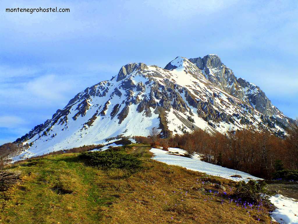
Komovi is easily accessed by the Andrijevica-Kolašin road that winds upwards to Trešnjevik pass, recognizable by the small inn of Savo Lekić. Here you can sip a drink, taste a game delicacy, get information about the area, or just enjoy the merry company of the locals. From this point, a 6km long gravel road branches out leading to the idyllic grassland plateau of Štavna with shepherd huts and freely grazing flocks of sheep, cows, and horses.

This is also the location of the ”Eko katun”, a new complex of several huts, each with five beds, with necessary facilities. With its wide vistas to the south and its relative flatness, Štavna is a perfect place to pitch your tents. The rugged, inhospitable-looking and in some places almost vertical sides of this mountain are a real challenge for climbers.
The climb to Vasojevićki Kom (2 and a half hours) is somewhat easier, while the one to Kučki Kom (3 and a half hours) should only be attempted by experienced climbers and is best achieved from its south face. There is also a nice circular walk around both peaks. From Štavna to Ljuban ridge, then to the source of Crnja river, then below Kučki Kom to the Carine katun at the southern face of the mountain, and back along the eastern side. Following a slow pace, the walk will take you a whole day.
Montenegro Hostel Team
PLAV
PLAV
The small town of Plav has a spectacular setting. It lies 900m above sea level near a large lake at the east edge of a broad and fertile valley that is bound on all sides by high mountains. Before reaching the town, one first observes the Plavsko Lake (Plavsko jezero), the largest and most beautiful of several glacier lakes of the Prokletije Mountains, which are mirrored on the surface. The lake is almost 5km wide, with its deepest point at 9 meters. Its always cold waters have a dark blue (plavo) color, which offers one of the explanations for the town’s name. The lake is fed by water from the River Ljuča coming from the west, while from its northern end, Lim, the longest river in Montenegro, flows out. Plavsko Lake is very rich in fish, especially trout, huchen, and grayling. The shores are covered in reed, and there aren’t many places suitable for swimming apart from the wooden pier on its east side.
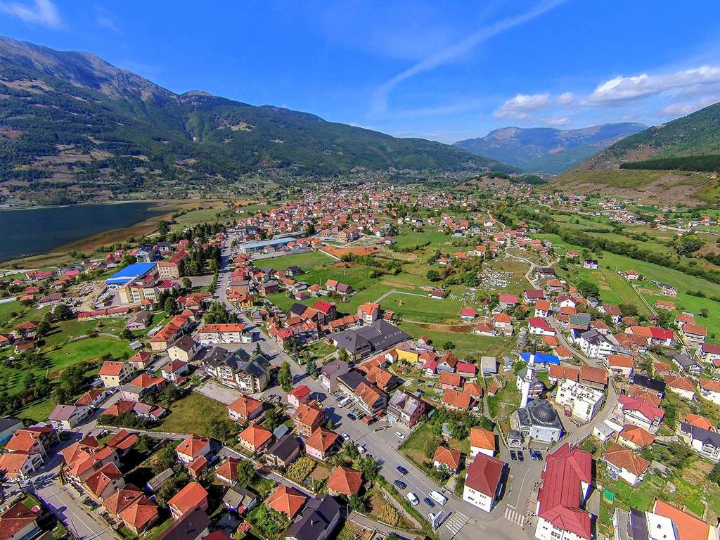
The town of Plav was first mentioned in the 13th century as a village of fishermen in possession of Serbian kings, who kept the monopoly on fishing here. Additionally, it functioned as a commercial center on the busy road from Podgorica to the Lim Valley. Plav developed further after the Ottoman conquest in the mid-15th century and especially at the beginning of the 17th c. when it got a small fort and a permanent garrison. It was during this era that most of the population converted to Islam, the religion still practiced by most of the locals. The place lived its life of seclusion until 1878, when, by the terms of the Peace Treaty of Berlin, this area was supposed to become a part of the Principality of Montenegro. The local Muslims rose to arms against this decision and, after fierce resistance, managed to reverse the decision and stay in the Ottoman Empire. Nevertheless, the old Empire’s rule came to an end in 1912 when the Montenegrin army seized the area. Unfortunately for the region, the newly formed Albanian state got a small portion of the old road to Podgorica, and thus Plav was denied its most important route, left with only a single road leading towards the north. This was the beginning of the end for this area, which became known for its high emigration. Today, most of the people born in Plav live abroad, and the town comes alive only during their summer vacations when they return to see their relatives.
Though it consists mostly of new houses, the town’s physiognomy is still very oriental. At the entrance to its center is a small roundabout with a post office. On a small mound to the right is Plav’s most important sight, the Old Mosque (Stara džamija). Made in a combination of wood and stone, this typical mosque of the western Balkans was constructed in the mid-18th c. on the site of an older one. The mosque’s porch has some fine carvings. To the left of the roundabout opens a view of the large Imperial Mosque (Carska džamija) constructed in 1909 with a donation from Sultan Abdul Hamid II, thus its name. In 1924, the mosque was turned into a warehouse, later into a school, and even into a police station, and has finally been returned to its original purpose.
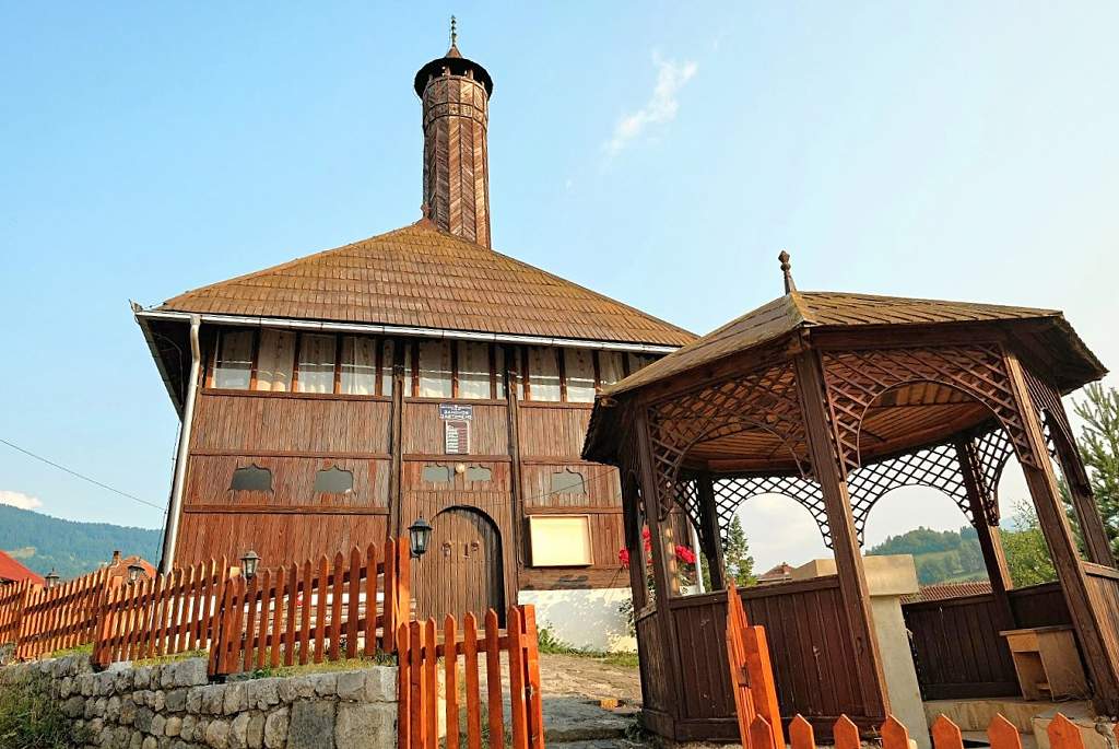
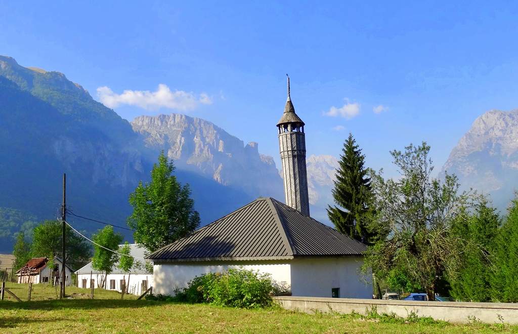
From the roundabout starts the narrow stone-paved street čaršija, the main trading street where most of the businesses and institutions are located. At its end, take the street to the right and walk past another small mosque with a nicely carved wooden minaret to reach Redžepagić Tower, standing tall in the middle of the courtyard outlined by family homes that surround it. The tower is probably the oldest building in the town, dating from the late 16th or early 17th c. The first two floors are made of stone and are about one meter thick, while the wooden top floor with a typical steep roof was added somewhat later. Towers such as this one were built by local landowners to serve as their homes, which could easily be transformed into impregnable forts. If you look closely, you will notice that several other houses around here are adapted towers.
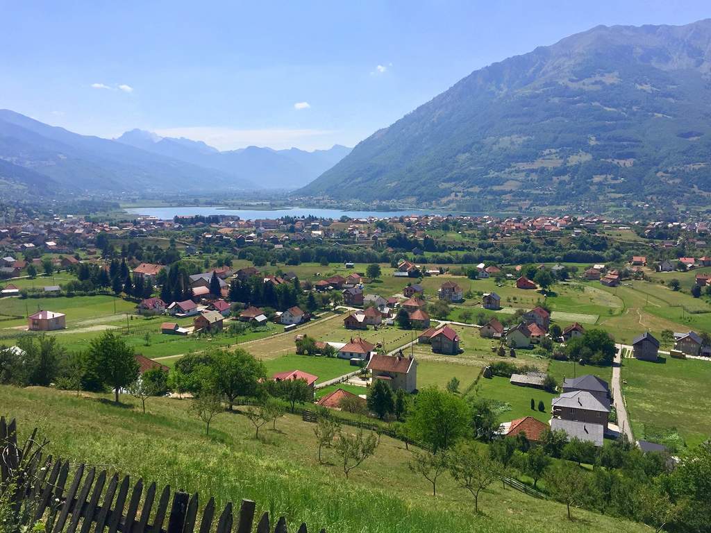
Plav is a convenient starting place for excursions to the mountain Kofiljača and Bogićevica, spreading to the south of it. There is a marked route leading to Kofiljača’s highest peak, Horolac (2,199m), starting from Bogajići village, immediately to the south of the town. The walking tour lasts approximately 3 hours. In a spectacular setting in the heart of the wilderness of Mt Bogićevica at a height of 1,960m, the Hridsko Lake (Hridsko jezero) is located and surrounded by Macedonian pine wood. One can drive to the village of Babino Polje (12 km to the east of the town), but to continue beyond, one needs a four-wheel-drive vehicle. Alternatively, a walk to the Lake will take you some two hours from Babino Polje.
MT. PROKLETIJE
Prokletije (literally Cursed Mountains, in Albanian Bjeshët e Nemuna) is the southernmost ridge of the Dinaric Alps. In a wider sense, these mountains stretch from Shkoder in the west to Peć in the east, spreading through three states, Albania, Montenegro, and Kosovo, and representing a natural borderline between them. However, their name suggests a somewhat different view. They were considered “cursed” by the shepherds for their inaccessibility and lack of water in pastures; in fact, they were unsuitable for any kind of life. These extremely rough conditions can only be found in the area south of Gusinje, which is considered to be the core of the Prokletije ridge. This part of Prokletije is the most impressive; its wilderness and the other side of its jagged stone cliffs make it a terrifying prospect. This is also where the Prokletije’s highest peak, Maja Jezerces (Jezerski vrh 2,694 m), looms. The massif is ideal for hiking and alpinism, and although it lacks facilities and many marked paths, it offers a feeling of discovery and walking off the beaten track.
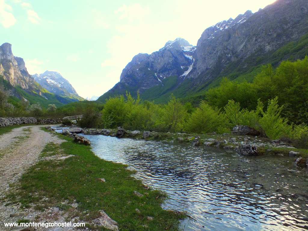
Moreover, with its alpine meadows, peaks rising towards the skies, and marvelous panoramic views, Prokletije is an astonishing sight even for those who are not attempting to climb one of its peaks. The look of Prokletije is due to the intensive glaciation process when glaciers are pushed down from the mountains, carving deep valleys that lead closer to the heart of the massif Grbaja in the west and Ropojana to the east. From Gusinje, one reaches Grbaja by way of Dolja village (7 km). As you approach this valley in front, you open one of the most picturesque views in Montenegro, an idyllic vale of green grass with a stream in its middle and birch woods on its sides, bordered with steep mountains finishing with bare stone peaks. To your left rise the Karanfili peaks are topped by Veliki vrh (2,490 m), while on your right are Popadija (2,056 m) and Volušnica (1,876 m).
Grbaja valley is some 3 km long, and it slowly rises towards the south with three lovely fields opening one after another. Apart from its enchanting beauty, Grbaja is also the usual starting point for hikers, because of its couple of mountain huts. Starting from Grbaja, all hiking tours are fully marked. Before starting, you should get a proper map and take a lot of water with you, as the upper areas are waterless. Continuing southwards from Ali-pasha’s Springs, the road follows the Skakavac stream, past the village of Vusanje, and slowly enters the valley of Ropojana, squeezed from all sides by high peaks. If you’re interested in staying longer in this area or are willing to climb some of the peaks, it is advisable to report to the border police at their base south of the Vusanje village.
On the other side of Vusanje, one comes to Grlja Waterfall. At this spot, the Grlja River makes a sudden turn and falls from 15m high into the stone abyss from which chilling spray rises. Not far away up the river is another waterfall, but this one is sheltered in the woods and impossible to see from the road. However, if you’re walking, you will certainly hear its roar. Just after the waterfall, the stream slows down in a place known as Savino oko (Sava’s Eye), where the striking blue water reveals unusually great depth. This is due to a strong factor that adds much to the stream’s strength.
Four kilometers further to the south, deeper in the narrowing field of Ropojana, lies the Čemerikino Lake. This wild and inaccessible lake disappears in high summer. Note that the Montenegrin-Albanian border lies directly on the other side of the lake. From Ropojana, one can climb the Rosni vrh (Maja Rosit 2,522 m), right on the border. From Zastan to the left of Ropojana, one can advance to the central part of Prokletije with Maja Jezerce lying in Albania some 7 km south of here. The climb from the end of the asphalt road takes some 10 hours in one direction and is therefore recommended to do it in two days with an overnight camp.
There are no border controls from the Albanian side, but if you want to be on the safe side, you can announce your group to the Albanian police. Turning left from Vusanje, one comes to the Zarunica hamlet. To the north of it are the green Bor ridge (2,012 m) and the south desolate massif of Belič with the highest peak of Maja Kolata (Kolac 2,530 m), a few hundred meters into Albania.
Montenegro Hostel Team
GUSINJE
GUSINJE
Located in the fertile valley underneath the craggy Prokletije Mountains, with Albania behind the first peaks to the west and the south, Gusinje finds itself at the end of all roads. This tiny town once had much more importance as it lay on the road to Podgorica. On the 18th. It was the seat of a country and had 600 houses with 200 shops, but since 1912, the road was served by the borderline that the town lost its importance completely, and in the last forty years it has dwindled the half its size.
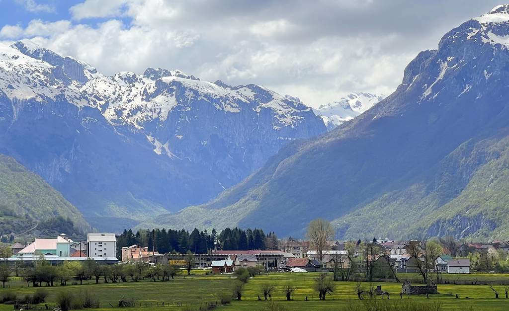
The best-known monument in Gusinje is the Vizier’s Mosque (Vezirova džamija), structured in a typical local style and built at the end of the 17th century by Mehmed-pasha Bushati, the Turkish vizier of Shkoder (today Albania). Curiously, the graves of the town’s fallen communists are located in the mosque’s yard. If you take a short walk a short through Gusinje, you will notice many fine examples of Balkan-oriental houses and some of the towers also, but all in a state of utter neglect. It is interesting to notice that a small place has a catholic and an Orthodox church as well.
The most famed spot for picnics in the vicinity of Gusinje is the illustrious All-pasha’s Springs (Ali-pašini izvori), 2 km to the south of town. In this remarkable place, one has the impression that water is coming from all sides, carried by several streams and spilling all over the field. The streams remain cold throughout the year as they are provided with water from the melting snowcaps. The spring got its name after the famous local hero Ali-pasha of Gusinje, who led the resistance against the Montenegrin annexation of the area in 1878-81. On August 2nd, on the day of St Elijah (Ilindan), all people originating from Gusinje gather here in celebration, a spontaneous outburst of folklore, sorrow for the homeland left behind, a display of riches gained abroad (mostly in the USA and Germany).
Montenegro Hostel Team
ROŽAJE
ROŽAJE
Rožaje is the center of a mountain region in the far east of Montenegro. It lies in the valley traversed by the fast and cold river Ibar, which springs nearby, along which passes the road leading to Novi Pazar in Serbia. In the town, a road branches off and leads across the snowy Kulina pass, descending towards Peć in the region of Kosovo. The town was first mentioned in the 17th c. under the name Trgovište (Market) as the peasants from the surrounding mountains came here to sell their meat, skins, and dairy products, and this tradition continued until not long ago. The name Rožaje, coming from the two crags rising above the town which reminded of horns (rogovi), was used simultaneously with Trgovište but became official only after the town was incorporated into Montenegro in 1912. At the end of the 17th century, the orthodox population had to flee because they sided with the Austrians and against their Turkish masters. The area was gradually resettled, but this time all the newcomers had to accept Islam, and the whole area remains almost entirely Muslim to this day.
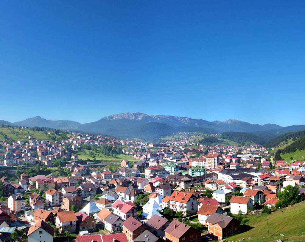
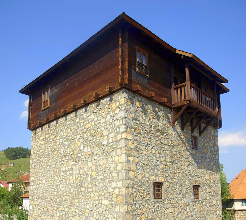
There is little left to witness the town’s history. Until a few decades ago, its most lovely feature was a multitude of surviving old houses with high shingled roofs, but today you will find only a few of these, most in a ruined state, while the rest of the town has been taken over by tall new houses of post-modern shapes and colors. The most important monument in the town is the Ganića kula, a tall tower built in 1802 by local landowners to serve as an easily defendable home. After the reconstruction works ended, it became the house of the eagerly expected local museum. There are two old mosques in Rožaje. The older one, Kurtagića džamija (Kuragic's Mosque), dates from 1697 but follows its strain's few signs of antiquity. On the other hand, Kučka džamija (Kucka's Mosque), though much younger (1830), retains the features of traditional architecture.
Of much more interest than the town itself are its environs. Rožaje is surrounded by a magnificent range of mountains such as Cmiljevica (1,963 m), Hajla (2,403 m), and Žljeb (2,155 m) to the south and Turjak (1,573 m) to the north. The lower regions are hidden in thick forests, while above them rise stony peaks attractive for hiking or even free climbing. The area is well known for its abundance is mushrooms, blueberries, and many rare and endemic flowers. Following a trail along the river Ibar in the southwest will lead you to its beautiful springs of Ibar (Vrelo Ibra), where six pretty streams join to form the river that will continue for another 272km until its confluence with the West Morava. Located just 4km from Rožaje on the highway towards Berane is the ski center Turjak with a hotel of the same name and two lifts.
Montenegro Hostel Team
